 Old Cumbria Gazetteer
 |
 |
|
| Levers Water, Coniston | ||
| runs into:- |  Levers Water Beck Levers Water Beck |
|
|
|
||
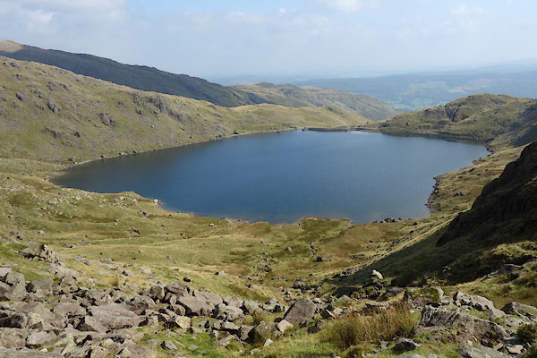
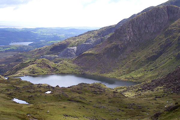
| Levers Water | ||
| Levers Water Reservoir | ||
| civil parish:- | Coniston (formerly Lancashire) | |
| county:- | Cumbria | |
| locality type:- | tarn | |
| locality type:- | reservoir | |
| coordinates:- | SD27929930 (etc) | |
| 1Km square:- | SD2799 | |
| 10Km square:- | SD29 | |
| altitude:- | 1358 feet | |
| altitude:- | 414m | |
|
|
||
 CBT42.jpg (taken 17.9.2014) 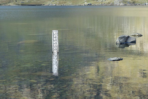 CBT57.jpg Depth gauge; reading downwards? (taken 17.9.2014) |
||
|
|
||
| evidence:- | old map:- West 1784 map placename:- Lever Water |
|
| source data:- | Map, hand coloured engraving, A Map of the Lakes in Cumberland,
Westmorland and Lancashire, scale about 3.5 miles to 1 inch,
engraved by Paas, 53 Holborn, London, about 1784.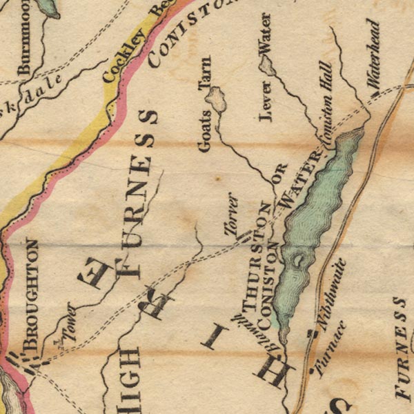 Ws02SD29.jpg item:- Armitt Library : A1221.1 Image © see bottom of page |
|
|
|
||
| evidence:- | old map:- Cooke 1802 placename:- Lever Water |
|
| source data:- | Map, The Lakes, Westmorland and Cumberland, scale about 8.5
miles to 1 inch, engravedby Neele and Son, published by
Sherwood, Jones and Co, Paternoster Road, London, 1824. click to enlarge click to enlargeGRA1Lk.jpg "Lever Water" outline with form lines; lake or tarn item:- Hampshire Museums : FA2000.62.5 Image © see bottom of page |
|
|
|
||
| evidence:- | old map:- Laurie and Whittle 1806 placename:- Levers Tarn |
|
| source data:- | Road map, Completion of the Roads to the Lakes, scale about 10
miles to 1 inch, by Nathaniel Coltman? 1806, published by Robert
H Laurie, 53 Fleet Street, London, 1834. click to enlarge click to enlargeLw18.jpg "Levers Tarn" lake item:- private collection : 18.18 Image © see bottom of page |
|
|
|
||
| evidence:- | old map:- Otley 1818 |
|
| source data:- | Map, uncoloured engraving, The District of the Lakes,
Cumberland, Westmorland, and Lancashire, scale about 4 miles to
1 inch, by Jonathan Otley, 1818, engraved by J and G Menzies,
Edinburgh, Scotland, published by Jonathan Otley, Keswick,
Cumberland, et al, 1833.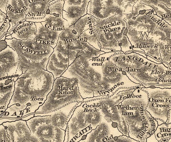 OT02NY20.jpg item:- JandMN : 48.1 Image © see bottom of page |
|
|
|
||
| evidence:- | descriptive text:- Otley 1823 (5th edn 1834) |
|
| source data:- | Guide book, A Concise Description of the English Lakes, the
mountains in their vicinity, and the roads by which they may be
visited, with remarks on the mineralogy and geology of the
district, by Jonathan Otley, published by the author, Keswick,
Cumberland now Cumbria, by J Richardson, London, and by Arthur
Foster, Kirkby Lonsdale, Cumbria, 1823; published 1823-49,
latterly as the Descriptive Guide to the English Lakes. goto source Page 36:- "... Levers Water ... is situated in a wide valley, between the mountains Old Man and Wetherlam. ..." |
|
|
|
||
| evidence:- | descriptive text:- Ford 1839 (3rd edn 1843) placename:- Levens Water |
|
| source data:- | Guide book, A Description of Scenery in the Lake District, by
Rev William Ford, published by Charles Thurnam, Carlisle, by W
Edwards, 12 Ave Maria Lane, Charles Tilt, Fleet Street, William
Smith, 113 Fleet Street, London, by Currie and Bowman,
Newcastle, by Bancks and Co, Manchester, by Oliver and Boyd,
Edinburgh, and by Sinclair, Dumfries, 1839. goto source Page 11:- "... Proceeding in a northerly direction under the summit of the Old Man, Levens Water is discovered, a tarn about a mile in circumference, open only towards the south, being enclosed in every other direction, and making a beautiful picture with part of Coniston Water, the hills about Nibthwaite, and beyond, a strip of sea reaching westward from the river Leven. ..." |
|
|
|
||
| evidence:- | old map:- Ford 1839 map |
|
| source data:- | Map, uncoloured engraving, Map of the Lake District of
Cumberland, Westmoreland and Lancashire, scale about 3.5 miles
to 1 inch, published by Charles Thurnam, Carlisle, and by R
Groombridge, 5 Paternoster Row, London, 3rd edn 1843. FD02SD28.jpg Outline with form lines. item:- JandMN : 100.1 Image © see bottom of page |
|
|
|
||
| evidence:- | old map:- Garnett 1850s-60s H placename:- Levers Water |
|
| source data:- | Map of the English Lakes, in Cumberland, Westmorland and
Lancashire, scale about 3.5 miles to 1 inch, published by John
Garnett, Windermere, Westmorland, 1850s-60s. GAR2SD29.jpg "Levers Wr." outline with shore form lines, lake or tarn item:- JandMN : 82.1 Image © see bottom of page |
|
|
|
||
 BOD14.jpg (taken 3.9.2007) 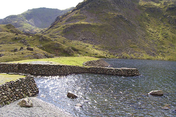 BOD18.jpg Dam and weir. (taken 3.9.2007) 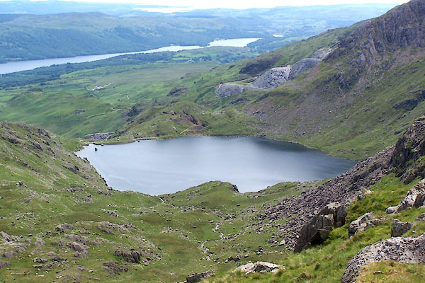 BWU58.jpg (taken 18.6.2012) 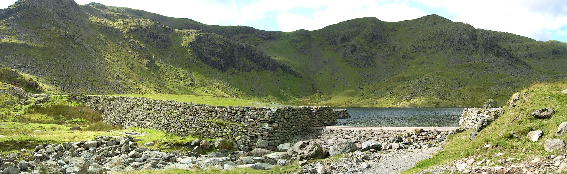 Click to enlarge BOD19.jpg Dam and weir. (taken 3.9.2007) 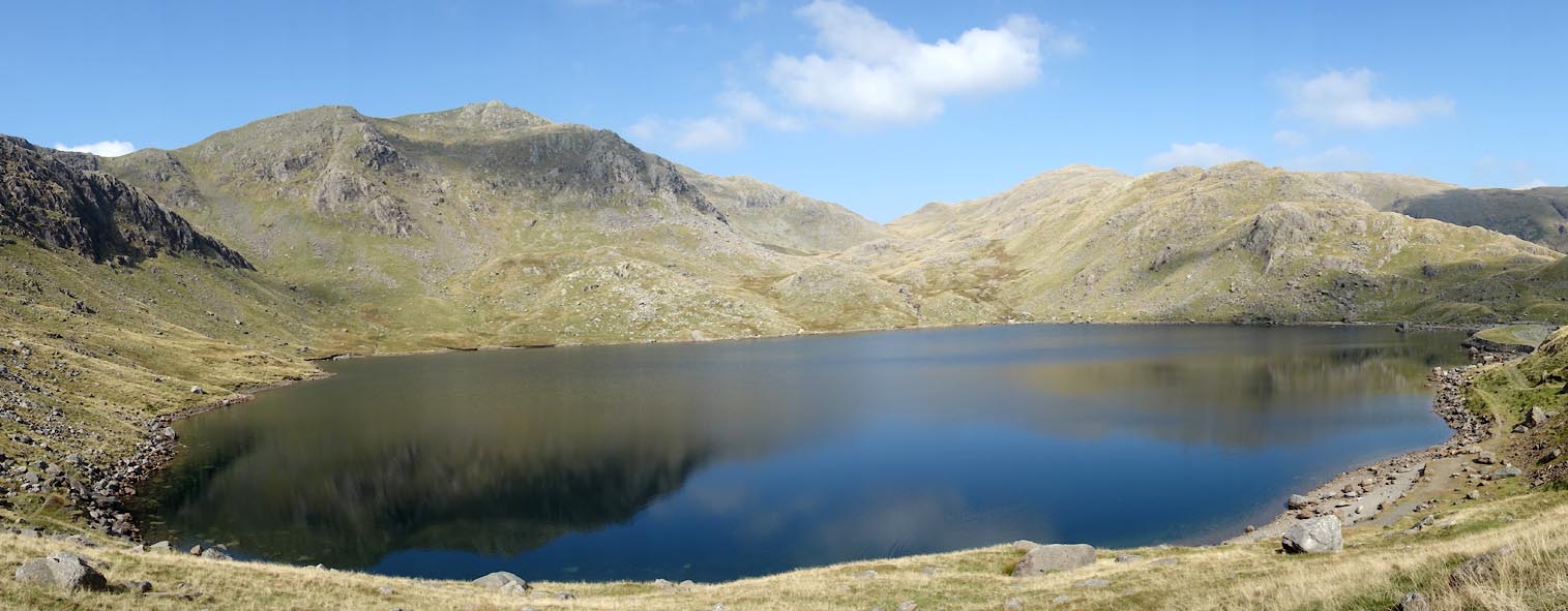 Click to enlarge CBT41.jpg (taken 17.9.2014) 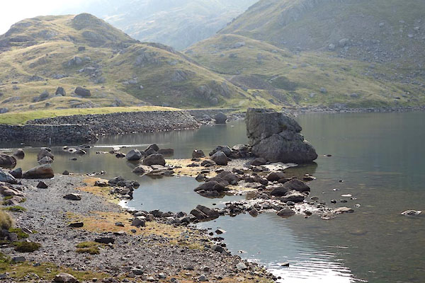 CBT56.jpg (taken 17.9.2014) |
||
|
|
||
Lakes Guides menu.