 West 1784 map SD19


|

|
|
|
gazetteer links places may or may not be labelled on the map |
||

|
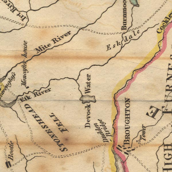
-- Corney Fell -- "STONESHEAD FELL" |
|
|
|
-- Devoke Water |
|
|
|
-- Duddon, River |
|
|
|
-- Esk, River |
|
|
|
-- Eskdale |
|
|
|
-- Linbeck Gill |
|
|
|
-- Mite, River |
|
|
|
-- Whillan Beck |
|
|
civil parishes The area roughly includes parts of parishes:- Millom Without Bootle Ulpha Dunnerdale-with-Seathwaite Eskdale Irton with Santon Waberthwaite Muncaster |
||
|
|
||
|
|
Lakes Guides menu. | |