 Old Cumbria Gazetteer
 |
 |
|
| Corney Fell, Waberthwaite | ||
| Corney Fell | ||
| civil parish:- | Waberthwaite (formerly Cumberland) | |
| county:- | Cumbria | |
| locality type:- | hill | |
| locality type:- | fell | |
| coordinates:- | SD13499180 (etc etc) | |
| 1Km square:- | SD1391 | |
| 10Km square:- | SD19 | |
|
|
||
| evidence:- | old map:- OS County Series (Cmd 86 1) placename:- Corney Fell |
|
| source data:- | Maps, County Series maps of Great Britain, scales 6 and 25
inches to 1 mile, published by the Ordnance Survey, Southampton,
Hampshire, from about 1863 to 1948. |
|
|
|
||
| evidence:- | old map:- Donald 1774 (Cmd) placename:- Corney Fell |
|
| source data:- | Map, hand coloured engraving, 3x2 sheets, The County of Cumberland, scale about 1
inch to 1 mile, by Thomas Donald, engraved and published by Joseph Hodskinson, 29
Arundel Street, Strand, London, 1774.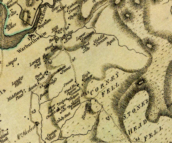 D4SD19SW.jpg "CORNEY FELL" hill hachuring; a hill or mountain item:- Carlisle Library : Map 2 Image © Carlisle Library |
|
|
|
||
| evidence:- | possibly old map:- West 1784 map placename:- Stoneshead Fell |
|
| source data:- | Map, hand coloured engraving, A Map of the Lakes in Cumberland,
Westmorland and Lancashire, scale about 3.5 miles to 1 inch,
engraved by Paas, 53 Holborn, London, about 1784.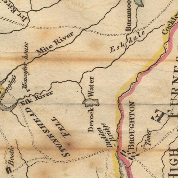 Ws02SD19.jpg "STONESHEAD FELL" item:- Armitt Library : A1221.1 Image © see bottom of page |
|
|
|
||
| evidence:- | old map:- Ford 1839 map placename:- Corney Fell |
|
| source data:- | Map, uncoloured engraving, Map of the Lake District of
Cumberland, Westmoreland and Lancashire, scale about 3.5 miles
to 1 inch, published by Charles Thurnam, Carlisle, and by R
Groombridge, 5 Paternoster Row, London, 3rd edn 1843.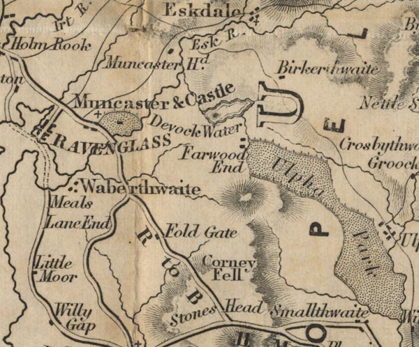 FD02SD19.jpg "Corney Fell" Hill hachuring. item:- JandMN : 100.1 Image © see bottom of page |
|
|
|
||
| evidence:- | old map:- Garnett 1850s-60s H placename:- Corney Fell |
|
| source data:- | Map of the English Lakes, in Cumberland, Westmorland and
Lancashire, scale about 3.5 miles to 1 inch, published by John
Garnett, Windermere, Westmorland, 1850s-60s.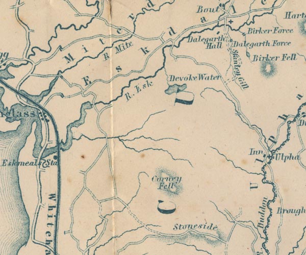 GAR2SD19.jpg "Corney Fell" hill hachuring item:- JandMN : 82.1 Image © see bottom of page |
|
|
|
||
| evidence:- | outline view:- Linton 1852 placename:- Corney Fell |
|
| source data:- | Print, engraving, outline views, Mountains as Seen from the Esk Viaduct, the Eskmeals
Viaduct, and Mountains as Seen from the Viaduct near Drigg, the Irt Viaduct, Whitehaven
and Furness Junction Railway, Cumberland, engraved by W H Lizars, Edinburgh, published
by Whittaker and Co, London, and by R Gibson and Son and by Callander and Dixon, Whitehaven,
Cumberland, 1852.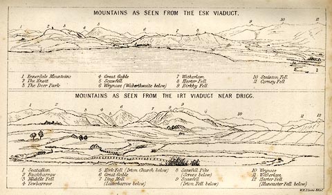 click to enlarge click to enlargeLN1E13.jpg Tipped in opposite p.86 of A Handbook of the Whitehaven and Furness Railway, by John Linton. item:- Armitt Library : A1158.11 Image © see bottom of page |
|
|
|
||
| evidence:- | old drawing:- Smith 1746 B placename:- Corno Fells |
|
| source data:- | Drawing, pencil and ink, A View of Corno Fells and the Black Comb, in a Survey of
the Coast of Cumberland, by George Smith, 1746.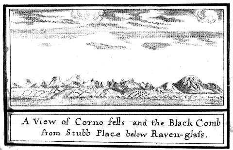 click to enlarge click to enlargeSM2101.jpg ms at bottom:- "A View of Corno fells and the Black Comb / from Stubb Place below Raven-glass." item:- Carlisle Library : 5.1 Image © Carlisle Library |
|
|
|
||
 Lakes Guides menu.