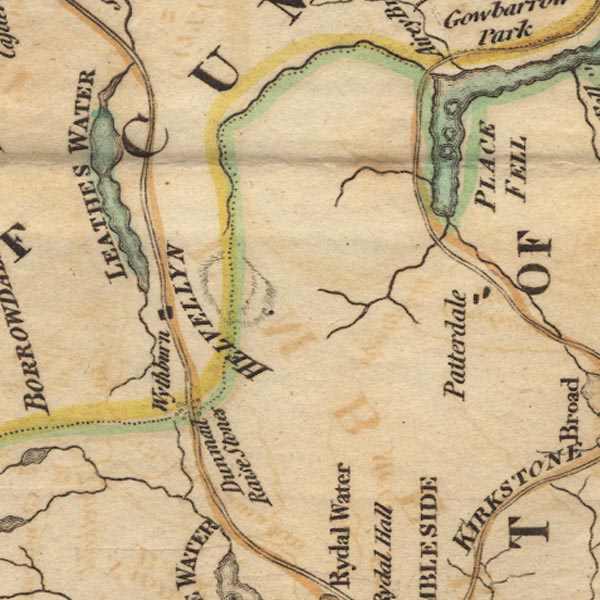
 West 1784 map NY31


|

|
|
|
gazetteer links places may or may not be labelled on the map |
||

|
-- Cherry Holm |
|
|
|
-- Glencoyne Beck |
|
|
|
-- Glenridding Beck |
|
|
|
-- Goldrill Beck |
|
|
|
-- Grisedale Beck |
|
|
|
-- Helvellyn -- "HELVELLYN" |
|
|
|
-- Norfolk Island |
|
|
|
-- Patterdale |
|
|
|
-- Place Fell -- "PLACE FELL" |
|
|
|
-- Thirlmere -- "LEATHES WATER" |
|
|
|
-- Ullswater -- "ULLS WATER" |
|
|
|
-- Wall Holm |
|
|
|
-- Wyth Burn |
|
|
|
-- Wythburn |
|
|
civil parishes The area roughly includes parts of parishes:- Lakes Matterdale Martindale St John's Castlerigg and Wythburn Patterdale |
||
|
|
||
|
|
Lakes Guides menu. | |