 Old Cumbria Gazetteer
 |
 |
|
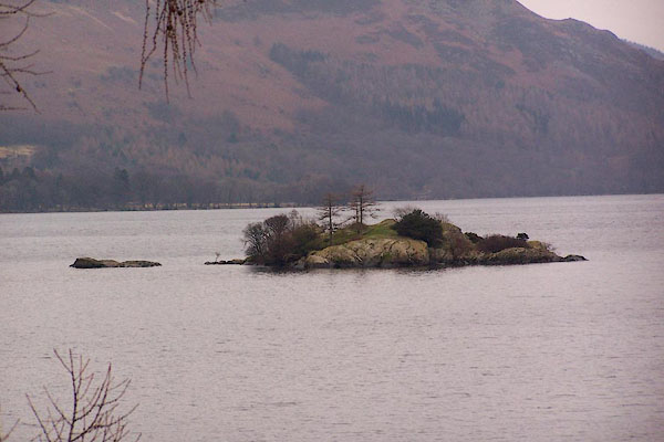
| Norfolk Island, Ullswater | ||
| Norfolk Island | ||
| site name:- | Ullswater | |
| civil parish:- | Patterdale (formerly Westmorland) | |
| county:- | Cumbria | |
| locality type:- | island | |
| coordinates:- | NY39161846 | |
| 1Km square:- | NY3918 | |
| 10Km square:- | NY31 | |
|
|
||
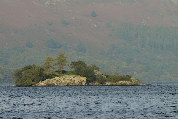 BTQ57.jpg (taken 8.10.2010) 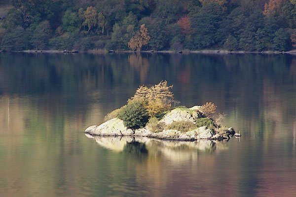 BMY15.jpg (taken 2.11.2006) |
||
|
|
||
| evidence:- | old map:- OS County Series (Wmd 12 7) placename:- House Holm |
|
| source data:- | Maps, County Series maps of Great Britain, scales 6 and 25
inches to 1 mile, published by the Ordnance Survey, Southampton,
Hampshire, from about 1863 to 1948. |
|
|
|
||
| evidence:- | old map:- Jefferys 1770 (Wmd) |
|
| source data:- | Map, 4 sheets, The County of Westmoreland, scale 1 inch to 1
mile, surveyed 1768, and engraved and published by Thomas
Jefferys, London, 1770.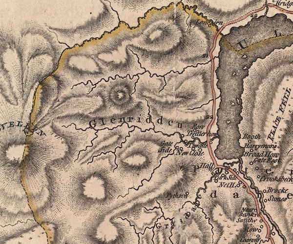 J5NY31NE.jpg island item:- National Library of Scotland : EME.s.47 Image © National Library of Scotland |
|
|
|
||
| evidence:- | old map:- Crosthwaite 1783-94 (Ull) placename:- House Holm |
|
| source data:- | Map, uncoloured engraving, Accurate Map of the Beautiful Lake of
Ullswater, scale about 3 inches to 1 mile, by Peter Crosthwaite,
Keswick, Cumberland, 1783, version published 1800.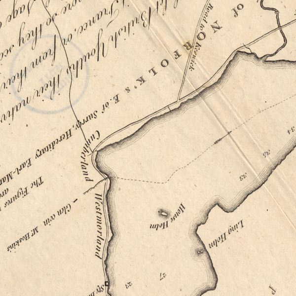 CT5NY31Z.jpg "House Holm" item:- Armitt Library : 1959.191.7 Image © see bottom of page |
|
|
|
||
| evidence:- | probably old map:- West 1784 map |
|
| source data:- | Map, hand coloured engraving, A Map of the Lakes in Cumberland,
Westmorland and Lancashire, scale about 3.5 miles to 1 inch,
engraved by Paas, 53 Holborn, London, about 1784.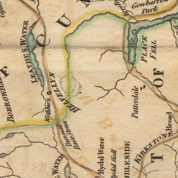 Ws02NY31.jpg item:- Armitt Library : A1221.1 Image © see bottom of page |
|
|
|
||
| evidence:- | old text:- Clarke 1787 placename:- Householm |
|
| source data:- | Guide book, A Survey of the Lakes of Cumberland, Westmorland,
and Lancashire, written and published by James Clarke, Penrith,
Cumberland, and in London etc, 1787; published 1787-93. goto source goto sourcePage 30:- "..." "From Gowbarrow, next proceed to the pleasant little island called Householm, though there is no vestige of an house there. On the higher side is a good landing, and from the island are some truly beautiful and picturesque views." "..." |
|
|
|
||
| evidence:- | old map:- Clarke 1787 map (Ullswater) placename:- House Holm |
|
| source data:- | Map, A Map of the Lake Ullswater and its Environs, scale about
6.5 ins to 1 mile, by James Clarke, engraved by S J Neele, 352
Strand, published by James Clarke, Penrith, Cumberland and in
London etc, 1787.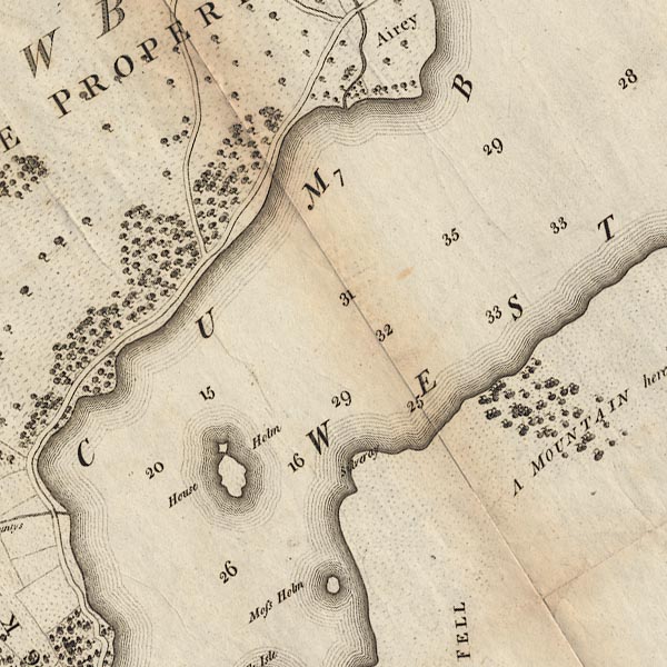 CL4NY31Z.jpg "House Holm" item:- private collection : 10.4 Image © see bottom of page |
|
|
|
||
| evidence:- | old text:- Green 1814 placename:- House Holm |
|
| source data:- | Set of prints, soft ground etchings, Sixty Small Prints, with
text, A Description of a Series of Sixty Small Prints, by
William Green, Ambleside, Westmorland, 1814. goto source page 30:- "... to the island called House Holm, ... the view from House Holm is exquisite. The splendid display of wood which feathers from the tops of the mountains on the right hand to the margin of the lake, is no where equalled in the north of England. ..." |
|
|
|
||
| evidence:- | descriptive text:- Otley 1823 (5th edn 1834) placename:- House Holm |
|
| source data:- | Guide book, A Concise Description of the English Lakes, the
mountains in their vicinity, and the roads by which they may be
visited, with remarks on the mineralogy and geology of the
district, by Jonathan Otley, published by the author, Keswick,
Cumberland now Cumbria, by J Richardson, London, and by Arthur
Foster, Kirkby Lonsdale, Cumbria, 1823; published 1823-49,
latterly as the Descriptive Guide to the English Lakes. goto source Page 8:- "ULLSWATER" "... and House-Holm; ... though houseless, is a fine station for viewing the surrounding scenery. ..." |
|
|
|
||
| evidence:- | old print:- Green 1819 placename:- House Holm item:- sailing boat; boat |
|
| source data:- | Print, aquatint, Ulls Water from House Holm, Patterdale, Westmorland, by William Green,
1819, published by R Lough and Co, Chronicle Office, Finkle Street, Kendal, and others,
1820.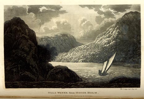 click to enlarge click to enlargeGN0109.jpg Tipped in opposite vol.1 p.341 of The Tourist's New Guide, by William Green. printed at bottom right, centre:- "Vol.I, page 341, line 22. / ULLS WATER from HOUSE HOLM. / Published at Ambleside, Augt. 1. 1819., by Wm. Green." item:- Armitt Library : A1141.10 Image © see bottom of page |
|
|
|
||
 BLN91.jpg (taken 7.1.2006) 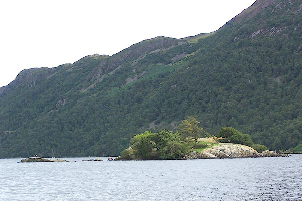 BOA25.jpg (taken 25.8.2007) |
||
|
|
||
Lakes Guides menu.