 West 1784 map NY11


|

|
|
|
gazetteer links places may or may not be labelled on the map |
||

|
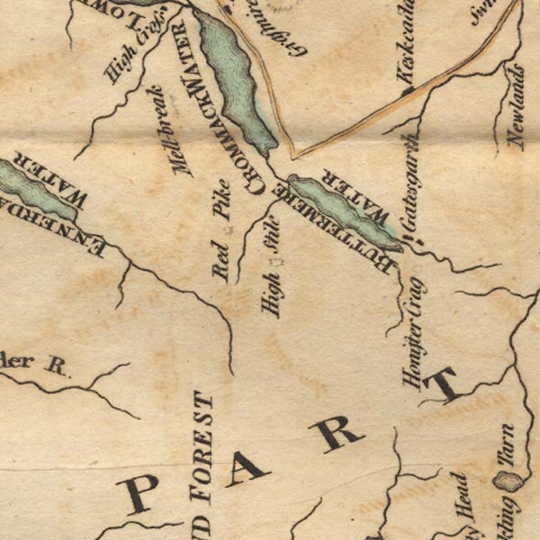
-- Buttermere -- "BUTTERMERE WATER" |
|
|
|
-- Crummock Water -- "CROMMACK WATER" |
|
|
|
-- Gatesgarth |
|
|
|
-- Gatesgarthdale Beck |
|
|
|
-- High Stile |
|
|
|
-- Honister Crag |
|
|
|
-- Keskadale Beck |
|
|
|
-- Liza, River |
|
|
|
-- Mellbreak |
|
|
|
-- Red Pike |
|
|
|
-- Sour Milk Gill |
|
|
civil parishes The area roughly includes parts of parishes:- Lamplugh Nether Wasdale Ennerdale and Kinniside Buttermere Loweswater Above Derwent |
||
|
|
||
|
|
Lakes Guides menu. | |