 Speed 1611 (Wmd) SD49


|

|
|
|
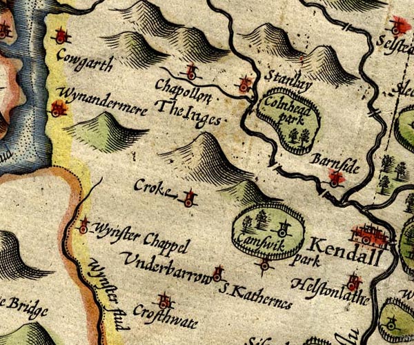
gazetteer links places may or may not be labelled on the map |
||

|
-- Bowston Bridge |
|
|
|
-- Burneside Bridge (?) |
|
|
|
-- Burneside -- "Barnside" |
|
|
|
-- Crook -- "Croke" |
|
|
|
-- Crosthwaite -- "Crosthwaite" |
|
|
|
-- Cunswick Hall -- "Camswik park" |
|
|
|
-- Gowan, River |
|
|
|
-- Ings -- "Chapollon The Inges" |
|
|
|
-- Cowan Head Park (?) -- "Colnhead park" |
|
|
|
-- St Catherine's Church -- "S. Katherines" |
|
|
|
-- Staveley -- "Stanlay" |
|
|
|
-- Underbarrow -- "Underbarrow" |
|
|
|
-- Winster -- "Wynster Chappel" |
|
|
|
-- Winster, River -- "Wynster flud" |
|
|
civil parishes The area roughly includes parts of parishes:- Crosthwaite and Lyth Cartmel Fell Helsington Strickland Ketel Windermere Underbarrow and Bradleyfield Hugill Strickland Roger Over Staveley Nether Staveley Crook |
||
|
|
||
|
|
Lakes Guides menu. | |