 Old Cumbria Gazetteer
 |
 |
|
| Cunswick Hall, Underbarrow and Bradleyfield | ||
| Cunswick Hall | ||
| Cunswick Park | ||
| civil parish:- | Underbarrow and Bradleyfield (formerly Westmorland) | |
| county:- | Cumbria | |
| locality type:- | buildings | |
| locality type:- | park | |
| coordinates:- | SD48579326 | |
| 1Km square:- | SD4893 | |
| 10Km square:- | SD49 | |
|
|
||
| evidence:- | old map:- OS County Series (Wmd 38 3) placename:- Cunswick Hall |
|
| source data:- | Maps, County Series maps of Great Britain, scales 6 and 25
inches to 1 mile, published by the Ordnance Survey, Southampton,
Hampshire, from about 1863 to 1948. |
|
|
|
||
| evidence:- | old map:- Saxton 1579 placename:- Camswick Park |
|
| source data:- | Map, hand coloured engraving, Westmorlandiae et Cumberlandiae Comitatus ie Westmorland
and Cumberland, scale about 5 miles to 1 inch, by Christopher Saxton, London, engraved
by Augustinus Ryther, 1576, published 1579-1645.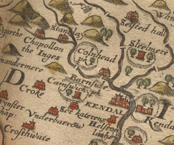 Sax9SD49.jpg Tower, symbol for a house, hall, tower, etc. "Camswick p~k" Fence palings, tree, house. item:- private collection : 2 Image © see bottom of page |
|
|
|
||
| evidence:- | old map:- Speed 1611 (Wmd) placename:- Camswik park |
|
| source data:- | Map, hand coloured engraving, The Countie Westmorland and
Kendale the Cheif Towne, scale about 2.5 miles to 1 inch, by
John Speed, 1610, published by George Humble, Popes Head Alley,
London, 1611-12.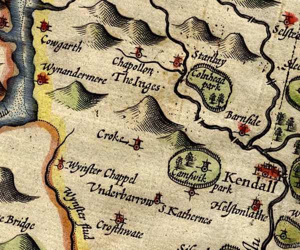 SP14SD49.jpg "Camswik park" circle, tower, in a ring of fence palings, trees, for the park item:- Armitt Library : 2008.14.5 Image © see bottom of page |
|
|
|
||
| evidence:- | probably old map:- Jansson 1646 placename:- Camswik Park |
|
| source data:- | Map, hand coloured engraving, Cumbria and Westmoria, ie
Cumberland and Westmorland, scale about 3.5 miles to 1 inch, by
John Jansson, Amsterdam, Netherlands, 1646.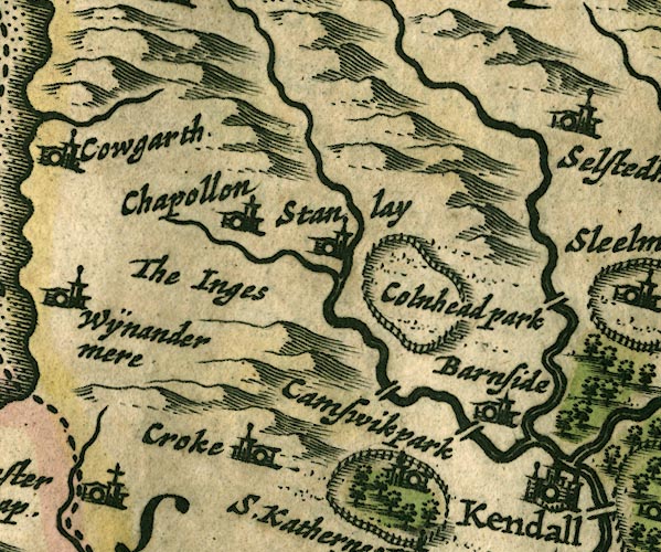 JAN3SD49.jpg "Camswik park" Ring of fence palings with trees. item:- JandMN : 88 Image © see bottom of page |
|
|
|
||
| evidence:- | old map:- Seller 1694 (Wmd) placename:- Camswik |
|
| source data:- | Map, hand coloured engraving, Westmorland, scale about 8 miles
to 1 inch, by John Seller, 1694. click to enlarge click to enlargeSEL7.jpg "Camswik" circle, italic lowercase text; settlement or house item:- Dove Cottage : 2007.38.87 Image © see bottom of page |
|
|
|
||
| evidence:- | old map:- Morden 1695 (Wmd) placename:- Cunswick Park |
|
| source data:- | Map, hand coloured engraving, Westmorland, scale about 2.5 miles to 1 inch, by Robert
Morden, published by Abel Swale, the Unicorn, St Paul's Churchyard, Awnsham, and John
Churchill, the Black Swan, Paternoster Row, London, 1695.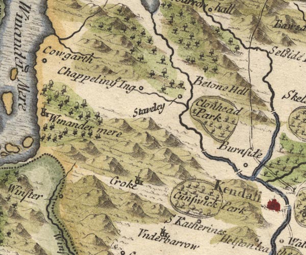 MD10SD49.jpg "Cunswick Park" Ring of fence palings, trees, with a circle. item:- JandMN : 24 Image © see bottom of page |
|
|
|
||
| evidence:- | old map:- Simpson 1746 map (Wmd) placename:- Cunswick Park |
|
| source data:- | Map, uncoloured engraving, Westmorland, scale about 8 miles to 1
inch, printed by R Walker, Fleet Lane, London, 1746.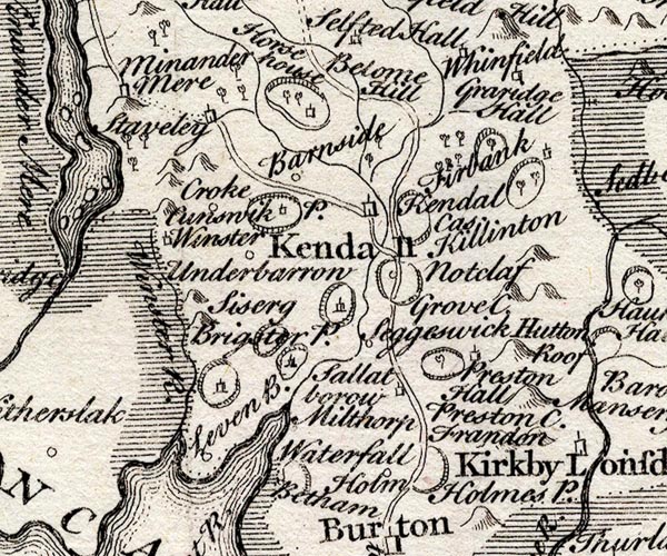 SMP2SDP.jpg "Cunswick P." Outline with fence palings and building. item:- Dove Cottage : 2007.38.59 Image © see bottom of page |
|
|
|
||
| evidence:- | old map:- Bowen and Kitchin 1760 placename:- Cunswick Park |
|
| source data:- | Map, hand coloured engraving, A New Map of the Counties of
Cumberland and Westmoreland Divided into their Respective Wards,
scale about 4 miles to 1 inch, by Emanuel Bowen and Thomas
Kitchin et al, published by T Bowles, Robert Sayer, and John
Bowles, London, 1760.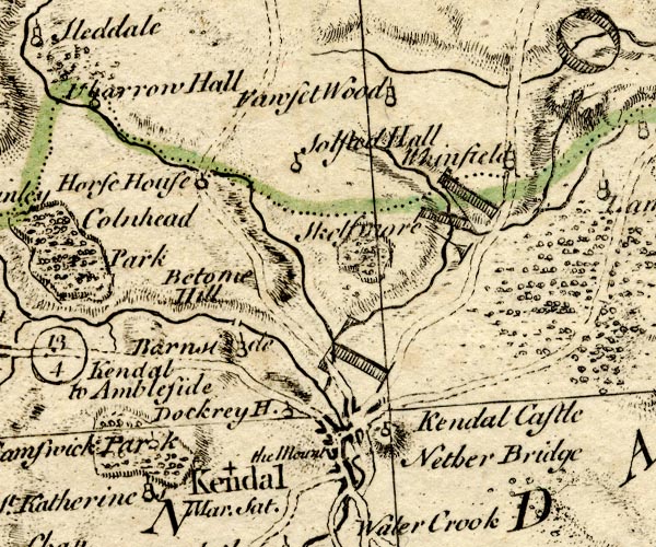 BO18SD49.jpg "Cunswick Park" outline of fence palings item:- Armitt Library : 2008.14.10 Image © see bottom of page |
|
|
|
||
| evidence:- | old map:- Jefferys 1770 (Wmd) placename:- Cunswick Hall |
|
| source data:- | Map, 4 sheets, The County of Westmoreland, scale 1 inch to 1
mile, surveyed 1768, and engraved and published by Thomas
Jefferys, London, 1770.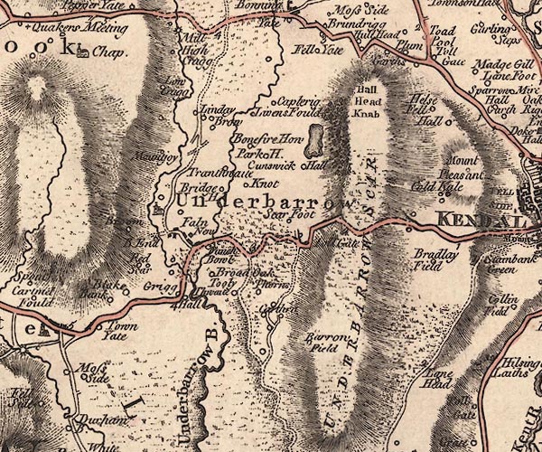 J5SD49SE.jpg "Cunswick Hall" circle, labelled in italic lowercase text; settlement, farm, house, or hamlet? item:- National Library of Scotland : EME.s.47 Image © National Library of Scotland |
|
|
|
||
| evidence:- | old map:- Cary 1789 (edn 1805) placename:- Cunswick Hall |
|
| source data:- | Map, uncoloured engraving, Westmoreland, scale about 2.5 miles
to 1 inch, by John Cary, London, 1789; edition 1805.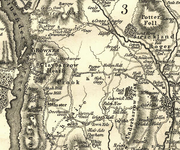 CY24SD49.jpg "Cunswick Hall" block/s, labelled in italic lowercase; house, or hamlet item:- JandMN : 129 Image © see bottom of page |
|
|
|
||
| evidence:- | old map:- Hall 1820 (Wmd) |
|
| source data:- | Map, hand coloured engraving, Westmoreland ie Westmorland, scale
about 14.5 miles to 1 inch, by Sidney Hall, London, 1820,
published by Samuel Leigh, 18 Strand, London, 1820-31. click to enlarge click to enlargeHA18.jpg outline of fence palings; park item:- Armitt Library : 2008.14.58 Image © see bottom of page |
|
|
|
||
| evidence:- | old photograph:- Bell 1880s-1940s placename:- Cunswick Hall |
|
| source data:- | Photograph, Cunswick Hall, Underbarrow and Bradleyfield, Westmorland, by Herbert Bell,
photographer, Ambleside, Westmorland, 1895.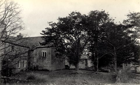 click to enlarge click to enlargeHB0151.jpg Vol.2 no.151 in an album, Examples of Early Domestic and Military Architecture in Westmorland, assembled 1910. ms at bottom:- "151. Cunswick Hall. Kendal. K." item:- Armitt Library : 1958.3166.45 Image © see bottom of page |
|
|
|
||
| evidence:- | old photograph:- Bell 1880s-1940s placename:- Cunswick Hall item:- gateway; coat of arms, royal |
|
| source data:- | Photograph, Cunswick Hall, Gateway, Underbarrow and Bradleyfield, Westmorland, by
Herbert Bell, photographer, Ambleside, Westmorland, 1895.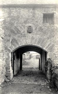 click to enlarge click to enlargeHB0152.jpg Vol.2 no.152 in an album, Examples of Early Domestic and Military Architecture in Westmorland, assembled 1910. ms at bottom:- "152. Cunswick Hall. Gateway. Kendal. K." item:- Armitt Library : 1958.3166.46 Image © see bottom of page |
|
|
|
||
| evidence:- | database:- Listed Buildings 2010 placename:- Cunswick Hall |
|
| source data:- | courtesy of English Heritage "CUNSWICK HALL / / / UNDERBARROW AND BRADLEYFIELD / SOUTH LAKELAND / CUMBRIA / II / 75302 / SD4857493264" |
|
| source data:- | courtesy of English Heritage "House. Mainly C19 on site of earlier house belonging to the Leyburn family until the C18 of which fragments of wall and a C16 two-light stone mullioned window remain. The window is said to have the oldest glass in Westmorland. Rubble walls, slate roof with stone ridge tiles. End chimney stacks to south wing, north wing has large external stack on West side and small central stack. 2 storeys. 6-panelled door with rectangular glazed fanlight in chamfered stone surround. 2 sash windows to left, 1 to right; 3 sash windows above: all with glazing bars. See also RCHM p.230." |
|
|
|
||
| evidence:- | database:- Listed Buildings 2010 |
|
| source data:- | courtesy of English Heritage "BARN TO EAST OF GATEHOUSE AT CUNSWICK HALL / / / UNDERBARROW AND BRADLEYFIELD / SOUTH LAKELAND / CUMBRIA / II / 412990 / SD4857693323" |
|
| source data:- | courtesy of English Heritage "Barn. Limestone rubble walls, green slate roof, blueglazed ridge tiles, corbelled chimney stack. C20 windows and doors. Included for group value." |
|
|
|
||
| evidence:- | database:- Listed Buildings 2010 |
|
| source data:- | courtesy of English Heritage "GATEHOUSE TO SOUTH OF CUNSWICK HALL / / / UNDERBARROW AND BRADLEYFIELD / SOUTH LAKELAND / CUMBRIA / II / 75303 / SD4856093351" |
|
| source data:- | courtesy of English Heritage "Gatehouse. Probably early C16, arches apparently rebuilt. Limestone walls and voussoirs; greenslate roof with stone ridges. Tudor arms with crown and garter above North Arch. Interior has curved tie-beams and remains of stair or possibly garderobe in thickness of wall." |
|
|
|
||
| evidence:- | database:- Listed Buildings 2010 |
|
| source data:- | courtesy of English Heritage "BARN TO WEST OF GATEHOUSE AT CUNSWICK HALL / / / UNDERBARROW AND BRADLEYFIELD / SOUTH LAKELAND / CUMBRIA / II / 75304 / SD4853893326" |
|
|
|
||
| story:- |
Roger, the son of Sir Charles de Leyburne at Cunswick Hall, was betrothed to Helen,
daughter of Sir Allan Bellingham of Burneside Hall. Roger murdered his father, claiming
he was lost in a flood, in order to inherit and marry. Reginald Duckett of Grayrigg
Hall and Sir Allan, walking by the river, found Sir Charles's body, with a stab wound.
Roger confessed, and killed himself. At this Sir Allan remembered that Sir Charles
had foretold that one Leyburne would rest uneasy, would whiten the rocks of Cunswick
Scar, and would haunt the hall. |
|
|
|
||
| notes:- |
15th century tower, hall, gateway etc |
|
| Perriam, D R &Robinson, J: 1998: Medieval Fortified Buildings of Cumbria: CWAAS::
ISBN 1 873124 23 6; plan and illustrations |
||
|
|
||
| hearsay:- |
The pele tower was pulled down in 1582, only a gateway (to a barmkin?) remains. Over
the arch is a coat of arms, England quartering France. |
|
| A clock and bell at the house was given to the inhabitants of Kendal, 1582. It was
set up 'opposite' the market place. |
||
| Palmer, J H & McIntire, W T (ed): 1945: Historic Farmhouses in and around Westmorland:
Westmorland Gazette (Kendal, Westmorland) |
||
|
|
||
 Lakes Guides menu.