 Saxton 1576 NY66


|

|
|
|
gazetteer links places may or may not be labelled on the map |
||

|
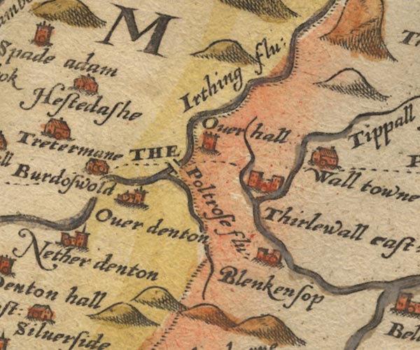
-- Birdoswald -- "Burdoswold" |
|
|
|
-- Blenkinsopp Hall -- "Blenkensop" |
|
|
|
-- Gilsland Bridge (?) |
|
|
|
-- Highstead Ash -- "Hestedashe" |
|
|
|
-- Irthing, River -- "Irthing flu:" -- "Irthing
flu:" -- "Trout bek" |
|
|
|
-- Nether Denton -- "Nether denton" |
|
|
|
-- Over Hall (?) -- "Overhall" |
|
|
|
-- Poltross Burn -- "Poltrose flu:" |
|
|
|
-- Thirlwall Castle -- "Thirlewall cast:" |
|
|
|
-- Tipalt Burn -- "Tippall flu:" |
|
|
|
-- Upper Denton -- "Over denton" |
|
|
|
-- Walltown -- "Wall towne" |
|
|
civil parishes The area roughly includes parts of parishes:- Kingwater Midgeholme Nether Denton Waterhead Farlam Upper Denton |
||
|
|
||
|
|
Lakes Guides menu. | |