 Old Cumbria Gazetteer
 |
 |
|
| Blenkinsopp Hall, Northumberland | ||
| Blenkinsopp Hall | ||
| county:- | Northumberland | |
| locality type:- | buildings | |
| coordinates:- | NY681641 | |
| 1Km square:- | NY6864 | |
| 10Km square:- | NY66 | |
|
|
||
| evidence:- | old map:- Saxton 1579 placename:- Blenkensop |
|
| source data:- | Map, hand coloured engraving, Westmorlandiae et Cumberlandiae Comitatus ie Westmorland
and Cumberland, scale about 5 miles to 1 inch, by Christopher Saxton, London, engraved
by Augustinus Ryther, 1576, published 1579-1645.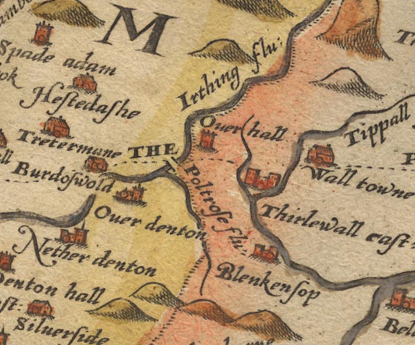 Sax9NY66.jpg Building with two towers, symbol for a castle. "Blenkensop" Castle? item:- private collection : 2 Image © see bottom of page |
|
|
|
||
| evidence:- | old map:- Speed 1611 (Cmd) placename:- Blenkensop |
|
| source data:- | Map, hand coloured engraving, Cumberland and the Ancient Citie
Carlile Described, scale about 4 miles to 1 inch, by John Speed,
1610, published by J Sudbury and George Humble, Popes Head
Alley, London, 1611-12.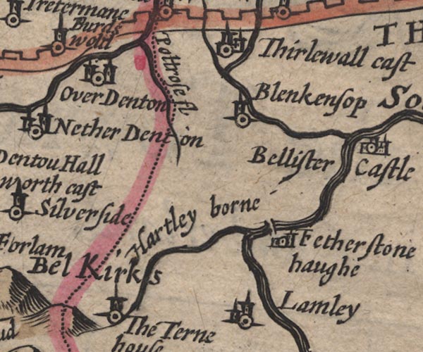 SP11NY66.jpg "Blenkensop" circle, tower; Northumberland item:- private collection : 16 Image © see bottom of page |
|
|
|
||
| evidence:- | old map:- Jansson 1646 placename:- Blenkensop |
|
| source data:- | Map, hand coloured engraving, Cumbria and Westmoria, ie
Cumberland and Westmorland, scale about 3.5 miles to 1 inch, by
John Jansson, Amsterdam, Netherlands, 1646.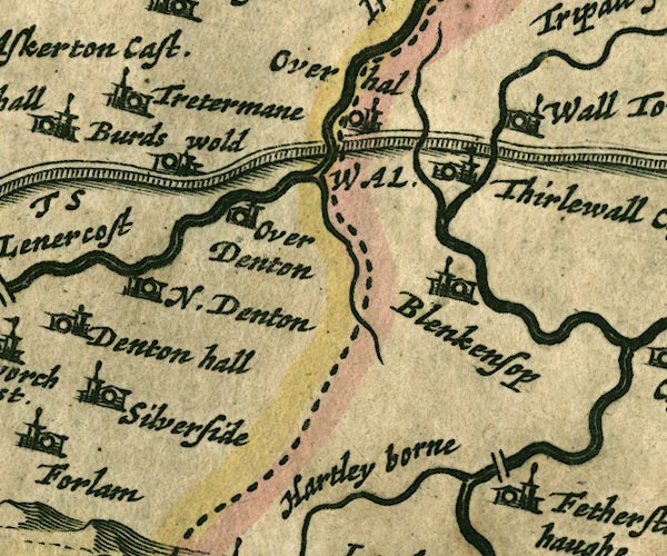 JAN3NY66.jpg "Blenkensop" Buildings and tower. item:- JandMN : 88 Image © see bottom of page |
|
|
|
||
| evidence:- | probably old map:- Morden 1695 (Cmd) placename:- Blenkensop |
|
| source data:- | Map, uncoloured engraving, Cumberland, scale about 4 miles to 1
inch, by Robert Morden, 1695, published by Abel Swale, the
Unicorn, St Paul's Churchyard, Awnsham, and John Churchill, the
Black Swan, Paternoster Row, London, 1695-1715.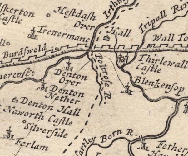 MD12NY66.jpg "Blenkensop" Circle, building and tower. item:- JandMN : 90 Image © see bottom of page |
|
|
|
||
 Lakes Guides menu.