 Old Cumbria Gazetteer
 |
 |
|
||
| Tipalt Burn | ||||
| county:- | Northumberland | |||
| locality type:- | river | |||
| 1Km square:- | NY6963 | |||
| 10Km square:- | NY66 | |||
|
|
||||
| evidence:- | old map:- Saxton 1579 placename:- Tippall Flu. |
|||
| source data:- | Map, hand coloured engraving, Westmorlandiae et Cumberlandiae Comitatus ie Westmorland
and Cumberland, scale about 5 miles to 1 inch, by Christopher Saxton, London, engraved
by Augustinus Ryther, 1576, published 1579-1645.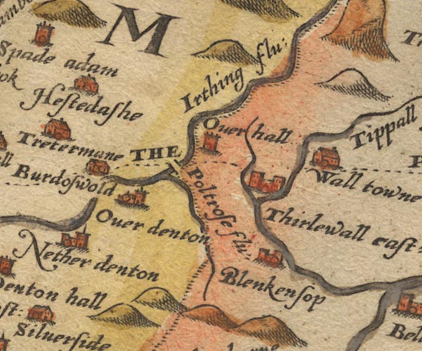 Sax9NY66.jpg 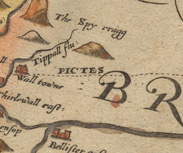 Sax9NY76.jpg "Tippall flu:" item:- private collection : 2 Image © see bottom of page |
|||
|
|
||||
| evidence:- | old map:- Speed 1611 (Cmd) placename:- Tripall flud |
|||
| source data:- | Map, hand coloured engraving, Cumberland and the Ancient Citie
Carlile Described, scale about 4 miles to 1 inch, by John Speed,
1610, published by J Sudbury and George Humble, Popes Head
Alley, London, 1611-12.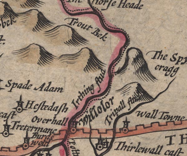 SP11NY67.jpg "Tripall flud" double line; Northumberland 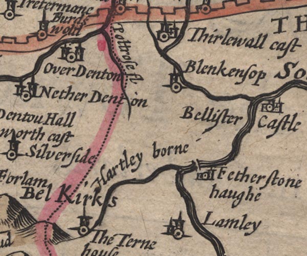 SP11NY66.jpg double line, runs into the South Tyne; Northumberland item:- private collection : 16 Image © see bottom of page |
|||
|
|
||||
| evidence:- | old map:- Jansson 1646 placename:- Tripall Flud |
|||
| source data:- | Map, hand coloured engraving, Cumbria and Westmoria, ie
Cumberland and Westmorland, scale about 3.5 miles to 1 inch, by
John Jansson, Amsterdam, Netherlands, 1646.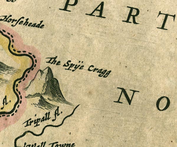 JAN3NY77.jpg "Tripall fl." Single wiggly line. item:- JandMN : 88 Image © see bottom of page |
|||
|
|
||||
| evidence:- | old map:- Ogilby 1675 (plate 86) |
|||
| source data:- | Road strip map, uncoloured engraving, the Road from Tinmouth ...
to Carlisle, scale about 1 inch to 1 mile, by John Ogilby,
London, 1675.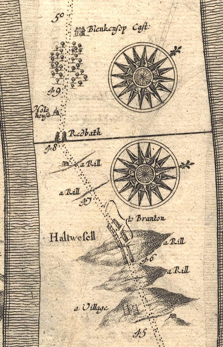 OG86m045.jpg In mile 47, Northumberland. "a Rill" drawn across the road, a house beside it. item:- JandMN : 73 Image © see bottom of page |
|||
|
|
||||
| evidence:- | old map:- Morden 1695 (Cmd) placename:- Tripall River |
|||
| source data:- | Map, uncoloured engraving, Cumberland, scale about 4 miles to 1
inch, by Robert Morden, 1695, published by Abel Swale, the
Unicorn, St Paul's Churchyard, Awnsham, and John Churchill, the
Black Swan, Paternoster Row, London, 1695-1715.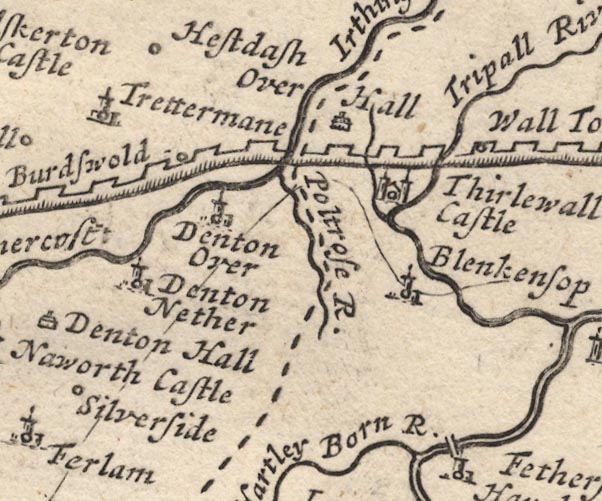 MD12NY66.jpg "Tripall River" item:- JandMN : 90 Image © see bottom of page |
|||
|
|
||||
| evidence:- | old print:- Rose 1832-35 (vol.2 no.57) |
|||
| source data:- | Print, engraving, Thirlwall Castle, Cumberland, by Thomas Allom, engraved by S Lacey,
1833.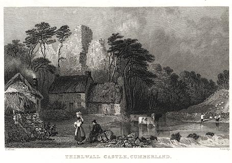 click to enlarge click to enlargePR0409.jpg Vol.2 no.57 in Westmorland, Cumberland, Durham and Northumberland Illustrated, with descriptions by Thomas Rose, published by H Fisher, R Fisher, and P Jackson, Newgate, London, about 1835. item:- Dove Cottage : 2008.107.402 Image © see bottom of page |
|||
|
|
||||
| places:- |
|
|||
 Lakes Guides menu.