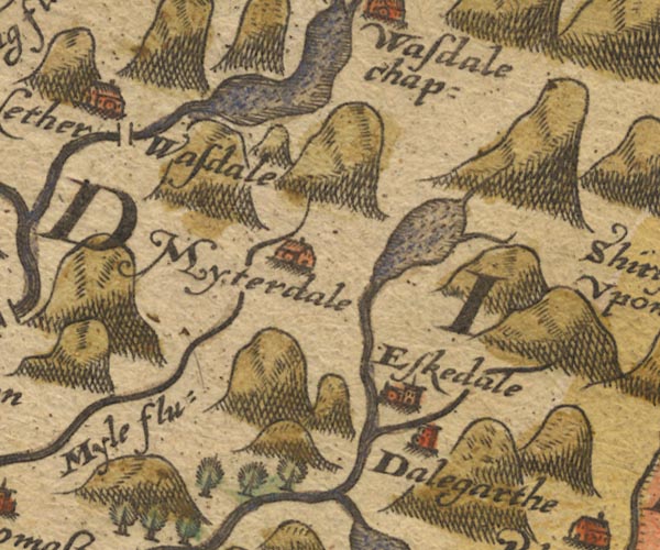
 Saxton 1576 NY10


|

|
|
|
gazetteer links places may or may not be labelled on the map |
||

|
-- Burnmoor Tarn |
|
|
|
-- Dalegarth Hall -- "Dalegarth" |
|
|
|
-- Eskdale -- "Eskedale" |
|
|
|
-- Forest Bridge |
|
|
|
-- |
|
|
|
-- Hardrigg Gill |
|
|
|
-- Mite, River -- "Myle flu:" |
|
|
|
-- Miterdale -- "Myterdale" |
|
|
|
-- Nether Wasdale -- "Nether Wasdale" |
|
|
|
-- Wast Water |
|
|
|
-- Whillan Beck |
|
|
civil parishes The area roughly includes parts of parishes:- Gosforth Eskdale Ennerdale and Kinniside Nether Wasdale Irton with Santon Muncaster |
||
|
|
||
|
|
Lakes Guides menu. | |