 Old Cumbria Gazetteer
 |
 |
|
||||||||||||||||||||||||
| Wast Water | ||||||||||||||||||||||||||
| runs into:- |  Irt, River Irt, River |
|||||||||||||||||||||||||
|
|
||||||||||||||||||||||||||
| Wassewater | ||||||||||||||||||||||||||
| locality:- | Wasdale | |||||||||||||||||||||||||
| civil parish:- | Nether Wasdale (formerly Cumberland) | |||||||||||||||||||||||||
| county:- | Cumbria | |||||||||||||||||||||||||
| locality type:- | lake | |||||||||||||||||||||||||
| coordinates:- | NY161059 | |||||||||||||||||||||||||
| 1Km square:- | NY1605 | |||||||||||||||||||||||||
| 10Km square:- | NY10 | |||||||||||||||||||||||||
|
|
||||||||||||||||||||||||||
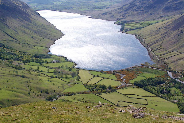 BQO25.jpg (taken 12.5.2009) 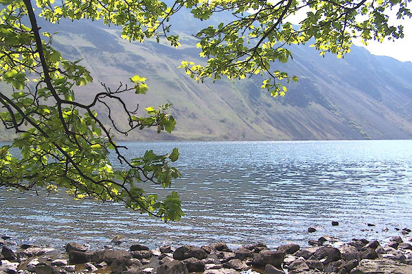 BMB61.jpg Level with Bowderdale. (taken 11.5.2006) |
||||||||||||||||||||||||||
|
|
||||||||||||||||||||||||||
| evidence:- | old map:- OS County Series (Cmd 79 2) placename:- Wast Water |
|||||||||||||||||||||||||
| source data:- | Maps, County Series maps of Great Britain, scales 6 and 25
inches to 1 mile, published by the Ordnance Survey, Southampton,
Hampshire, from about 1863 to 1948. |
|||||||||||||||||||||||||
|
|
||||||||||||||||||||||||||
| evidence:- | old map:- OS County Series (Cmd 79) |
|||||||||||||||||||||||||
| source data:- | Maps, County Series maps of Great Britain, scales 6 and 25
inches to 1 mile, published by the Ordnance Survey, Southampton,
Hampshire, from about 1863 to 1948. "Lowest point of bed of lake 54 feet below O.S. datum" elsewhere "Sur. of Water 204 4" |
|||||||||||||||||||||||||
|
|
||||||||||||||||||||||||||
| evidence:- | old map:- Saxton 1579 |
|||||||||||||||||||||||||
| source data:- | Map, hand coloured engraving, Westmorlandiae et Cumberlandiae Comitatus ie Westmorland
and Cumberland, scale about 5 miles to 1 inch, by Christopher Saxton, London, engraved
by Augustinus Ryther, 1576, published 1579-1645. Sax9NY10.jpg Lake. item:- private collection : 2 Image © see bottom of page |
|||||||||||||||||||||||||
|
|
||||||||||||||||||||||||||
| evidence:- | old map:- Mercator 1595 (edn?) placename:- |
|||||||||||||||||||||||||
| source data:- | Map, hand coloured engraving, Northumbria, Cumberlandia, et
Dunelmensis Episcopatus, ie Northumberland, Cumberland and
Durham etc, scale about 6.5 miles to 1 inch, by Gerard Mercator,
Duisberg, Germany, about 1595. MER8CumE.jpg "" outline, coast shaded, tinted blue; lake item:- JandMN : 169 Image © see bottom of page |
|||||||||||||||||||||||||
|
|
||||||||||||||||||||||||||
| evidence:- | old map:- Speed 1611 (Cmd) |
|||||||||||||||||||||||||
| source data:- | Map, hand coloured engraving, Cumberland and the Ancient Citie
Carlile Described, scale about 4 miles to 1 inch, by John Speed,
1610, published by J Sudbury and George Humble, Popes Head
Alley, London, 1611-12.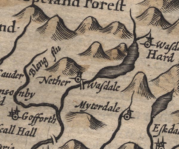 SP11NY10.jpg outline, shaded item:- private collection : 16 Image © see bottom of page |
|||||||||||||||||||||||||
|
|
||||||||||||||||||||||||||
| evidence:- | perhaps table of distances:- Simons 1635 |
|||||||||||||||||||||||||
| source data:- | Table of distances, uncoloured engraving, Cumberland, with a
thumbnail map, scale about 41 miles to 1 inch, by Mathew Simons,
published in A Direction for the English Traviller, 1635.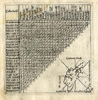 click to enlarge click to enlargeSIM4.jpg outline on thumbnail map item:- private collection : 50.11 Image © see bottom of page |
|||||||||||||||||||||||||
|
|
||||||||||||||||||||||||||
| evidence:- | old map:- Jansson 1646 |
|||||||||||||||||||||||||
| source data:- | Map, hand coloured engraving, Cumbria and Westmoria, ie
Cumberland and Westmorland, scale about 3.5 miles to 1 inch, by
John Jansson, Amsterdam, Netherlands, 1646.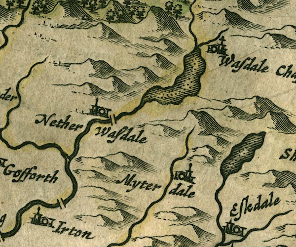 JAN3NY10.jpg Outline with shore shaded, dotted area. item:- JandMN : 88 Image © see bottom of page |
|||||||||||||||||||||||||
|
|
||||||||||||||||||||||||||
| evidence:- | old map:- Sanson 1679 |
|||||||||||||||||||||||||
| source data:- | Map, hand coloured engraving, Ancien Royaume de Northumberland
aujourdhuy Provinces de Nort, ie the Ancient Kingdom of
Northumberland or the Northern Provinces, scale about 9.5 miles
to 1 inch, by Nicholas Sanson, Paris, France, 1679. click to enlarge click to enlargeSAN2Cm.jpg outline, shore shaded; lake item:- Dove Cottage : 2007.38.15 Image © see bottom of page |
|||||||||||||||||||||||||
|
|
||||||||||||||||||||||||||
| evidence:- | old map:- Seller 1694 (Cmd) |
|||||||||||||||||||||||||
| source data:- | Map, uncoloured engraving, Cumberland, scale about 12 miles to 1
inch, by John Seller, 1694. click to enlarge click to enlargeSEL9.jpg outline with shaded shore; lake item:- Dove Cottage : 2007.38.89 Image © see bottom of page |
|||||||||||||||||||||||||
|
|
||||||||||||||||||||||||||
| evidence:- | old map:- Morden 1695 (Cmd) |
|||||||||||||||||||||||||
| source data:- | Map, uncoloured engraving, Cumberland, scale about 4 miles to 1
inch, by Robert Morden, 1695, published by Abel Swale, the
Unicorn, St Paul's Churchyard, Awnsham, and John Churchill, the
Black Swan, Paternoster Row, London, 1695-1715.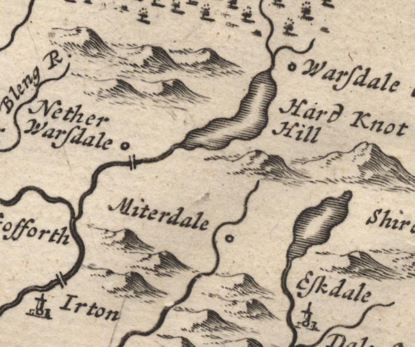 MD12NY10.jpg Outline with shore shading. item:- JandMN : 90 Image © see bottom of page |
|||||||||||||||||||||||||
|
|
||||||||||||||||||||||||||
| evidence:- | old map:- Badeslade 1742 placename:- |
|||||||||||||||||||||||||
| source data:- | Map, uncoloured engraving, A Map of Cumberland North from
London, scale about 11 miles to 1 inch, with descriptive text,
by Thomas Badeslade, London, engraved and published by William
Henry Toms, Union Court, Holborn, London, 1742. click to enlarge click to enlargeBD10.jpg "" outline with form lines item:- JandMN : 115 Image © see bottom of page |
|||||||||||||||||||||||||
|
|
||||||||||||||||||||||||||
| evidence:- | old map:- Simpson 1746 map (Wmd) |
|||||||||||||||||||||||||
| source data:- | Map, uncoloured engraving, Westmorland, scale about 8 miles to 1
inch, printed by R Walker, Fleet Lane, London, 1746.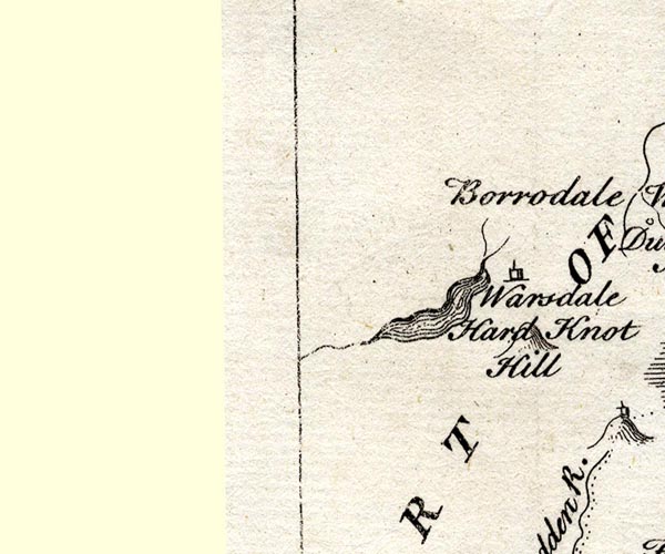 SMP2NYA.jpg Outline with form lines. item:- Dove Cottage : 2007.38.59 Image © see bottom of page |
|||||||||||||||||||||||||
|
|
||||||||||||||||||||||||||
| evidence:- | old map:- Bowen and Kitchin 1760 |
|||||||||||||||||||||||||
| source data:- | Map, hand coloured engraving, A New Map of the Counties of
Cumberland and Westmoreland Divided into their Respective Wards,
scale about 4 miles to 1 inch, by Emanuel Bowen and Thomas
Kitchin et al, published by T Bowles, Robert Sayer, and John
Bowles, London, 1760.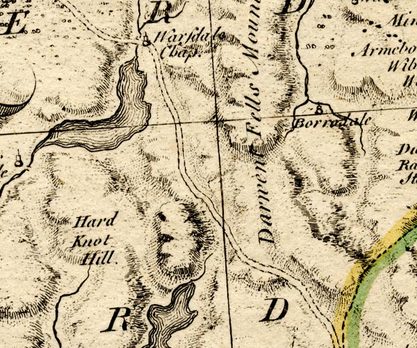 BO18NY10.jpg outline with form lines item:- Armitt Library : 2008.14.10 Image © see bottom of page |
|||||||||||||||||||||||||
|
|
||||||||||||||||||||||||||
| evidence:- | old map:- Donald 1774 (Cmd) placename:- Wast Water |
|||||||||||||||||||||||||
| source data:- | Map, hand coloured engraving, 3x2 sheets, The County of Cumberland, scale about 1
inch to 1 mile, by Thomas Donald, engraved and published by Joseph Hodskinson, 29
Arundel Street, Strand, London, 1774. D4NY10NE.jpg  D4NY10SW.jpg "WAST WATER" lake item:- Carlisle Library : Map 2 Images © Carlisle Library |
|||||||||||||||||||||||||
|
|
||||||||||||||||||||||||||
| evidence:- | old map:- West 1784 map placename:- Wast Water |
|||||||||||||||||||||||||
| source data:- | Map, hand coloured engraving, A Map of the Lakes in Cumberland,
Westmorland and Lancashire, scale about 3.5 miles to 1 inch,
engraved by Paas, 53 Holborn, London, about 1784.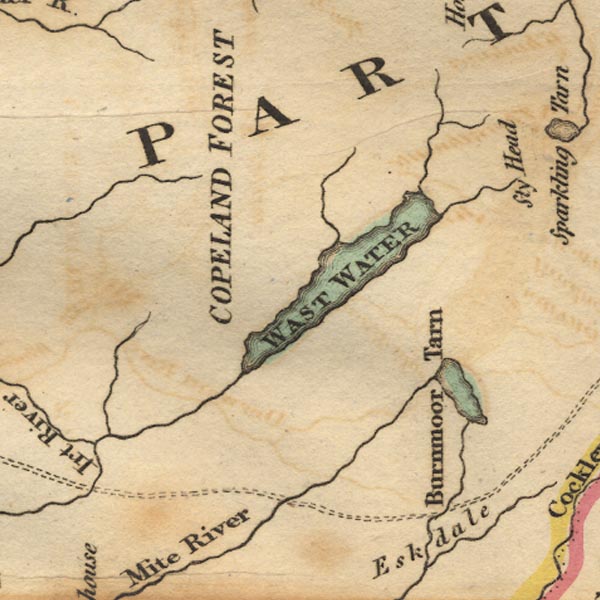 Ws02NY10.jpg "WAST WATER" item:- Armitt Library : A1221.1 Image © see bottom of page |
|||||||||||||||||||||||||
|
|
||||||||||||||||||||||||||
| evidence:- | old map:- Aikin 1790 (Cmd) placename:- |
|||||||||||||||||||||||||
| source data:- | Map, uncoloured engraving, Cumberland, by John Aikin, London,
1790. click to enlarge click to enlargeAIK3.jpg "" outline with form lines; lake item:- JandMN : 145 Image © see bottom of page |
|||||||||||||||||||||||||
|
|
||||||||||||||||||||||||||
| evidence:- | old map:- Housman 1800 map 3 placename:- Wast Water |
|||||||||||||||||||||||||
| source data:- | Maps, hand coloured engraving, Lakes in Cumberland, 9 lakes on one sheet, engraved
by James Lowes, published by F Jollie, Carlisle, Cumberland, and C Law, Ave Maria
Lane, London, 1800.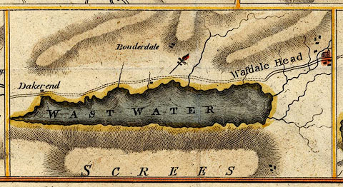 click to enlarge click to enlargeHM01Was.jpg "WAST WATER" item:- Dove Cottage : 2007.38.96 Image © see bottom of page |
|||||||||||||||||||||||||
|
|
||||||||||||||||||||||||||
| evidence:- | old map:- Cooke 1802 placename:- Wast Water |
|||||||||||||||||||||||||
| source data:- | Map, Cumberland, scale about 15.5 miles to 1 inch, by George
Cooke, 1802, bound in Gray's New Book of Roads, 1824, published
by Sherwood, Jones and Co, Paternoster Road, London, 1824. click to enlarge click to enlargeGRA1Cd.jpg "Wast Water" outline with form lines; lake or tarn item:- Hampshire Museums : FA2000.62.2 Image © see bottom of page |
|||||||||||||||||||||||||
|
|
||||||||||||||||||||||||||
| evidence:- | old print:- Green 1804 (plate 24) placename:- Wast Water |
|||||||||||||||||||||||||
| source data:- | Print, uncoloured aquatint, Wast Water, Nether Wasdale, Cumberland, by William Green,
Ambleside, Westmorland, 1804.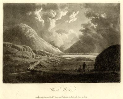 click to enlarge click to enlargeGN1624.jpg Plate 24 from a series. printed at bottom:- "Wast Water. / Drawn and Engraved by Wm. Green, and Published at Ambleside, June 24, 1804." printed at top right:- "24" at :- "W ELGAR / 1802" item:- Armitt Library : 2014.173 Image © see bottom of page |
|||||||||||||||||||||||||
|
|
||||||||||||||||||||||||||
| evidence:- | old map:- Laurie and Whittle 1806 placename:- Wast Water |
|||||||||||||||||||||||||
| source data:- | Road map, Completion of the Roads to the Lakes, scale about 10
miles to 1 inch, by Nathaniel Coltman? 1806, published by Robert
H Laurie, 53 Fleet Street, London, 1834. click to enlarge click to enlargeLw18.jpg "Wast Water" lake item:- private collection : 18.18 Image © see bottom of page |
|||||||||||||||||||||||||
|
|
||||||||||||||||||||||||||
| evidence:- | old map:- Cooper 1808 placename:- Wast Water |
|||||||||||||||||||||||||
| source data:- | Map, uncoloured engraving, Cumberland, scale about 10.5 miles to
1 inch, drawn and engraved by Cooper, published by R Phillips,
Bridge Street, Blackfriars, London, 1808. click to enlarge click to enlargeCOP3.jpg "Wast W." outline, shaded; lake item:- JandMN : 86 Image © see bottom of page |
|||||||||||||||||||||||||
|
|
||||||||||||||||||||||||||
| evidence:- | old text:- Green 1810 placename:- Wast Water |
|||||||||||||||||||||||||
| source data:- | Set of prints, soft ground etchings, Sixty Studies from Nature,
by William Green, Ambleside, Westmorland, drawn 1808-10,
published 1810. goto source page 82:- "..." "Wast Water is seen to the greatest advantage by travelling, first to the" page 83:- "foot, and then up its western side to the head." "The head of this lake is in a straight line, about fourteen miles north-west of Ambleside; but its approach from Ambleside or Keswick, is either difficult or circuitous." "The best pedestrian road from Ambleside to the foot of Wast Water, is over Hardknott and Wrynose, and through the vale of Esk, by Sandholme bridge to Nether Wastdale; or leaving Eskdale earlier, cross Miterdale, the Screes End, and Latter-barrow at half a mile from the foot of the lake, either to the public house, or to the nearest part of the road leading to the lake: From Nether Wastdale, travel the side of the lake, ..." "..." goto sourcepage 89:- "..." "Wast Water is four miles long, and about three quarters of a mile over in the broadest part; on the Screes or eastern side it is of a tolerably straight line, but the opposite shores are irregular, and appear beautifully embayed when seen from the higher grounds; the road is up the western side of the lake, often on its margin," goto sourcepage 90:- "and seldom more than one hundred yards from it." "Wast Water has, in its composition, more of the sublime than any other of the English lakes, the mountains are not only higher than the other mountains of the country, but swelling proudly above their intersecting bases, each has a distinct and characteristic appearance." |
|||||||||||||||||||||||||
|
|
||||||||||||||||||||||||||
| evidence:- | old text:- Green 1810 placename:- Wast Water item:- sun; clouds |
|||||||||||||||||||||||||
| source data:- | Set of prints, soft ground etchings, Sixty Studies from Nature,
by William Green, Ambleside, Westmorland, drawn 1808-10,
published 1810. goto source page 96:- "..." "Wast Water is not fine when enlightened by a meridian sun from a cloudless sky, for then the mountains on the north and west are uniformly illuminated; nor is it better at three, for then the sun's rays dart down the middle of the vale. In cloudless weather, the evening and the morning will be better than the mid-day or afternoon; but cloudy weather, with occa-" page 97:- "[occa]sional gleams of the sun, will exhibit Wast Water to great advantage - mists and clouds travelling the surface of the rocks, sometimes, displaying their huge forms as if hung in vapour, alternately light, and of the deepest air tints, will not fail of giving great pleasure to all who are capable of being moved by the wonders of God in the works of his creation." "Those who delight in the beautiful rather than the sublime, or in its mixture, Wast Water, it is feared, will not satisfy. Wastdale is seldom seen to advantage, and those who view it under unfavourable circumstances, will, perhaps, return disgusted." |
|||||||||||||||||||||||||
|
|
||||||||||||||||||||||||||
| evidence:- | old print:- Green 1810 (plate 47) placename:- Wast Water |
|||||||||||||||||||||||||
| source data:- | Print, soft ground etching, Wast Water, Nether Wasdale, Cumberland, by William Green,
Ambleside, Westmorland, 1808.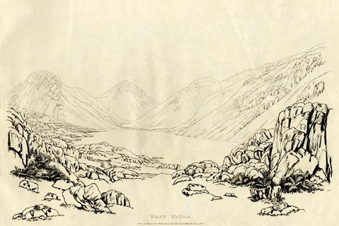 click to enlarge click to enlargeGN1247.jpg Plate 47 in Sixty Studies from Nature, 1810. printed at top right:- "[47]" printed at bottom:- "WAST WATER. / Drawn and Engraved by William Green, and Published at Ambleside, June 24, 1808." watermark:- "J WHATMAN / 1813" item:- Armitt Library : A6641.47 Image © see bottom of page |
|||||||||||||||||||||||||
|
|
||||||||||||||||||||||||||
| evidence:- | old map:- Wallis 1810 (Cmd) placename:- Wast Water |
|||||||||||||||||||||||||
| source data:- | Road map, hand coloured engraving, Cumberland, scale about 16
miles to 1 inch, by James Wallis, 77 Berwick Stree, Soho,
London, 1810. click to enlarge click to enlargeWL13.jpg "Wast Water" outline, shaded; lake item:- Dove Cottage : 2009.81.10 Image © see bottom of page |
|||||||||||||||||||||||||
|
|
||||||||||||||||||||||||||
| evidence:- | old print:- Wilkinson 1810 (plate 41) placename:- Wast Water |
|||||||||||||||||||||||||
| source data:- | Print, uncoloured soft ground etching, Wast Water, looking up to Wastdale Head, Cumberland,
by Joseph Wilkinson, engraved by William Frederick Wells, published by R Ackermann,
Repository of Arts, 101 Strand, London, 1810.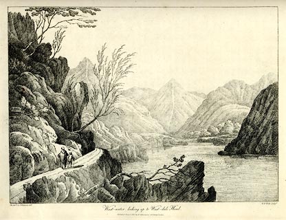 click to enlarge click to enlargeWKN141.jpg Plate 41 in Select Views in Cumberland, Westmoreland, and Lancashire. printed at bottom left, right, centre:- "The Revd. Jos: Wilkenson delt. / W. F. Wells sculpt. / Wast-water, looking up to Wast-dale Head. / Published June 1. 1810. by R. Ackermann. 101. Strand. London." item:- Fell and Rock Climbing Club : MN4.41 Image © see bottom of page |
|||||||||||||||||||||||||
|
|
||||||||||||||||||||||||||
| evidence:- | old print:- Green 1814 (plate 45) placename:- Wast Water item:- sheep |
|||||||||||||||||||||||||
| source data:- | Print, tinted soft ground etching, Schofell on Wast Water, Nether Wasdale, Cumberland,
by William Green, Ambleside, Westmorland, 1814.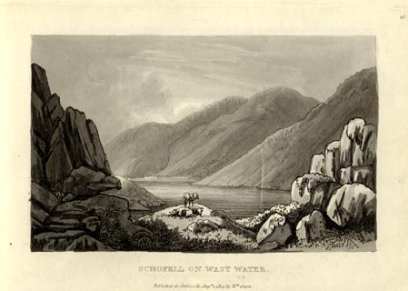 click to enlarge click to enlargeGN1045.jpg Plate 45 in Sixty Small Prints. printed at top right:- "45" printed at bottom:- "SCHOFELL ON WAST WATER. / Published at Ambleside Augst. 1, 1814, by Wm. Green." item:- Armitt Library : A6653.45 Image © see bottom of page |
|||||||||||||||||||||||||
|
|
||||||||||||||||||||||||||
| evidence:- | old print:- Green 1814 (plate 45) placename:- Wast Water item:- sheep |
|||||||||||||||||||||||||
| source data:- | Print, uncoloured soft ground etching, Schofell on Wast Water, Nether Wasdale, Cumberland,
by William Green, Ambleside, Westmorland, 1814.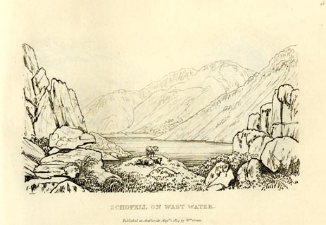 click to enlarge click to enlargeGN0945.jpg Plate 45 in Sixty Small Prints. printed at top right:- "45" printed at bottom:- "SCHOFELL ON WAST WATER. / Published at Ambleside Augst. 1, 1814, by Wm. Green." item:- Armitt Library : A6656.45 Image © see bottom of page |
|||||||||||||||||||||||||
|
|
||||||||||||||||||||||||||
| evidence:- | old print:- Green 1814 (plate 44) placename:- Wast Water |
|||||||||||||||||||||||||
| source data:- | Print, tinted soft ground etching, Wast Water from the Road, Nether Wasdale, Cumberland,
by William Green, Ambleside, Westmorland, 1814.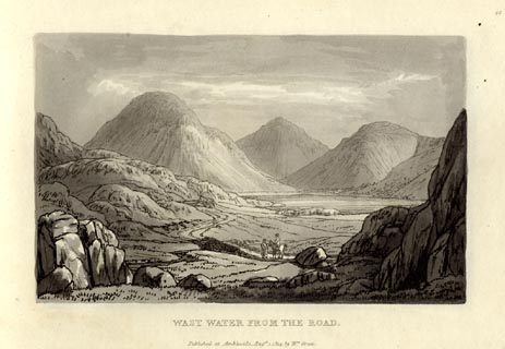 click to enlarge click to enlargeGN1044.jpg Plate 44 in Sixty Small Prints. printed at top right:- "44" printed at bottom:- "WAST WATER FROM THE ROAD. / Published at Ambleside Augst. 1, 1814, by Wm. Green." item:- Armitt Library : A6653.44 Image © see bottom of page |
|||||||||||||||||||||||||
|
|
||||||||||||||||||||||||||
| evidence:- | old print:- Green 1814 (plate 44) placename:- Wast Water |
|||||||||||||||||||||||||
| source data:- | Print, uncoloured soft ground etching, Wast Water from the Road, Nether Wasdale, Cumberland,
by William Green, Ambleside, Westmorland, 1814.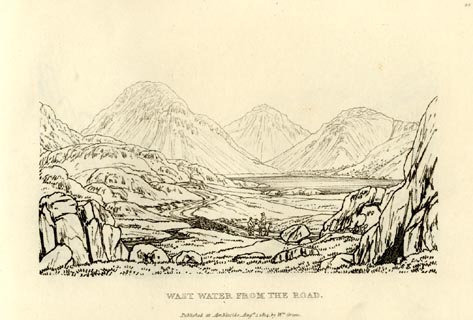 click to enlarge click to enlargeGN0944.jpg Plate 44 in Sixty Small Prints. printed at top right:- "44" printed at bottom:- "WAST WATER FROM THE ROAD. / Published at Ambleside Augst. 1, 1814, by Wm. Green." item:- Armitt Library : A6656.44 Image © see bottom of page |
|||||||||||||||||||||||||
|
|
||||||||||||||||||||||||||
| evidence:- | old print:- Green 1814 (plate 43) item:- sheep |
|||||||||||||||||||||||||
| source data:- | Print, tinted soft ground etching, Wast Water, Nether Wasdale, Cumberland, by William
Green, Ambleside, Westmorland, 1814.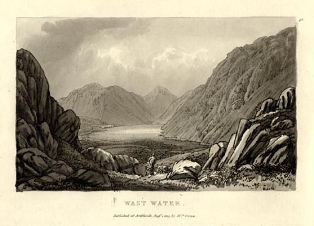 click to enlarge click to enlargeGN1043.jpg Plate 43 in Sixty Small Prints. printed at top right:- "43" printed at bottom:- "WAST WATER. / Published at Ambleside Augst. 1, 1814, by Wm. Green." item:- Armitt Library : A6653.43 Image © see bottom of page |
|||||||||||||||||||||||||
|
|
||||||||||||||||||||||||||
| evidence:- | old print:- Green 1814 (plate 43) item:- sheep |
|||||||||||||||||||||||||
| source data:- | Print, uncoloured soft ground etching, Wast Water, Nether Wasdale, Cumberland, by
William Green, Ambleside, Westmorland, 1814.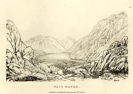 click to enlarge click to enlargeGN0943.jpg Plate 43 in Sixty Small Prints. printed at top right:- "43" printed at bottom:- "WAST WATER. / Published at Ambleside Augst. 1, 1814, by Wm. Green." item:- Armitt Library : A6656.43 Image © see bottom of page |
|||||||||||||||||||||||||
|
|
||||||||||||||||||||||||||
| evidence:- | old text:- Green 1814 placename:- Wast Water |
|||||||||||||||||||||||||
| source data:- | Set of prints, soft ground etchings, Sixty Small Prints, with
text, A Description of a Series of Sixty Small Prints, by
William Green, Ambleside, Westmorland, 1814. goto source page 23:- "..." "WAST WATER." "Wast Water is seen to the greatest advantage by travelling first to the foot, and then up the eastern side to the head." "The head of the lake, in a straight line, is about fourteen miles north-west of Ambleside; but its approach from Ambleside to Keswick is either difficult or circuitous." "The best pedestrian road from Ambleside to the foot of Wast Water is over Hardknott and Wrynose, and through the vale of Esk, by Santon Bridge to Nether Wasdale, which is about 22 miles; or leaving Eskdale earlier, cross Matterdale, the Screes end, and Latterbarrow, at half a mile from the foot of the lake, either by the public-house, or to the nearest part of the road leading to the lake: by this route the distance from Ambleside is about 20 miles." goto sourcepage 24:- "From Nether Wasdale travel the side of the lake, and by Wastdale Head up the side of Gable to the Sty; and leaving Sty Head Tarn, Sprinkling Tarn, and Angle Tarn, all on the left hand, drop down through the vale of Langdale to Ambleside. Or from Sty Head, leaving Sty Head Tarn upon the right, pass through Seathwaite, Rosthwaite (where there is an ale-house), and Stonethwaite; and keeping Eagle Crag upon the right ascend a steep hill, (the ascent is called Greenup,) from the top of which, by proceeding some time south-east, come to the head of Easedale, descend into the valley, and passing Grasmere Church return to Ambleside." "For those who wish to return to Keswick from Wast Water, the way is from Rosthwaite, by Bowder Stone and Lowdore, to Keswick." "The horse-road from Ambleside is over Hardknott and Wrynose to Santon Bridge, as before, and by the above described pedestrian route to Rosthwaite; from which proceed, as before, to Keswick, and back to Ambleside.Or when at Rosthwaite, pass through Stonethwaite, and up the valley called Langstre to the Stake, which cross, to Langdale Head, and from Langdale Head to Ambleside." "The carriage-road from Ambleside is through Coniston, eight miles, Broughton, nine more, and over Birker Fell (a road somewhat rugged), by Santon Bridge to Nether Wastdale, which is this way from Ambleside about thirty-five miles; or from Broughton to Nether Wastdale, (enquire at Broughton about the tides,) by Bootle, Ravenglass, or by Muncaster. As such who take this tour in a carriage must not only approach but return from the lake through Nether Wastdale, they will proceed up its side only as far as they find pleasant: this last line from Ambleside is about forty miles." "From Nether Wastdale pass through Gosforth to Calder Bridge, Egremont, Lampleugh, and by Scale Hill to Keswick - distance thirty-four miles. Or from Nether Wastdale to Whitehaven by Calder Bridge and Egermont, and from Whitehaven to Keswick: the distance from Nether Wastdale by Whitehaven to Keswick is forty-one miles." goto sourcepage 25:- "The most extended circuit for a carriage from Ambleside or Keswick to see Wast Water is about eighty miles; the shortest, over Birker Fell and by Scale Hill, about seventy; and that by Bootle and Scale Hill, seventy-five miles." "The road on foot or on horseback from Keswick to Wast Water is by the Inn at Buttermere, Scale Force (which leave on the left), and over the mountains by Fluttering Tarn to Ennerdale Water, Ennerdale Bridge, Calder Bridge and Abbey, Gosforth, Nether Wastdale, Wastdale Head, Sty Head Tarn, Seathwaite, Rosthwaite, and Bowder Stone to Keswick; this round is about fifty miles: the resting place is at Calder Bridge, where there are two good inns, and near them a beautiful abbey." "Should the Scale Force road be objected to for horses, the tour may be made by Scale Hill, Low's Water, and Lampleugh, meeting the road first spoken of at Ennerdale Bridge." "As this excursion will cost two days, the writer here takes liberty to advise the traveller to see Wast Water on the second day rather than the first, by which he will have the advantage of passing from the foot to the head of the lake, and see in succession some of the grandest scenes in England, all which he will have upon his back should he commence his tour by Borrowdale rather than by Buttermere or Scale Hill." "Wast Water is three miles long, and about three-quarters of a mile over in the broadest part; on the Screes, or eastern side, it is of a tolerably straight line; but the opposite shores are irregular, and appear beautifully embayed when seen from the higher grounds: the road is up the western side of the lake, often on its margin, and seldom more than one hundred yards from it." "This view shews the junction of the lake and the Screes about the shivering part of the mountain; the enclosures at the foot of the water at Crook, and those at Wastdale Head, vary the scene, by their contrast to the rest of the rude materials which compose it. Yewbarrow, Kirk Fell, and Gable (the last of which is the most remote object) are all seen in distance." goto sourcepage 26:- "..." "The views on the travelled side of the lake certainly deserve great attention; ..." "The road, which is of a fine elevation above the water, is seen meandering among the rocks to a good distance. Yewbarrow lies on the left; part of the Screes are on the right; Wastdale head, at the end of the lake, by its enclosures serves as a scale whereby to judge the vastness of the mountains; and over them is Great Gable, so called from its resemblance to the roof of a house. Between Gable and Yewbarrow is seen a part of Kirk Fell, and between Gable and the Screes, Lingmell." |
|||||||||||||||||||||||||
|
|
||||||||||||||||||||||||||
| evidence:- | old print:- Green 1815 placename:- Wast Water item:- cattle |
|||||||||||||||||||||||||
| source data:- | Print, coloured aquatint, Head of Wast Water from Crook, Nether Wasdale, Cumberland,
by William Green, Ambleside, Westmorland, 1815.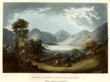 click to enlarge click to enlargeGN0552.jpg Plate 56 in Lake Scenery. printed at upper right:- "56" printed at bottom:- "HEAD of WAST WATER from CROOK. / Published at Ambleside, June 1, 1815, by Wm. Green." item:- Armitt Library : A6646.52 Image © see bottom of page |
|||||||||||||||||||||||||
|
|
||||||||||||||||||||||||||
| evidence:- | old print:- Green 1815 placename:- Wast Water item:- fishing |
|||||||||||||||||||||||||
| source data:- | Print, coloured aquatint, Screes on Wast Water, Nether Wasdale, Cumberland, by William
Green, Ambleside, Westmorland, 1815.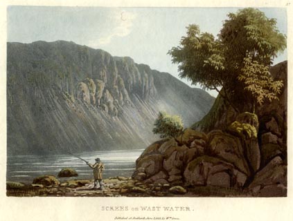 click to enlarge click to enlargeGN0553.jpg Plate 57 in Lake Scenery. printed at upper right:- "57" printed at bottom:- "SCREES on WAST WATER. / Published at Ambleside, June 1, 1815, by Wm. Green." item:- Armitt Library : A6646.53 Image © see bottom of page |
|||||||||||||||||||||||||
|
|
||||||||||||||||||||||||||
| evidence:- | old map:- Otley 1818 |
|||||||||||||||||||||||||
| source data:- | Map, uncoloured engraving, The District of the Lakes,
Cumberland, Westmorland, and Lancashire, scale about 4 miles to
1 inch, by Jonathan Otley, 1818, engraved by J and G Menzies,
Edinburgh, Scotland, published by Jonathan Otley, Keswick,
Cumberland, et al, 1833. OT02NY10.jpg item:- JandMN : 48.1 Image © see bottom of page |
|||||||||||||||||||||||||
|
|
||||||||||||||||||||||||||
| evidence:- | old map:- Hall 1820 (Cmd) placename:- Wast Water |
|||||||||||||||||||||||||
| source data:- | Map, hand coloured engraving, Cumberland, scale about 21 miles
to 1 inch, engraved by Sidney Hall, published by S Leigh, 18
Strand, London, 1820-31. click to enlarge click to enlargeHA14.jpg "Wast Water" outline, shaded; lake item:- JandMN : 91 Image © see bottom of page |
|||||||||||||||||||||||||
|
|
||||||||||||||||||||||||||
| evidence:- | old print:- Fielding and Walton 1821 (plate 29) placename:- Wast Water |
|||||||||||||||||||||||||
| source data:- | Print, coloured aquatint, Wast Water, Nether Wasdale, Cumberland, drawn by Theodore
H A Fielding, published by R Ackermann, 101 Strand, London, 1821.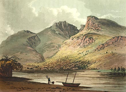 click to enlarge click to enlargeFW0129.jpg Scafell Pike, Mickledore, and Sca Fell in the background. Tipped in opposite p.196 in A Picturesque Tour of the English Lakes. item:- Dove Cottage : 1993.R566.29 Image © see bottom of page |
|||||||||||||||||||||||||
|
|
||||||||||||||||||||||||||
| evidence:- | outline view:- Otley 1823 (8th edn 1849) placename:- Wast Water |
|||||||||||||||||||||||||
| source data:- | Engraving, outline view of mountains, Head of Wast Water, drawn by T Binns, engraved
by O Jewitt, opposite p.21 of A Descriptive Guide of the English Lakes, by Jonathan
Otley, 8th edition, 1849.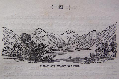 click to enlarge click to enlargeO80E12.jpg item:- Armitt Library : A1180.13 Image © see bottom of page |
|||||||||||||||||||||||||
|
|
||||||||||||||||||||||||||
| evidence:- | descriptive text:- Otley 1823 (5th edn 1834) item:- depth, Wast Water; fishing; trout; char; boat |
|||||||||||||||||||||||||
| source data:- | Guide book, A Concise Description of the English Lakes, the
mountains in their vicinity, and the roads by which they may be
visited, with remarks on the mineralogy and geology of the
district, by Jonathan Otley, published by the author, Keswick,
Cumberland now Cumbria, by J Richardson, London, and by Arthur
Foster, Kirkby Lonsdale, Cumbria, 1823; published 1823-49,
latterly as the Descriptive Guide to the English Lakes. goto source Page 29:- "WAST WATER" "Is a lake full three miles in length and more than half a mile in breadth. Its depth, being lately sounded by some neighbouring gentlemen, was found to be 45 fathoms, and probably some parts may be still deeper; so that its bottom must be at least 15 fathoms below the level of the sea: and it is probably owing to its great depth in proportion to the extent of surface, that it has never been known to freeze; the duration of winter not being sufficient to cool the whole mass of water to that temperature which permits ice to be formed upon its surface." "The mountains environing Wast Water are lofty and majestic. A shivery mountain side called the Screes bounds the lake on the south-east, extending quite into the water; so that it cannot be passed on that side, even by a pedestrian, without considerable difficulty, and some danger. Looking up the lake, Yewbarrow forms a fine apex; Kirkfell pushes forwards its bold front on the left; at the head of the dale the pyramidical Gable appears conspicuous; Lingmell comes finely in view on the right, over which Scawfell and the Pikes reign pre-eminent; the Hay Cock may be seen through the lateral vale of Bowderdale, and the Pillar crowns the head of the branch called Mosedale: Middlefell, running along the margin of the lake on the spectator's side, and the Screes on the opposite, complete" goto sourcePage 30:- "the panorama. In short, Wast Water affords many peculiarities well worth visiting once, but scarcely sufficient to yield that increased degree of pleasure in a second or third inspection, which would be experienced on Derwent, Ullswater, or Windermere." "The fish of Wast Water are chiefly trout, with which it is well stored: it also contains a few char. Boats are kept by neighbouring gentlemen for the diversion of angling; and the appearance of the Screes from the lake is magnificent. ..." goto sourcePage 64:- "... By exertion too long continued, the mind as well as the body becomes enervated and incapable of enjoyment; as it has been known in some, who travelling through Borrowdale in a morning, would not overlook the most trifling object; yet, in the latter part of the same day, have passed the most interesting scenes of Wast Water without making any other inquiry than 'how far is it to the inn?'" "..." goto sourcePage 131:- "After passing the inhabited part of the valley, the road approaches the lake, which shews the purity of its water, by the clean blue gravel washed upon its shores. As the road proceeds along the margin of the lake, the screes on the opposite side form a striking object, and the mountains left behind should not be forgotten; ..." "It has been suggested that Wast Water would be more advantageously seen, by reversing the excursion, so that the principal mountain views would be always in prospect on advancing up the vale. As far as relates to Wast Water alone, this is certainly true; but in what concerns Borrowdale, Lowes Water, and Crummock, they are seen to more advantage by this route: besides, tourists generally congratulate themselves, on having passed over the most difficult part of the road on the first day." "Towards the lower parts of the lake, the shores are more rocky; and the composition of the rock is changed, from a kind of greenstone, to a reddish sienite. ..." |
|||||||||||||||||||||||||
|
|
||||||||||||||||||||||||||
| evidence:- | descriptive text:- Ford 1839 (3rd edn 1843) placename:- Wast Water item:- depth, Wast Water |
|||||||||||||||||||||||||
| source data:- | Guide book, A Description of Scenery in the Lake District, by
Rev William Ford, published by Charles Thurnam, Carlisle, by W
Edwards, 12 Ave Maria Lane, Charles Tilt, Fleet Street, William
Smith, 113 Fleet Street, London, by Currie and Bowman,
Newcastle, by Bancks and Co, Manchester, by Oliver and Boyd,
Edinburgh, and by Sinclair, Dumfries, 1839. goto source Page 71:- "..." "... within a bed of steep rocky mountains of pure, unmixed, impenetrable sterility, is the long, narrow, stern, and desolate lake of Wast Water, ..." goto sourcePage 72:- "..." "WAST WATER" "Is three miles and a half long, and three quarters of a mile broad, the depth is from forty to fifty fathoms, and it is probably owing to this, in proportion to the extent of its surface, that it has never been known to freeze. Trout in great quantities, and a few char, frequent its waters. The chief feeders are Over Beck on the south of Yewbarrow, and Nether Beck on the north of Middle fell, issuing from tarns near the Haycocks, and running through Bowderdale. The waters are discharged by the Irt at Ravenglass." "Being a border lake, its end lying in the low country, whilst its head is nestled in mountains, it appears from the foot to the greatest advantage, and is under that aspect most distinguished for sublimity. The mountains are naked to their base, their sides and summits are uniform, shooting up into lofty points, and ending in pyramidical forms. Looking upwards, Yewbarrow forms a fine apex; Kirkfell pushes forward its front to the left; and at the head of the dale, the Gable appears conspicuous. On the right, Lingmell comes finely forward, over which the Pikes of Scafell reign supreme. Up the side vale of Bowderdale, is the Haycock; and the" goto sourcePage 73:- "Pillar crowns the head of Mosedale. Middle Fell runs along the margin of the lake; and on the opposite side are the Screes, which seem going to decay, their foundation in the water, and their surface and soil being gone, while immense debris and torrents of rocks and stones cover their sides. This range of fell prevents a circumambulation of the lake. Proceeding onwards, a retrospective view of Yewbarrow, the Gable, and the Pikes, seen over Over Beck Bridge, is a fine picture. From Nether Beck Bridge the road passes over a rising ground, and from a field in front of Crookhead, where a beautiful cottage has been built by Stansfield Rawson, Esq. of Halifax, is one of the finest views of Wastdale Head and Water." goto sourcePage 171:- "..." "WAST WATER.- The principal approach to this lake is that by which we have introduced the tourist to it, viz. by the foot. This lake is well worth the notice of the traveller who is not afraid of fatigue: no part of the country is more distinguished by sublimity." goto sourcePage 177:- "A TABLE" "OF THE LENGTH, BREADTH, &c. OF THE LAKES," "COLLECTED FROM DIFFERENT AUTHORITIES."
|
|||||||||||||||||||||||||
|
|
||||||||||||||||||||||||||
| evidence:- | old map:- Ford 1839 map placename:- Wast Water |
|||||||||||||||||||||||||
| source data:- | Map, uncoloured engraving, Map of the Lake District of
Cumberland, Westmoreland and Lancashire, scale about 3.5 miles
to 1 inch, published by Charles Thurnam, Carlisle, and by R
Groombridge, 5 Paternoster Row, London, 3rd edn 1843.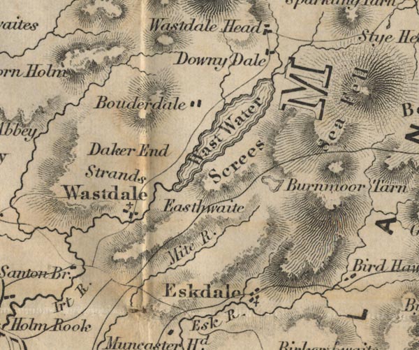 FD02NY10.jpg "Wast Water" Outline with form lines. item:- JandMN : 100.1 Image © see bottom of page |
|||||||||||||||||||||||||
|
|
||||||||||||||||||||||||||
| evidence:- | old map:- Wyld 1847 placename:- Wastwater |
|||||||||||||||||||||||||
| source data:- | Map, uncoloured engraving, Loweswater, Crummock, Buttermere,
Ennerdale and Wastwaters, Cumberland, scale about 3.5 miles to 1
inch, by James Wyld, published by John Johnstone, Paternoster
Row, London, et al, 1847.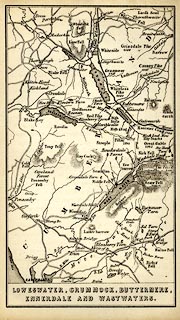 click to enlarge click to enlargeWLD3M3.jpg printed at bottom:- "LOWESWATER, CRUMMOCK, BUTTERMERE, / ENNERDALE AND WASTWATERS." item:- Armitt Library : A1201.66 Image © see bottom of page |
|||||||||||||||||||||||||
|
|
||||||||||||||||||||||||||
| evidence:- | old map:- Garnett 1850s-60s H placename:- Wast Water |
|||||||||||||||||||||||||
| source data:- | Map of the English Lakes, in Cumberland, Westmorland and
Lancashire, scale about 3.5 miles to 1 inch, published by John
Garnett, Windermere, Westmorland, 1850s-60s.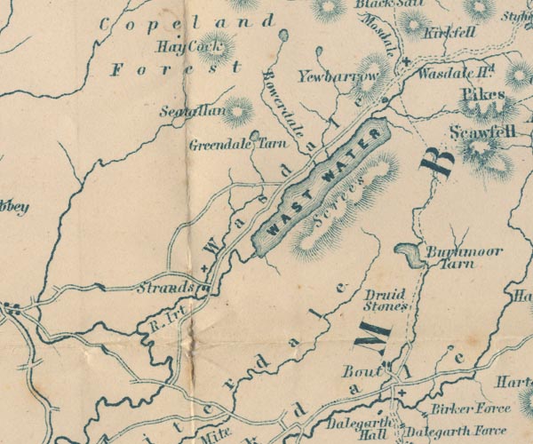 GAR2NY10.jpg "WAST WATER" outline with shore form lines, lake or tarn item:- JandMN : 82.1 Image © see bottom of page |
|||||||||||||||||||||||||
|
|
||||||||||||||||||||||||||
| evidence:- | old print:- Pyne 1853 placename:- Wast Water |
|||||||||||||||||||||||||
| source data:- | Print, tinted lithograph, Wast Water, Nether Wasdale, Cumberland, by James Baker Pyne,
engraved by W Gauci, published by Thomas Agnew and Sons, Manchester, Lancashire, 1853.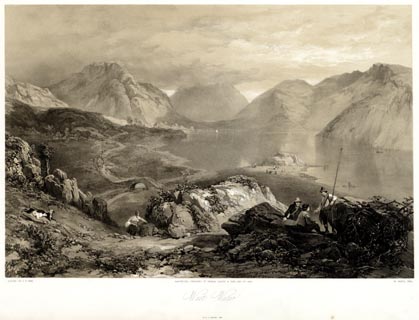 click to enlarge click to enlargePYN225.jpg "PAINTED BY J. B. PYNE. / W. GAUCI LITH. / MANCHESTER, PUBLISHED BY THOMAS AGNEW & SONS, 1853. / Wast Water / M.& N. HANHART, IMPT." item:- Armitt Library : A6678.26 Image © see bottom of page |
|||||||||||||||||||||||||
|
|
||||||||||||||||||||||||||
| evidence:- | old print:- Pyne 1853 placename:- Wast Water |
|||||||||||||||||||||||||
| source data:- | Print, coloured lithograph, Wast Water, Nether Wasdale, Cumberland, by James Baker
Pyne, engraved by W Gauci, published by Thomas Agnew and Sons, Manchester, Lancashire,
1853.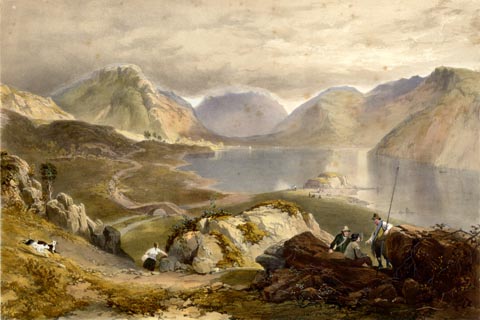 click to enlarge click to enlargePYN425.jpg item:- Armitt Library : A6677.26 Image © see bottom of page |
|||||||||||||||||||||||||
|
|
||||||||||||||||||||||||||
| evidence:- | outline view, old text:- Martineau 1855 placename:- Wastwater |
|||||||||||||||||||||||||
| source data:- | Opposite p.118 in A Complete Guide to the English Lakes, by Harriet Martineau. goto source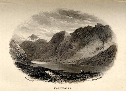 click to enlarge click to enlargeMNU116.jpg Print, engraving, Wastwater, drawn by L Aspland, engraved by W Banks, Edinburgh, published by John Garnett, Windermere, Westmorland, and by Whittaker and Co, London, 1855. "L Aspland Delt. / W Banks Sc Edinr. / WASTWATER." item:- Armitt Library : A1159.16 Image © see bottom of page |
|||||||||||||||||||||||||
|
|
||||||||||||||||||||||||||
| evidence:- | old text:- Martineau 1855 placename:- Wastwater item:- depth, Wast Water |
|||||||||||||||||||||||||
| source data:- | Guide book, A Complete Guide to the English Lakes, by Harriet
Martineau, published by John Garnett, Windermere, Westmorland,
and by Whittaker and Co, London, 1855; published 1855-76. goto source Page 180:- "A TABLE OF THE LENGTH, BREADTH, AND DEPTH OF THE LAKES." "No. : Names of Lakes. : Counties : Length in Miles. : Extreme breadth in Miles : Extreme depth in Feet : Height above the Sea" "16 : Wastwater : Cumberland : 3 : ½: 270 : 160" |
|||||||||||||||||||||||||
|
|
||||||||||||||||||||||||||
| evidence:- | old map:- Jenkinson 1875 map1 placename:- |
|||||||||||||||||||||||||
| source data:- | Map, Wastwater Section, Cumberland, ?colour lithograph, scale
about 1 mile to 1 inch, by Stanford's Geographical
Establishment, published by Edward Stanford, 55 Charing Cross,
London, 1875.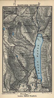 click to enlarge click to enlargeJK09.jpg item:- JandMN : 28.11 Image © see bottom of page |
|||||||||||||||||||||||||
|
|
||||||||||||||||||||||||||
| evidence:- | old photograph:- Bell 1880s-1940s |
|||||||||||||||||||||||||
| source data:- | Photograph, sepia, Wast Water, Nether Wasdale, Cumberland, by Herbert Bell, photographer,
Ambleside, Westmorland, 1890s?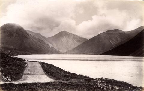 click to enlarge click to enlargeHB0954.jpg item:- Armitt Library : 1958.4264 Image © see bottom of page |
|||||||||||||||||||||||||
|
|
||||||||||||||||||||||||||
| evidence:- | old photograph:- Bell 1880s-1940s item:- reflections |
|||||||||||||||||||||||||
| source data:- | Photograph, black and white, Wast Water, Nether Wasdale, Cumberland, by Herbert Bell,
photographer, Ambleside, Westmorland, 1890s. click to enlarge click to enlargeHB0780.jpg stamped at reverse:- "HERBERT BELL / Photographer / AMBLESIDE" item:- Armitt Library : ALPS443 Image © see bottom of page |
|||||||||||||||||||||||||
|
|
||||||||||||||||||||||||||
| evidence:- | old photograph:- Bell 1880s-1940s |
|||||||||||||||||||||||||
| source data:- | Photograph, black and white, Wast Water, Nether Wasdale, Cumberland, by Herbert Bell,
photographer, Ambleside, Westmorland, 1890s. click to enlarge click to enlargeHB0781.jpg stamped at reverse:- "HERBERT BELL / Photographer / AMBLESIDE" item:- Armitt Library : ALPS444 Image © see bottom of page |
|||||||||||||||||||||||||
|
|
||||||||||||||||||||||||||
| evidence:- | old photograph:- Bell 1880s-1940s item:- rowing boat; boat |
|||||||||||||||||||||||||
| source data:- | Photograph, black and white, Wast Water, Sca Fell behind, Nether Wasdale, Cumberland,
by Herbert Bell, photographer, Ambleside, Westmorland, 1890s. click to enlarge click to enlargeHB0782.jpg stamped at reverse:- "HERBERT BELL / Photographer / AMBLESIDE" item:- Armitt Library : ALPS445 Image © see bottom of page |
|||||||||||||||||||||||||
|
|
||||||||||||||||||||||||||
| evidence:- | old photograph:- Bell 1880s-1940s item:- rowing boat; boat |
|||||||||||||||||||||||||
| source data:- | Photograph, black and white, Wast Water, Lingmell and Scafell Pike behind, Nether
Wasdale, Cumberland, by Herbert Bell, photographer, Ambleside, Westmorland, 1890s. click to enlarge click to enlargeHB0783.jpg stamped at reverse:- "HERBERT BELL / Photographer / AMBLESIDE" item:- Armitt Library : ALPS446 Image © see bottom of page |
|||||||||||||||||||||||||
|
|
||||||||||||||||||||||||||
| evidence:- | old photograph:- Bell 1880s-1940s |
|||||||||||||||||||||||||
| source data:- | Photograph, black and white, Wast Water looking up, Nether Wasdale, Cumberland, by
Herbert Bell, photographer, Ambleside, Westmorland, 1890s. click to enlarge click to enlargeHB0879.jpg item:- Armitt Library : ALPS550 Image © see bottom of page |
|||||||||||||||||||||||||
|
|
||||||||||||||||||||||||||
| evidence:- | old map:- Mill and Heawood 1895 placename:- Wastwater |
|||||||||||||||||||||||||
| source data:- | Map, Wastwater, scale 2 inches to 1 mile, with soundings by Hugh
Robert Mill and Edward Heawood, by Bartholomew, Edinburgh,
Scotland, published by George Philip and Son, 32 Fleet Street,
London, etc, 1895.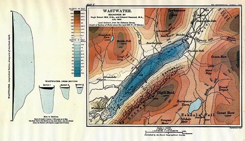 click to enlarge click to enlargeMIL6.jpg - with soundings and sections item:- Kendal Library : 7.5 Image © see bottom of page |
|||||||||||||||||||||||||
|
|
||||||||||||||||||||||||||
| evidence:- | old print:- Brabant 1902 placename:- Wastwater |
|||||||||||||||||||||||||
| source data:- | Print, uncoloured lithograph, Wastwater, Nether Wasdale, Cumberland, by Edmund H New,
published by Methuen and Co, 36 Essex Street, Strand, London, 1902.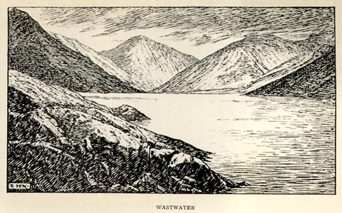 click to enlarge click to enlargeBBT113.jpg Tipped in opposite p.330 of The English Lakes, by F G Brabant. printed at bottom left:- "E. H. N." printed at bottom:- "WASTWATER" item:- JandMN : 502.23 Image © see bottom of page |
|||||||||||||||||||||||||
|
|
||||||||||||||||||||||||||
| evidence:- | old print:- Heaton Cooper 1905 (edn 1908) placename:- Wastwater |
|||||||||||||||||||||||||
| source data:- | Print, colour halftone, Wastwater, from Strands, Nether Wasdale, Cumberland, from
a watercolour painting by Alfred Heaton Cooper, published by Adam and Charles Black,
London, 2nd edn 1908.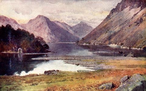 click to enlarge click to enlargeHC0130.jpg Opposite p.82 of The English Lakes, painted by Alfred Heaton Cooper, described by William T Palmer. printed at tissue opposite the print:- "WASTWATER, FROM STRANDS" printed at signed lower left:- "[A HEATON COOPER]" item:- JandMN : 468.30 Image © see bottom of page |
|||||||||||||||||||||||||
|
|
||||||||||||||||||||||||||
| evidence:- | old print:- Heaton Cooper 1905 (edn 1908) placename:- Wastwater |
|||||||||||||||||||||||||
| source data:- | Print, colour halftone, Wastwater and Scawfell, Nether Wasdale, Cumberland, from a
watercolour painting by Alfred Heaton Cooper, published by Adam and Charles Black,
London, 2nd edn 1908.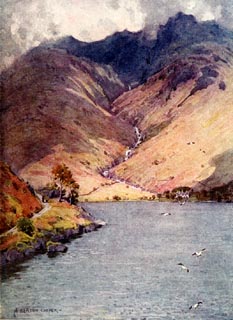 click to enlarge click to enlargeHC0131.jpg Opposite p.84 of The English Lakes, painted by Alfred Heaton Cooper, described by William T Palmer. printed at tissue opposite the print:- "WASTWATER AND SCAWFELL" printed at signed lower left:- "A HEATON COOPER" item:- JandMN : 468.31 Image © see bottom of page |
|||||||||||||||||||||||||
|
|
||||||||||||||||||||||||||
| evidence:- | old map:- Postlethwaite 1877 (3rd edn 1913) placename:- Wast Water |
|||||||||||||||||||||||||
| source data:- | Map, uncoloured engraving, Map of the Lake District Mining Field, Westmorland, Cumberland,
Lancashire, scale about 5 miles to 1 inch, by John Postlethwaite, published by W H
Moss and Sons, 13 Lowther Street, Whitehaven, Cumberland, 1877 edn 1913. PST2NY10.jpg "WAST WATER" lake item:- JandMN : 162.2 Image © see bottom of page |
|||||||||||||||||||||||||
|
|
||||||||||||||||||||||||||
| evidence:- | old print:- Reynolds 1915 placename:- Wastwater |
|||||||||||||||||||||||||
| source data:- | Print, colour halftone, Wastwater and Scawfell, Nether Wasdale, Cumberland, from a
painting by Alfred Heaton Cooper, published by Adam and Charles Black, London, 1915.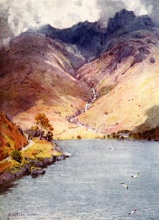 click to enlarge click to enlargeREY615.jpg "A HEATON COOPER" "WASTWATER AND SCAWFELL." item:- JandMN : 1071.15 Image © see bottom of page |
|||||||||||||||||||||||||
|
|
||||||||||||||||||||||||||
| evidence:- | old photograph:- Seascale 1920s-30s |
|||||||||||||||||||||||||
| source data:- | Photograph, halftone, Wast Water, Cumberland, by H Wade, in a guide book, Seascale
for Health and Holidays, published by Edward Burrow and Son, Cheltenham, Gloucestershire,
1920s-30s.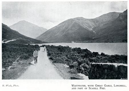 click to enlarge click to enlargeSES110.jpg item:- JandMN : 1079.10 Image © see bottom of page |
|||||||||||||||||||||||||
|
|
||||||||||||||||||||||||||
| evidence:- | old postcard:- placename:- Wastwater |
|||||||||||||||||||||||||
| source data:- | Postcard, sepia coloured photograph, Wast Water and Great Gable, Nether Wasdale, Cumberland,
published by G P Abraham, Keswick, Cumberland, about 1936?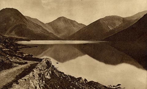 click to enlarge click to enlargePH0094.jpg printed at bottom:- "WASTWATER AND GREAT GABLE" printed at rev:- "Photogravure Series by G. P. ABRAHAM, LTD. (copyright) KESWICK" postmark:- "[ ] / OC 13 / [3]6 / [ CUMBER ]" item:- JandMN : 962 Image © see bottom of page |
|||||||||||||||||||||||||
|
|
||||||||||||||||||||||||||
| evidence:- | old print:- Pearson 1900s placename:- Wastwater |
|||||||||||||||||||||||||
| source data:- | Print, halftone photograph, Wastwater, Nether Wasdale, Cumberland, published by C
Arthur Pearson, Henrietta Street, London, 1900s. click to enlarge click to enlargePS1E24.jpg On p.55 of Pearson's Gossipy Guide to the English Lakes and Neighbouring Districts. printed at bottom:- "WASTWATER. (p.199). / (The summit of Great Gable, in the background, is hidden in mist)." item:- Armitt Library : A1188.31 Image © see bottom of page |
|||||||||||||||||||||||||
|
|
||||||||||||||||||||||||||
| evidence:- | old print:- Rowbotham 1875 |
|||||||||||||||||||||||||
| source data:- | Print, colour lithograph? Wast Water, Cumberland, by T L Rowbotham, published by Marcus
Ward and Co, London? 1875?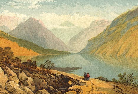 click to enlarge click to enlargePR0128.jpg Included in the set of prints, Views in the English Lake District. printed at lower left, right:- "Rowbotham / MARCUS WARD &CO" item:- Dove Cottage : 2008.107.128 Image © see bottom of page |
|||||||||||||||||||||||||
|
|
||||||||||||||||||||||||||
| evidence:- | outline view:- Jenkinson 1875 placename:- Wast Water |
|||||||||||||||||||||||||
| source data:- | Print, lithograph, outline view, Panoramic Sketches from Scawfell Pike, Cumberland,
by Edwin A Pettitt, London, published by Edward Stanford, 55 Charing Cross, London,
1875. click to enlarge click to enlargeJk01E3.jpg "... Wast Water ..." item:- JandMN : 28.9 Image © see bottom of page |
|||||||||||||||||||||||||
|
|
||||||||||||||||||||||||||
| evidence:- | old print:- Prior 1865 placename:- Wast Water |
|||||||||||||||||||||||||
| source data:- | Print, uncoloured engraving, The Screes and Wast Water, Nether Wasdale, Cumberland,
published by John Garnett, Windermere, Westmorland, and by Simpkin, Marshall and Co,
London, 1865.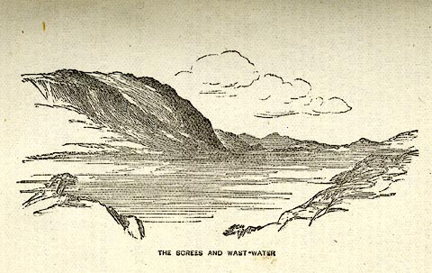 click to enlarge click to enlargePI0112.jpg Included on page 89 of the guide book, Ascents and Passes in the Lake District of England, by Herman Prior. printed at bottom:- "THE SCREES AND WAST-WATER" item:- JandMN : 235.14 Image © see bottom of page |
|||||||||||||||||||||||||
|
|
||||||||||||||||||||||||||
| evidence:- | old print:- Payn 1860s-70s placename:- Wastwater |
|||||||||||||||||||||||||
| source data:- | Print, colour printed, Wastwater, Nether Wasdale, Cumberland, published by John Garnett,
Windermere, Westmorland, and by Simpkin, Marshall and Co, London, 1860s-70s?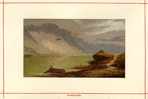 click to enlarge click to enlargePN0115.jpg Tipped in opposite p.66 of England's Lakeland, a Tour Therein, by James Payn. printed at bottom:- "WASTWATER." item:- Armitt Library : A1183.15 Image © see bottom of page |
|||||||||||||||||||||||||
|
|
||||||||||||||||||||||||||
| evidence:- | old print:- placename:- Wastwater |
|||||||||||||||||||||||||
| source data:- | Print, uncoloured engraving, Scawfell over Wastwater, Cumberland, engraved by M Jackson,
published late 19th century? click to enlarge click to enlargePR0341.jpg On a page of The Land We Live In. printed at lower left:- "M. JACKSON. SC" printed at bottom:- "3.- SCAWFELL OVER WASTWATER." item:- Dove Cottage : 2008.107.341 Image © see bottom of page |
|||||||||||||||||||||||||
|
|
||||||||||||||||||||||||||
| evidence:- | old print:- Pyne 1853 placename:- Wast Water |
|||||||||||||||||||||||||
| source data:- | Drawn by James Barker Pyne, 1848-1853, lithographed by T Picken, 1859.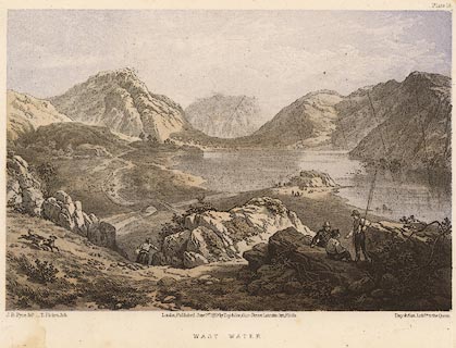 click to enlarge click to enlargePY14.jpg "Wast Water" item:- JandMN : 97.13 Image © see bottom of page |
|||||||||||||||||||||||||
|
|
||||||||||||||||||||||||||
| evidence:- | old print:- Linton 1852 placename:- Wastwater |
|||||||||||||||||||||||||
| source data:- | Print, engraving, Wastwater from Windy Knott, Nether Wasdale, Cumberland, drawn by
R Shepherd, engraved by W H Lizars, Edinburgh, published by Whittaker and Co, London,
and by R Gibson and Son and by Callander and Dixon, Whitehaven, Cumberland, 1852.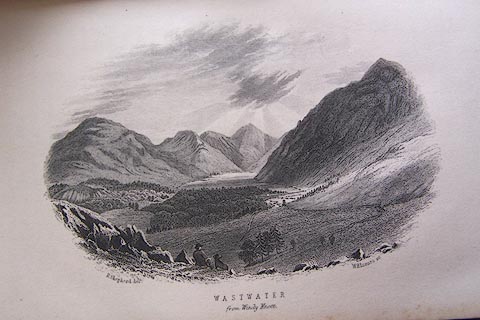 click to enlarge click to enlargeLN1E09.jpg Tipped in opposite p.58 of A Handbook of the Whitehaven and Furness Railway, by John Linton. printed at bottom left, right, centre:- "R. Shepherd delt. / W. H. Lizars sc. / WASTWATER / from Windy Knott." item:- Armitt Library : A1158.9 Image © see bottom of page |
|||||||||||||||||||||||||
|
|
||||||||||||||||||||||||||
| evidence:- | old print:- Garnett 1850s-60s F placename:- Wastwater |
|||||||||||||||||||||||||
| source data:- | Print, uncoloured engraving, Wastwater, Cumberland, drawn by L Aspland, engraved by
William Banks, Edinburgh, published by John Garnett, Windermere, Westmorland, 1850s-60s?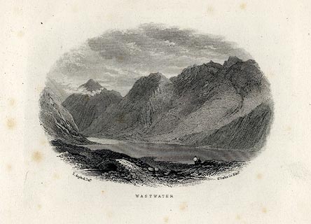 click to enlarge click to enlargeGAR710.jpg Included in Views of the English Lakes. printed at bottom:- "L. Aspland Delt. / WASTWATER. / W. Banks Sc. Edinr." item:- JandMN : 165.10 Image © see bottom of page |
|||||||||||||||||||||||||
|
|
||||||||||||||||||||||||||
| evidence:- | old print:- Harwood 1842 placename:- Wast Water |
|||||||||||||||||||||||||
| source data:- | Print, uncoloured engraving, Wast Water, Cumberland, engraved and published by John
Harwood, 26 Fenchurch Street, London, 1844.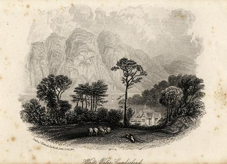 click to enlarge click to enlargeHRW209.jpg printed at bottom left, centre:- "London, J. Harwood, 26, Fenchurch Street. Oct 30. 1844. / WT / Wast Water, Cumberland." item:- JandMN : 166.9 Image © see bottom of page |
|||||||||||||||||||||||||
|
|
||||||||||||||||||||||||||
| evidence:- | outline view:- Tattersall 1836 (version 1869) placename:- Wast Water |
|||||||||||||||||||||||||
| source data:- | Print, hand coloured, Wast Water and Scawfell Pikes, from the road to Calder Bridge,
Nether Wasdale, Cumberland, drawn by George Tattersall, 1836, engraved by W F Topham,
published by T J Allman, 463 Oxford Street, London, 1869.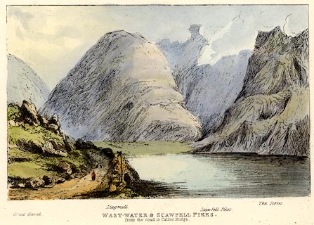 click to enlarge click to enlargeTAT214.jpg Included in The Lakes of England, by W F Topham. printed at bottom:- "WAST WATER &SCAWFELL PIKES, / from the road to Calder Bridge." printed at bottom:- "Great Gavel. / Lingmell. / Scawfell Pikes. / The Screes." item:- Armitt Library : A1067.14 Image © see bottom of page |
|||||||||||||||||||||||||
|
|
||||||||||||||||||||||||||
| evidence:- | outline view:- Tattersall 1836 placename:- Wast Water item:- fingerpost |
|||||||||||||||||||||||||
| source data:- | Print, engraving, Wast Water and Scawfell Pikes, from the road to Calder Bridge, Nether
Wasdale, Cumberland, drawn by George Tattersall, engraved by W F Topham, published
by Sherwood and Co, Paternoster Row, London, about 1836.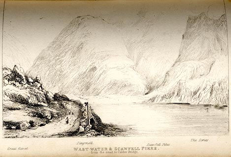 click to enlarge click to enlargeTAT132.jpg The print is captioned with mountain names and acts as an outline view. Tipped in opposite p.80 of The Lakes of England, by George Tattersall. printed at bottom:- "WAST WATER &SCAWFELL PIKES, / from the road to Calder Bridge." printed at bottom left to right:- "Great Gavel. / Lingmell. / Scawfell Pikes. / The Screes." item:- Armitt Library : A1204.33 Image © see bottom of page |
|||||||||||||||||||||||||
|
|
||||||||||||||||||||||||||
| evidence:- | old print:- Rose 1832-35 (vol.3 no.44) placename:- Wastwater |
|||||||||||||||||||||||||
| source data:- | Print, uncoloured engraving, Wastwater, Cumberland, drawn by Thomas Allom, engraved
by H Wallis, published by Fisher, Son and Co, London, 1835.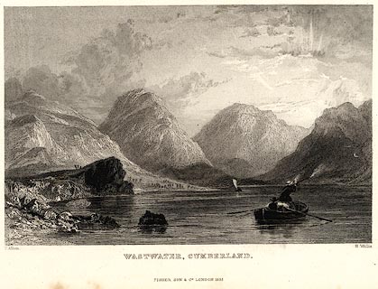 click to enlarge click to enlargePR0048.jpg vol.3 pl.44 in the set of prints, Westmorland, Cumberland, Durham and Northumberland Illustrated. printed at bottom left, right, centre:- "T. Allom. / H. Wallis. / WASTWATER, CUMBERLAND. / FISHER, SON &CO. LONDON, 1835." item:- Dove Cottage : 2008.107.48 Image © see bottom of page |
|||||||||||||||||||||||||
|
|
||||||||||||||||||||||||||
| evidence:- | old print:- Rose 1832-35 |
|||||||||||||||||||||||||
| source data:- | Print, engraving, Wastdale Head, Scawfell Pikes, Cumberland, by Thomas Allom, engraved
by S Lacey, 1833.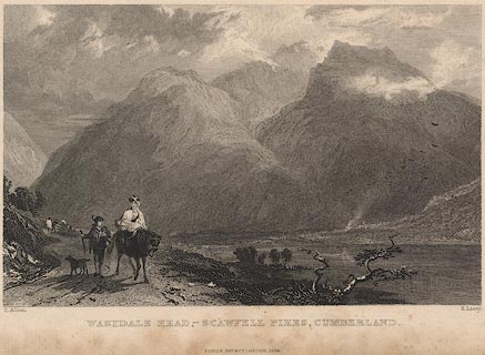 click to enlarge click to enlargeR258.jpg "Wastdale Head, Scawfell Pikes, Cumberland" item:- JandMN : 96.19 Image © see bottom of page |
|||||||||||||||||||||||||
|
|
||||||||||||||||||||||||||
| evidence:- | old print:- Housman 1800 placename:- Wastwater |
|||||||||||||||||||||||||
| source data:- | Print, uncoloured engraving, The Head of Wastwater, drawn by IW, engraved by R Scott,
published by F Jollie, Carlisle, Cumberland, 1800.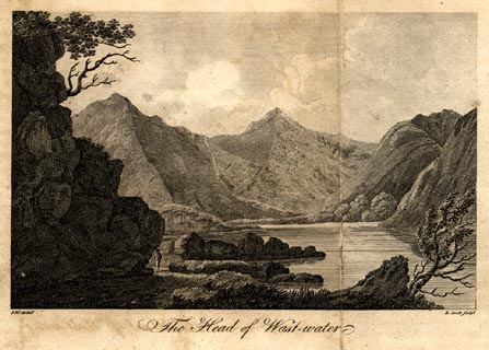 click to enlarge click to enlargePR0474.jpg Taken from a guide book, A Descriptive Tour, and Guide to the Lakes, Caves and Mountains, by John Housman, 1800, 5th edn 1812. printed at bottom left, right, centre:- "I.W. delint. / R. Scott sculpt. / The Head of Wast-water" item:- JandMN : 233.6 Image © see bottom of page |
|||||||||||||||||||||||||
|
|
||||||||||||||||||||||||||
| evidence:- | old print:- placename:- Wastwater |
|||||||||||||||||||||||||
| source data:- | Print, uncoloured engraving, Head of Wastwater, drawn by IW, engraved by R Scott,
about 1800?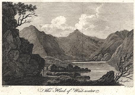 click to enlarge click to enlargePR0400.jpg printed at bottom left, right, centre:- "I.W. delint. / R. Scott sculpt. / The Head of Wastwater" item:- Dove Cottage : 2008.107.393 Image © see bottom of page |
|||||||||||||||||||||||||
|
|
||||||||||||||||||||||||||
| evidence:- | old print:- Rumney 1899 placename:- Wast Water |
|||||||||||||||||||||||||
| source data:- | Print, halftone photograph, Wast Water, Cumberland, published by George Philip and
Son, 32 Fleet Street, London, and Liverpool, 1899.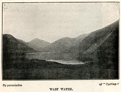 click to enlarge click to enlargeRUM126.jpg On p.73 of the Cyclist's Guide to the English Lake District, by A W Rumney. printed at bottom:- "By permission of "Cyclist." / WAST WATER." item:- JandMN : 147.27 Image © see bottom of page |
|||||||||||||||||||||||||
|
|
||||||||||||||||||||||||||
 BNM85.jpg (taken 4.4.2007) 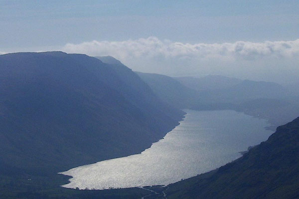 BNM93.jpg (taken 4.4.2007) 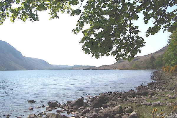 BMB60.jpg From level with Bowderdale. (taken 11.5.2006)  BMB68.jpg (taken 11.5.2006) 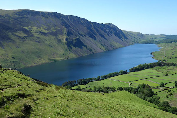 BYO52.jpg from Yewbarrow. (taken 18.6.2013) |
||||||||||||||||||||||||||
|
|
||||||||||||||||||||||||||
Lakes Guides menu.