 Stanford 1904

|

|
|
|
item:- Hampshire Museums : FA2002.654.8 image:- © see bottom of page |
click to enlarge |
|
|
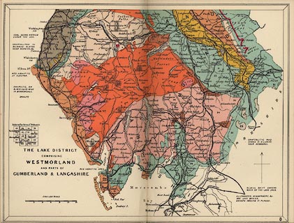
Geological map, colour printed, Lake District, ie
Westmorland, and parts of Cumberland and Lancashire, scale
about 7 miles to 1 inch, in Stanford's Geological Atlas of
Great Britain and Ireland, by Horace B Woodward, published
by Edward Stanford, 12-14 Long Acre, London, 3rd edn 1914.
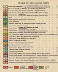
The areas of solid geology are coloured and labelled with a number that refers to a table of strata near the front of the atlas. An index map indicates which New Series 1 inch OS geological maps are relevant to the county. |
||

|
Stanford 1904 | |
| inscription:- |
printed
THE LAKE DISTRICT / COMPRISING / WESTMORLAND / AND PARTS OF / CUMBERLAND & LANCASHIRE |
|
| scale line:- | 12 miles = 42.7 mm | |
| scale:- | 1 to 450000 ? (from scale line) | |
|
||
|
|
notes | |