 Speed 1611

|

|
|
|
item:- private collection (16) image:- © see bottom of page |
click to enlarge |
|

|
menu with map squares and placename index | |
|
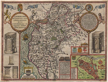
Map, hand coloured engraving, Cumberland and the Ancient
Citie Carlile Described, scale about 4 miles to 1 inch, by
John Speed, 1610, published by J Sudbury and George Humble,
Popes Head Alley, London, 1611-12.
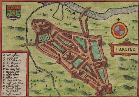
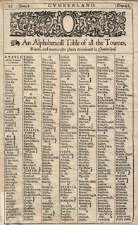
From the Theatre of the Empire of Great Britain, by John Speed. The map of Carlisle is an inset map, a bird's eye view, at a larger scale. The reverse of the map has a gazetteer of places on the map or in the accompanying text, and the first page of the accompanying text, in English. |
||
|
|
Speed 1611 | |
| map feature:- | picture frame border & picture frame cartouche & swash lettering & coat of arms & heraldic border & descriptive text & vignettes & labelled borders & scale line & sea moire effect & coast shaded & rivers & bridges & lakes & relief & hillocks & woods & forests & parks & county & settlements & inset map | |
| inscription:- |
printed title cartouche, upper left
CUMBERLAND / AND THE ANCIENT CITIE / CARLILE DESCRIBED / WITH / MANY MEMORABLE AN / TIQUITIES THEREIN / FOUND OBSERVED |
|
| inscription:- |
printed lower right of centre
Performed by John Speed, and are to be / sould in Popes. head Alley, by the exchan : / ge by J. Sudbury and Georg. Humble. / Cum Privilegio Anno Domini 1610. |
|
| scale line:- | 10 miles = 64.8 mm | |
| scale:- | 1 to 250000 ? (1 to 248356 from scale line wrongly assuming a statute mile) | |
| wxh, sheet (trimmed):- | 51.5x39cm | |
| wxh, plate:- | 511x385mm | |
| wxh, map:- | 509x382mm | |
|
||
|
||
|
|
notes | |