item:- private collection : 16
image:- © see bottom of page
 Sp11.jpg
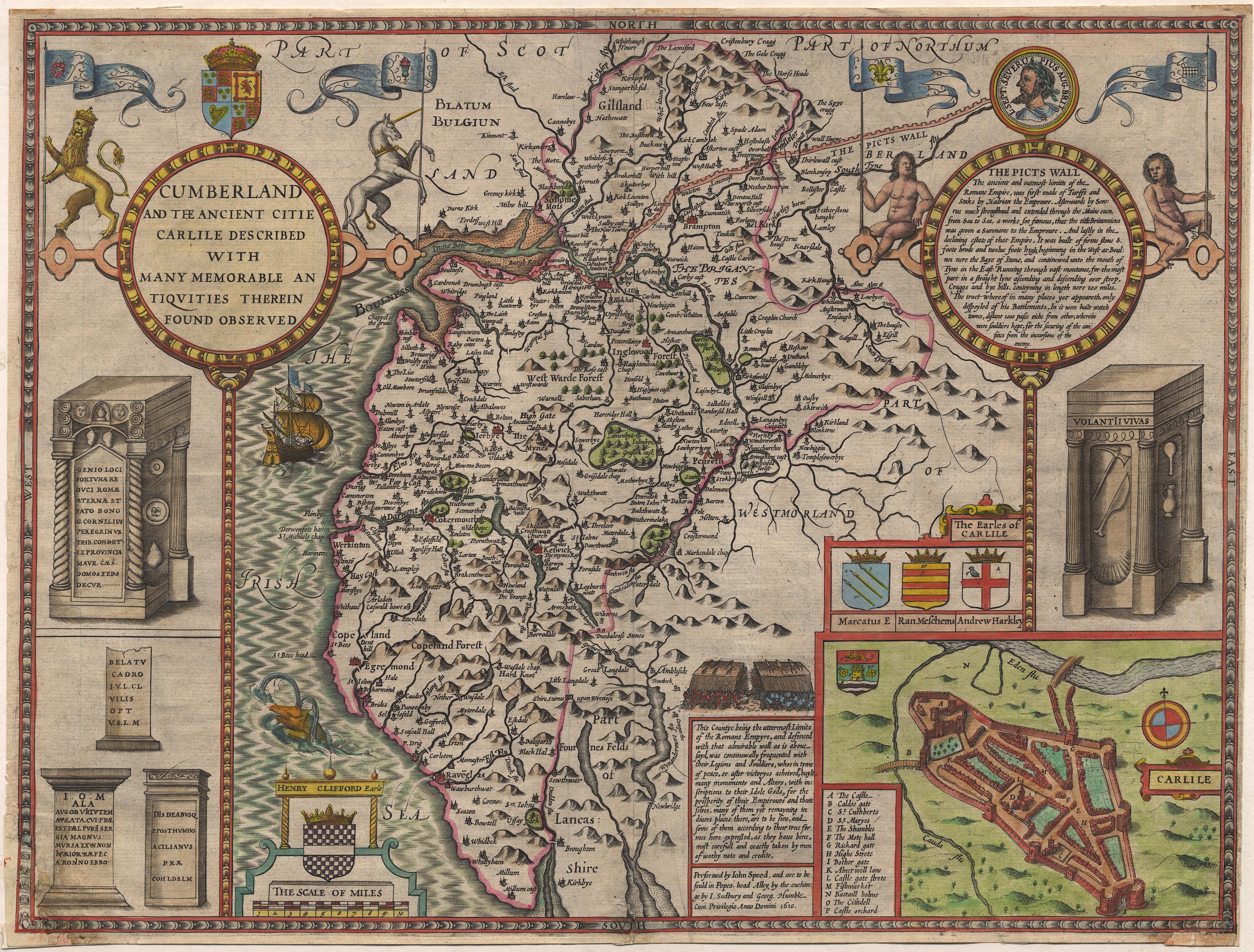
Map, hand coloured engraving, Cumberland and the Ancient Citie
Carlile Described, scale about 4 miles to 1 inch, by John Speed,
1610, published by J Sudbury and George Humble, Popes Head
Alley, London, 1611-12.
 Lakes Guides menu.