 Old Cumbria Gazetteer
 |
 |
|
| road, Penrith to Hesket Newmarket | ||
| Penrith to Hesket Newmarket | ||
| Hesket Newmarket to Penrith | ||
| locality:- | Penrith | |
| civil parish:- | Penrith (formerly Cumberland) | |
| county:- | Cumbria | |
| locality type:- | route | |
| locality:- | Hesket Newmarket | |
| civil parish:- | Caldbeck (formerly Cumberland) | |
| county:- | Cumbria | |
| locality type:- | route | |
|
|
||
| route parts:- |  Penrith to Wigton until a junction road, through Hesket Newmarket Penrith to Wigton until a junction road, through Hesket Newmarket |
|
|
|
||
| evidence:- | old map:- Donald 1774 (Cmd) |
|
| source data:- | Map, hand coloured engraving, 3x2 sheets, The County of Cumberland, scale about 1
inch to 1 mile, by Thomas Donald, engraved and published by Joseph Hodskinson, 29
Arundel Street, Strand, London, 1774. double line, solid or dotted, with a dot or milestone and number at 1 mile intervals, tinted red; turnpike road 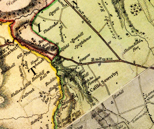 D4NY33NE.jpg "H. to P. 13:2:12" miles.furlongs.poles; Hesket to Penrith  D4NY43NW.jpg  D4NY43NE.jpg  D4NY43SE.jpg 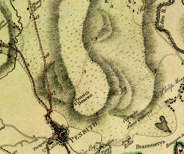 D4NY53SW.jpg item:- Carlisle Library : Map 2 Images © Carlisle Library |
|
|
|
||
| evidence:- | old map:- Cooke 1802 |
|
| source data:- | Map, Cumberland, scale about 15.5 miles to 1 inch, by George
Cooke, 1802, bound in Gray's New Book of Roads, 1824, published
by Sherwood, Jones and Co, Paternoster Road, London, 1824. click to enlarge click to enlargeGRA1Cd.jpg double line, light dark solid; road AND double line, light dark dotted; unfenced road item:- Hampshire Museums : FA2000.62.2 Image © see bottom of page |
|
|
|
||
| evidence:- | old map:- Ford 1839 map |
|
| source data:- | Map, uncoloured engraving, Map of the Lake District of
Cumberland, Westmoreland and Lancashire, scale about 3.5 miles
to 1 inch, published by Charles Thurnam, Carlisle, and by R
Groombridge, 5 Paternoster Row, London, 3rd edn 1843.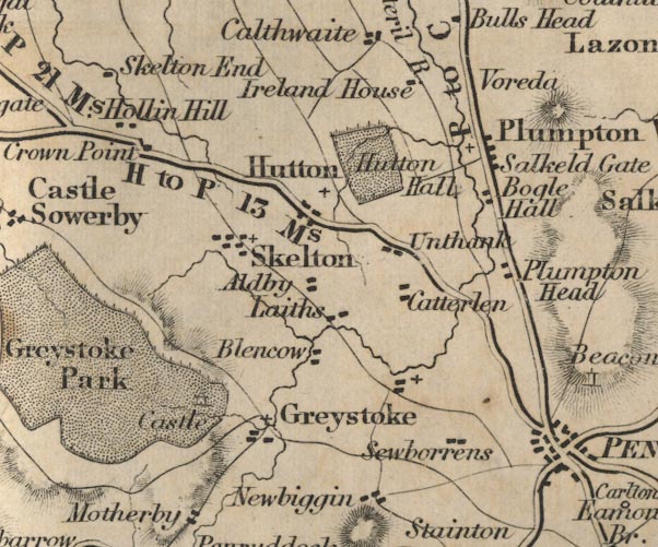 FD02NY43.jpg "H to P 13 Ms." 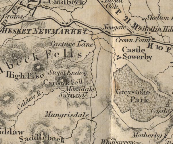 FD02NY33.jpg item:- JandMN : 100.1 Image © see bottom of page |
|
|
|
||
| evidence:- | old strip map:- CTC 1911 (Roads) |
|
| source data:- | Page 106 of Cyclists' Touring Club British Road Book new series vol.6, edited by F
B Sandford, published by Thomas Nelson and Sons, London etc, 1911.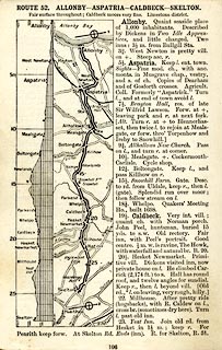 click to enlarge click to enlargeCTC2A6.jpg Strip road map, route 52, Allonby Aspatria Caldbeck Skelton, scale roughly 5 miles to 1 inch. Together with an itinerary and gradient diagram. item:- JandMN : 491.106 Image © see bottom of page |
|
|
|
||
| Act of Parliament |
||
|
|
||
 Lakes Guides menu.