Old Cumbria Gazetteer
 |
 |
|
||
| Watendlath Beck | ||||
| runs into:- |  Derwent Water Derwent Water |
|||
|
|
||||
| civil parish:- | Borrowdale (formerly Cumberland) | |||
| county:- | Cumbria | |||
| locality type:- | river | |||
| 1Km square:- | NY2717 (etc) | |||
| 10Km square:- | NY21 | |||
|
|
||||
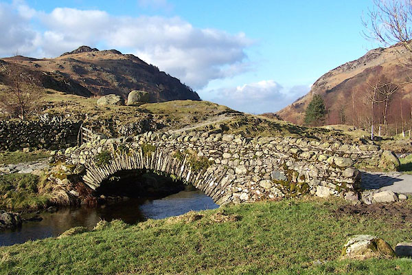
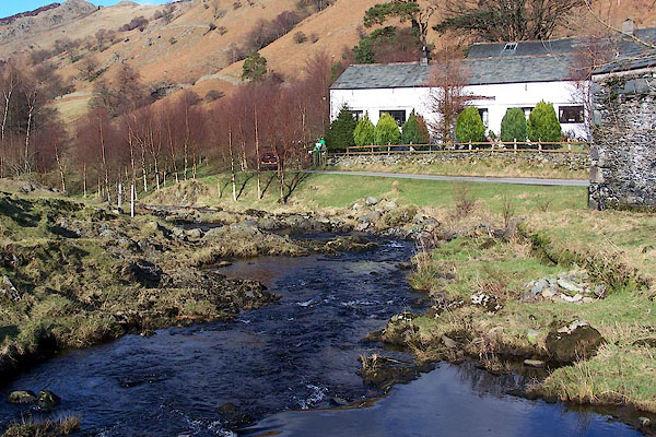 BNE44.jpg At Watendlath Bridge. (taken 17.2.2007) 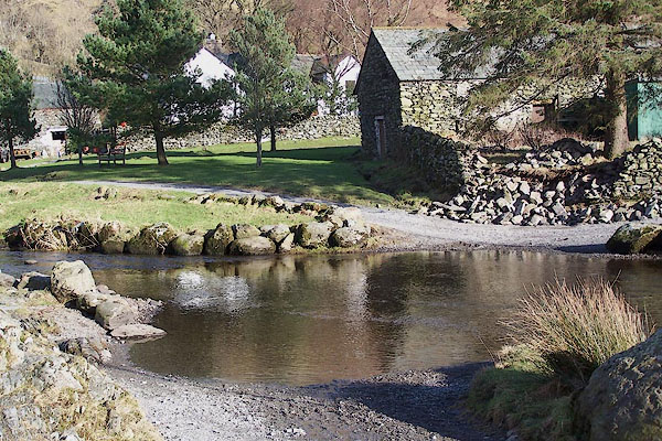 BNE46.jpg Ford in Watendlath. (taken 17.2.2007) |
||||
|
|
||||
| evidence:- | old map:- OS County Series (Cmd 70 2) placename:- Watendlath Beck |
|||
| source data:- | Maps, County Series maps of Great Britain, scales 6 and 25
inches to 1 mile, published by the Ordnance Survey, Southampton,
Hampshire, from about 1863 to 1948. |
|||
|
|
||||
| evidence:- | old map:- Gents Mag 1751 |
|||
| source data:- | Map, uncoloured engraving, Map of the Black Lead Mines in
Cumberland, and area, scale about 2 miles to 1 inch, by George
Smith, published in the Gentleman's Magazine, 1751.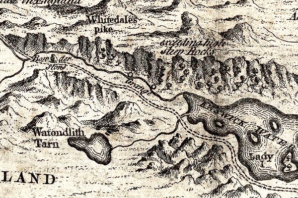 GM1310.jpg tapering wiggly line; river item:- JandMN : 114 Image © see bottom of page |
|||
|
|
||||
| evidence:- | old map:- Donald 1774 (Cmd) |
|||
| source data:- | Map, hand coloured engraving, 3x2 sheets, The County of Cumberland, scale about 1
inch to 1 mile, by Thomas Donald, engraved and published by Joseph Hodskinson, 29
Arundel Street, Strand, London, 1774.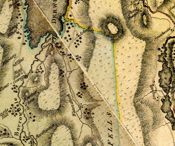 D4NY21NE.jpg single or double wiggly line; a river from Watendlath Tarn to Derwent Water item:- Carlisle Library : Map 2 Image © Carlisle Library |
|||
|
|
||||
| evidence:- | descriptive text:- West 1778 (11th edn 1821) |
|||
| source data:- | Guide book, A Guide to the Lakes, by Thomas West, published by
William Pennington, Kendal, Cumbria once Westmorland, and in
London, 1778 to 1821. goto source Addendum; From Dr. Dalton's descriptive poem enumerating the Beauties of the Vale of Keswick, about 1775 Page 197:- "..." "Let other streams rejoice to roar / Down the rough rocks of dread Lowdore, / Rush raving on with bois'trous sweep, / And foaming rend the 'frighted deep, ..." goto sourceAddendum; Mr Gray's Journal, 1769 Page 204:- "... we turned aside into a coppice, ascending a little in front of Lowdore water-fall: the height appeared to be about 200 feet, the quantity of water not great, though (these three days excepted) it hath rained daily for near two months before; but then the stream was nobly broken, leaping from rock to rock, and foaming with fury. ... The force of the water wearing a deep channel in the ground, hurries away to join the lake. We descended again, and passed the stream over a rude bridge. ..." |
|||
|
|
||||
| evidence:- | old map:- Crosthwaite 1783-94 (Der) |
|||
| source data:- | Map, uncoloured engraving, An Accurate Map of the Matchless Lake
of Derwent, ie Derwent Water, scale about 3 inches to 1 mile, by
Peter Crosthwaite, Keswick, Cumberland, 1783, version published
1800.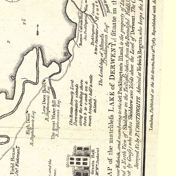 CT2NY21T.jpg item:- Armitt Library : 1959.191.3 Image © see bottom of page |
|||
|
|
||||
| evidence:- | old text:- Gilpin 1786 placename:- Lodoar River |
|||
| source data:- | Book, Observations, Relative Chiefly to Picturesque Beauty, Made
in the Year 1772, on Several Parts of England, Particularly the
Mountains, and Lakes of Cumberland Westmoreland, by Rev William
Gilpin, 1772-74; published 1786-1808. goto source vol.1 p.192 "..." "These two rivers, the Lodoar, and the Derwent, furnish the chief supplies of Derwentwater. But those of the latter are much ampler. The Lodoar accordingly is lost in the lake: while the Derwent, first giving it's name to it, retains it's own to the sea." |
|||
|
|
||||
| evidence:- | old map:- Otley 1818 |
|||
| source data:- | Map, uncoloured engraving, The District of the Lakes,
Cumberland, Westmorland, and Lancashire, scale about 4 miles to
1 inch, by Jonathan Otley, 1818, engraved by J and G Menzies,
Edinburgh, Scotland, published by Jonathan Otley, Keswick,
Cumberland, et al, 1833.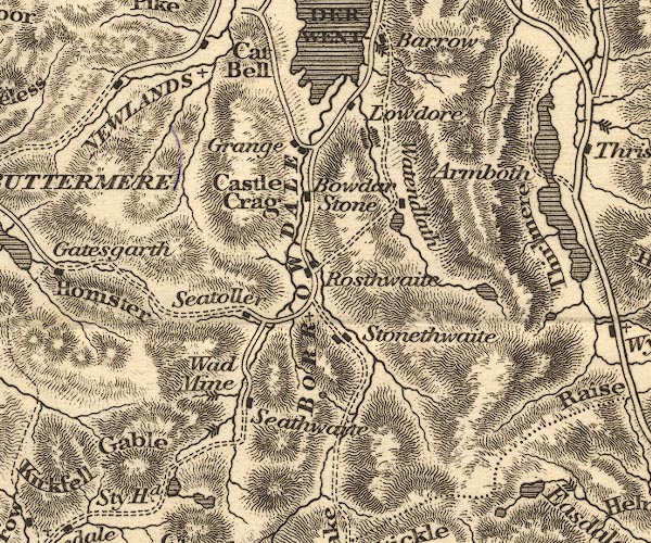 OT02NY21.jpg item:- JandMN : 48.1 Image © see bottom of page |
|||
|
|
||||
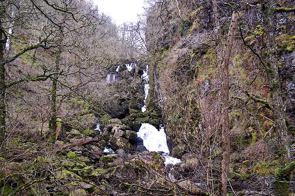
| evidence:- | old print:- Rose 1832-35 (vol.2 no.4) placename:- Stream of Lowdore |
|||
| source data:- | Print, uncoloured engraving, Watendlath, and the Stream of Lowdore, drawn by Thomas
Allom, engraved by J Sands, published by Fisher, Son and Co, London, 1833.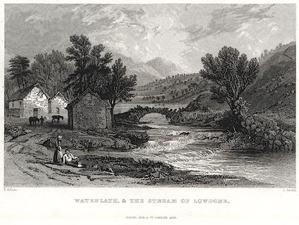 click to enlarge click to enlargePR0401.jpg Vol.2 no.4 in Westmorland, Cumberland, Durham and Northumberland Illustrated, with descriptions by Thomas Rose, published by H Fisher, R Fisher, and P Jackson, Newgate, London, about 1835. printed at bottom left, right, centre:- "T. Allom. / . Sands. / WATENDLATH, & THE STREAM OF LOWDORE. / FISHER, SON &CO. LONDON, 1833." item:- Dove Cottage : 2008.107.394 Image © see bottom of page |
|||
|
|
||||
 BRP79.jpg (taken 23.9.2009) |
||||
|
|
||||
| hearsay:- |
A rock feature in the beck below the hamlet is called the Devil's Punch Bowl, or just
The Churn; presumably a churn pot? |
|||
|
|
||||
| places:- |
|
|||
|
||||
|
||||
Lakes Guides menu.