 Old Cumbria Gazetteer
 |
 |
|
| Roughtongill Mines, Caldbeck | ||
| Roughtongill Mines | ||
| Roughtongill Lead Mines | ||
| Roughton Gill Mines | ||
| Silver Gill Mine | ||
| Mexico Mine | ||
| locality:- | Roughton Gill | |
| locality:- | Caldbeck Fells | |
| civil parish:- | Caldbeck (formerly Cumberland) | |
| county:- | Cumbria | |
| locality type:- | copper mine | |
| locality type:- | lead mine | |
| locality type:- | zinc mine | |
| locality type:- | mine | |
| coordinates:- | NY30283445 (etc) | |
| 1Km square:- | NY3034 | |
| 10Km square:- | NY33 | |
| 10Km square:- | NY33 | |
| references:- | Adams, John: 1988: Mines of the Lake District Fells: Dalesman Books (Lancaster, Lancashire)::
ISBN 0 85206 931 6 |
|
|
|
||
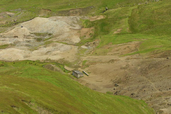 BNZ02.jpg Works. (taken 15.8.2007) |
||
|
|
||
| evidence:- | old map:- OS County Series (Cmd 47 11) placename:- Roughtongill Mining Works |
|
| source data:- | Maps, County Series maps of Great Britain, scales 6 and 25
inches to 1 mile, published by the Ordnance Survey, Southampton,
Hampshire, from about 1863 to 1948. "Roughtongill Mining Works (Lead) / Level / Smithy" |
|
|
|
||
| evidence:- | old map:- Saxton 1579 placename:- Mynes, The |
|
| source data:- | Map, hand coloured engraving, Westmorlandiae et Cumberlandiae Comitatus ie Westmorland
and Cumberland, scale about 5 miles to 1 inch, by Christopher Saxton, London, engraved
by Augustinus Ryther, 1576, published 1579-1645.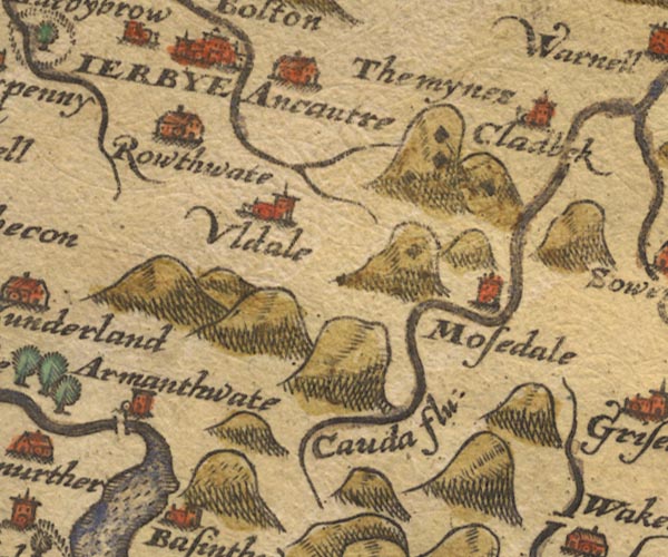 Sax9NY23.jpg "The mynes" 4 or 5 black diamond shapes, the mine holes, in the hillocks N of Mosedale. item:- private collection : 2 Image © see bottom of page |
|
|
|
||
| evidence:- | probably old map:- Mercator 1595 (edn?) |
|
| source data:- | Map, hand coloured engraving, Northumbria, Cumberlandia, et
Dunelmensis Episcopatus, ie Northumberland, Cumberland and
Durham etc, scale about 6.5 miles to 1 inch, by Gerard Mercator,
Duisberg, Germany, about 1595.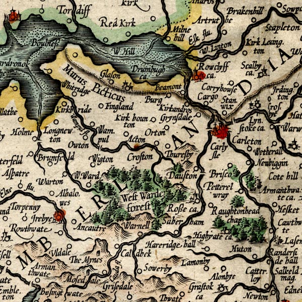 MER8CumC.jpg "The Mynes" ?caverns on Caldbeck Fell item:- JandMN : 169 Image © see bottom of page |
|
|
|
||
| evidence:- | old map:- Speed 1611 (Cmd) |
|
| source data:- | Map, hand coloured engraving, Cumberland and the Ancient Citie
Carlile Described, scale about 4 miles to 1 inch, by John Speed,
1610, published by J Sudbury and George Humble, Popes Head
Alley, London, 1611-12.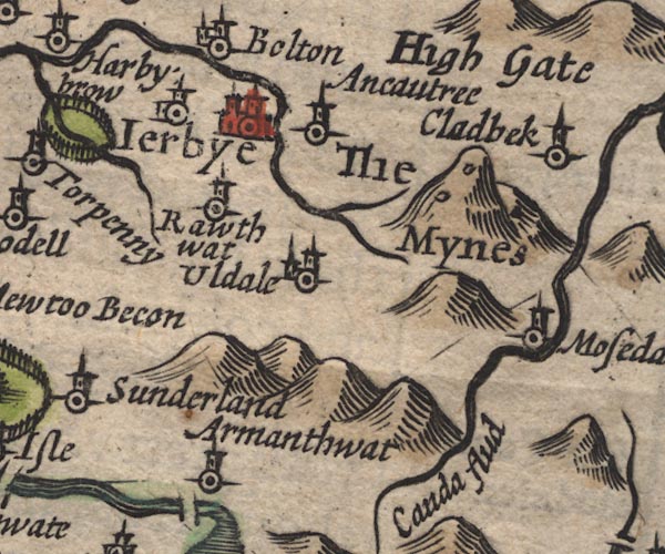 SP11NY23.jpg "The Mynes" two ?adits on a hillock item:- private collection : 16 Image © see bottom of page |
|
|
|
||
| evidence:- | perhaps poem:- Drayton 1612/1622 text |
|
| source data:- | Poem, Poly Olbion, by Michael Drayton, published by published by
John Marriott, John Grismand and Thomas Dewe, and others?
London, part 1 1612, part 2 1622. goto source goto sourcepage 166:- "... But Westward [Forest] ... by her more widened Slade. Of more abundance boasts, as of those mighty Mynes, Which in her Verge she hath: ..." |
|
|
|
||
| evidence:- | old map:- Jansson 1646 placename:- Mynes, The |
|
| source data:- | Map, hand coloured engraving, Cumbria and Westmoria, ie
Cumberland and Westmorland, scale about 3.5 miles to 1 inch, by
John Jansson, Amsterdam, Netherlands, 1646.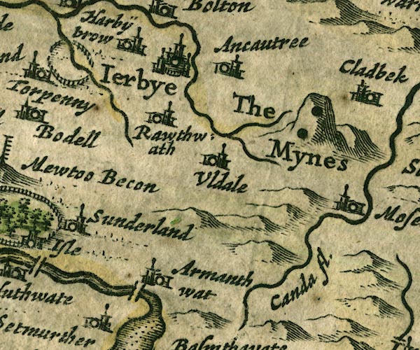 JAN3NY23.jpg "The Mynes" Two black spots drawn on the hillock. item:- JandMN : 88 Image © see bottom of page |
|
|
|
||
| evidence:- | probably old map:- Seller 1694 (Cmd) |
|
| source data:- | Map, uncoloured engraving, Cumberland, scale about 12 miles to 1
inch, by John Seller, 1694. click to enlarge click to enlargeSEL9.jpg "the Myne" two spots; mines item:- Dove Cottage : 2007.38.89 Image © see bottom of page |
|
|
|
||
| evidence:- | old map:- Morden 1695 (Cmd) |
|
| source data:- | Map, uncoloured engraving, Cumberland, scale about 4 miles to 1
inch, by Robert Morden, 1695, published by Abel Swale, the
Unicorn, St Paul's Churchyard, Awnsham, and John Churchill, the
Black Swan, Paternoster Row, London, 1695-1715.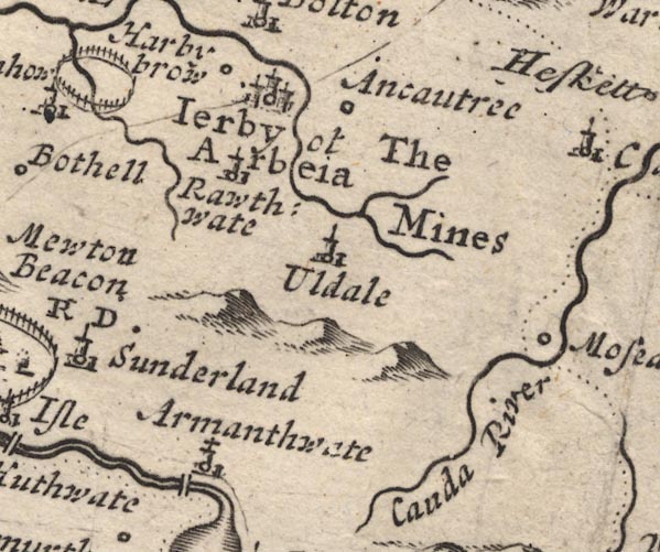 MD12NY23.jpg "The Mines" No symbols. item:- JandMN : 90 Image © see bottom of page |
|
|
|
||
| evidence:- | probably old map:- Bowen and Kitchin 1760 |
|
| source data:- | Map, hand coloured engraving, A New Map of the Counties of
Cumberland and Westmoreland Divided into their Respective Wards,
scale about 4 miles to 1 inch, by Emanuel Bowen and Thomas
Kitchin et al, published by T Bowles, Robert Sayer, and John
Bowles, London, 1760.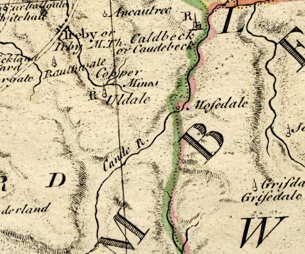 BO18NY23.jpg "Copper Mines" in hills near Uldale item:- Armitt Library : 2008.14.10 Image © see bottom of page |
|
|
|
||
| evidence:- | old text:- Camden 1789 |
|
| source data:- | Book, Britannia, or A Chorographical Description of the Flourishing Kingdoms of England,
Scotland, and Ireland, by William Camden, 1586, translated from the 1607 Latin edition
by Richard Gough, published London, 1789. goto source Page 174:- "..." "On the Caude, besides the copper mines at Caudebeck, ..." |
|
|
|
||
| evidence:- | old text:- Postlethwaite 1877 (3rd edn 1913) placename:- Roughtengill Mine item:- lead ore; zinc ore; iron pyrites; manganese; barytes; galena; silver; smelter |
|
| source data:- | Book, Mines and Mining in the English Lake District, by John Postlethwaite, Keswick,
published by W H Moss and Sons, Whitehaven, Cumberland now Cumbria, 1877; published
1877-1913. goto source page 129:- "ROUGHTENGILL MINE." "Roughtengill has been the most productive mine in the Caldbeck Fells District, both as regards the quantity and variety of its ores and minerals. It is also the oldest having been wrought extensively before the use of gunpowder was known, and there are traces of several ancient smelting hearths, which prove that lead ore has been smelted here at a very early period. In 1794 large and commodious smelting works were erected near this mine, but they soon fell into disuse, and were afterwards converted into cottages. The mine is situated about four miles south-west of Caldbeck; it embraces two parallel veins, about eleven fathoms apart, the bearings of which are about fifteen degrees south of west and north of east, and a cross course, which runs about twenty degrees north of west and south of east, and intersects the other veins diagonally. Immense numbers of strings also intersect the veins, and often produce ore at the points of intersection. These veins yield no less than twenty-three distinct minerals, consisting chiefly of different varieties of lead, copper, and zinc ores, together with manganese, iron pyrites, barytes, &c.*" "The old workings in Roughtengill, which have been cut with stope and feather, are very extensive, reaching downwards from the point where the mine was first opened, to a depth of twenty fathoms. The blue galena and copper ores alone, had been removed by the old men, while the various coloured decomposition products" "*The great variety of ores and minerals found in these veins, is probably due in part to the mineral character of the enclosing rocks, the igneous rocks of the Caldbeck Mountains." goto sourcepage 130:- "of lead were left, showing that the miners of those days were not aware of the value of the latter; but their successors have profited by it, and have obtained many hundreds of tons from the old refuse. After the introduction of gunpowder into mining, three lower adits were driven, namely, the thirty, sixty, and ninety fathom levels; a shaft has also been sunk to a depth of twenty fathoms below the ninety fathom level. During these operations large quantities of lead, copper, and zinc ores were raised, varying in the aggregate from 60 to 100 tons per month. It became exhausted, however, and was closed about thirty-five years ago, but was re-opened - 1888 - for the purpose of raising barytes and umber." "The proprietors of this mine also held and worked Carrock End, Drygill, and Silvergill Mines." |
|
|
|
||
| evidence:- | old map:- Postlethwaite 1877 (3rd edn 1913) placename:- Roughtengill Mine |
|
| source data:- | Map, uncoloured engraving, Map of the Lake District Mining Field, Westmorland, Cumberland,
Lancashire, scale about 5 miles to 1 inch, by John Postlethwaite, published by W H
Moss and Sons, 13 Lowther Street, Whitehaven, Cumberland, 1877 edn 1913.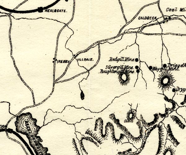 PST2NY23.jpg "Roughtengill Mine" mine symbol item:- JandMN : 162.2 Image © see bottom of page |
|
|
|
||
| evidence:- | old map:- Postlethwaite 1877 (3rd edn 1913) placename:- Silvergill Mine |
|
| source data:- | Map, uncoloured engraving, Map of the Lake District Mining Field, Westmorland, Cumberland,
Lancashire, scale about 5 miles to 1 inch, by John Postlethwaite, published by W H
Moss and Sons, 13 Lowther Street, Whitehaven, Cumberland, 1877 edn 1913. PST2NY23.jpg "Silvergill Mine" mine symbol item:- JandMN : 162.2 Image © see bottom of page |
|
|
|
||
| evidence:- | visit log:- KDMRS 1979-82 placename:- Roughton Gill Mines item:- agate; malachite; brochanite; copper pyrites; pyromorphite; azurite |
|
| source data:- | Notes, log book of Geological Outings, mine plans, etc, Kendal
and District Mine Research Society, Kendal area, Cumbria, etc,
visits made 1979-82. Geological Outing of the Kendal and District Mine Research Society Log book page 15:- "DATE - 27/5/79 SUNDAY. / MAP REF - (SHEET 33) 3025/3450 / LOCATION - ROUGHTON GILL CALDBECK / NAME - ROUGHTON GILL MINES / TYPE OF SITE - MINES. / WORKING OR DISUSED - DISUSED / PEOPLE IN PARTY [ ] / NOS. OF PHOTOS - 13 / SPECIMENS FOUND - PIECES OF AGATE, MALACHITE BROCHANITE, COPPER PYRITES, PYROMORPHITE AND AZURITE. / COMMENTS - SHOWERY DAY, BUT WARM. NO LEVELS OPEN TO ENTER. VERY INTERESTING AREA." item:- private collection : 82 Image © see bottom of page |
|
|
|
||
| :- |
Group of mines on the Caldbeck Fells, worked by the Company of Mines Royal, late 16th
century. A smelting work was installed here 1794. Worked up to 1870s. It was later
a source of umber and other pigments. |
|
| Silver Gill Vein; Dobson's Vein; Roughton Gill North Vein; Great South Roughton Gill
Lode. Ores of lead, copper and zinc, some silver: chalcopyrite, copper iron sulphide,
CuFeS2; galena, lead sulphide, PbS. |
||
| Famous for unusual and colourful minerals, decomposition products of sulphide ores. |
||
| : 2015 (?): Mines in Cumbria: Cumbria RIGS Adams, John: 1988: Mines of the Lake District Fells: Dalesman Books (Lancaster, Lancashire):: ISBN 0 85206 931 6 |
||
|
|
||
Lakes Guides menu.