 Old Cumbria Gazetteer
 |
 |
|
|
| included in:- |
 road, Carlisle to Berwick road, Carlisle to Berwick |
||
| road, Carlisle to Newcastleton | |||
| Carlisle to Newcastleton | |||
| Newcastleton to Carlisle | |||
| civil parish:- | Carlisle (formerly Cumberland) | ||
| civil parish:- | Kingmoor (formerly Cumberland) | ||
| civil parish:- | Rockcliffe (formerly Cumberland) | ||
| civil parish:- | Westlinton (formerly Cumberland) | ||
| civil parish:- | Kirklinton Middle (formerly Cumberland) | ||
| civil parish:- | Arthuret (formerly Cumberland) | ||
| civil parish:- | Nicholforest (formerly Cumberland) | ||
| county:- | Cumbria | ||
| locality type:- | road route | ||
| 10Km square:- | NY35 | ||
| 10Km square:- | NY36 | ||
| 10Km square:- | NY46 | ||
| 10Km square:- | NY47 | ||
| 10Km square:- | NY48 | ||
| locality:- | Newcastleton | ||
| country:- | Scotland | ||
| SummaryText:- | an old route | ||
|
|
|||
| evidence:- | old map:- Ogilby 1675 (plate 62) |
||
| source data:- | Raod strip map, uncoloured engraving, the Road from Carlisle to
Barwick, scale about 1 inch to 1 mile, by John Ogilby, London,
1675.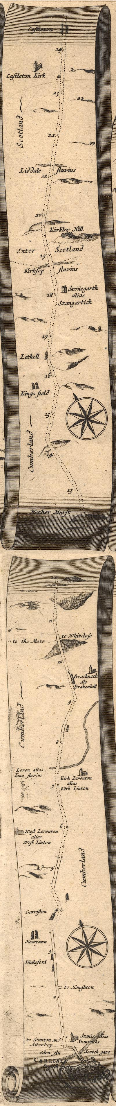 OG62CtoS.jpg item:- JandMN : 83 Image © see bottom of page |
||
|
|
|||
| evidence:- | old map:- Morden 1695 (Cmd) |
||
| source data:- | Map, uncoloured engraving, Cumberland, scale about 4 miles to 1
inch, by Robert Morden, 1695, published by Abel Swale, the
Unicorn, St Paul's Churchyard, Awnsham, and John Churchill, the
Black Swan, Paternoster Row, London, 1695-1715.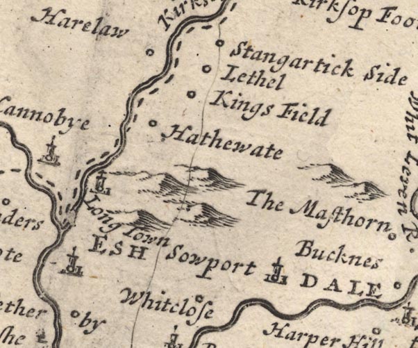 MD12NY47.jpg 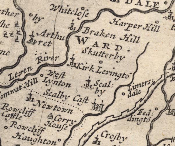 MD12NY46.jpg 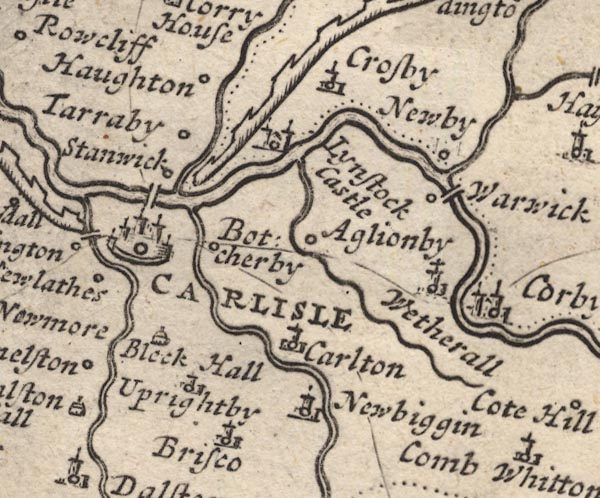 MD12NY45.jpg Single line. item:- JandMN : 90 Image © see bottom of page |
||
|
|
|||
| evidence:- | old map:- Bowen 1720 (plate 161) |
||
| source data:- | Road strip map, uncoloured engraving, pl.161, part of The Road
from Carlisle to Barwick, scale about 2 miles to 1 inch, with
sections in Cumberland, and Scotland, published by Emanuel
Bowen, St Katherines, London, 1720.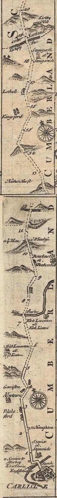 B161CtoJ.jpg item:- JandMN : 65.161 Image © see bottom of page |
||
|
|
|||
| evidence:- | old map:- Bowen and Kitchin 1760 |
||
| source data:- | Map, hand coloured engraving, A New Map of the Counties of
Cumberland and Westmoreland Divided into their Respective Wards,
scale about 4 miles to 1 inch, by Emanuel Bowen and Thomas
Kitchin et al, published by T Bowles, Robert Sayer, and John
Bowles, London, 1760. BO18NY47.jpg double line, dotted item:- Armitt Library : 2008.14.10 Image © see bottom of page |
||
|
|
|||
| evidence:- | old map:- Kitchin 1767 (plate 68) |
||
| source data:- | Road strip map, uncoloured engraving, The Road from Carlisle to
Berwick, in Kitchin's Post Chaise Companion, by Thomas Kitchin,
published by Robert Sayer, 53 Fleet Street, John Bowles,
Cornhill, and Carington Bowles, St Paul's Church Yard, London,
1767.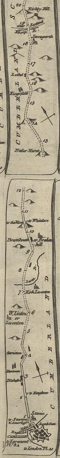 K068CtoJ.jpg item:- Hampshire Museums : FA1999.138.68 Image © see bottom of page |
||
|
|
|||
| places:- | Carlisle Blackford, Westlinton Cliff Bridge, Kirklinton Middle Brackenhill, Arthuret Kershopefoot, Nicholforest Newcastleton, Scotland |
||
|
|
|||
Lakes Guides menu.