 Old Cumbria Gazetteer
 |
 |
|
| Linstock Castle, Linstock | ||
| Linstock Castle | ||
| locality:- | Linstock | |
| civil parish:- | Stanwix Rural (formerly Cumberland) | |
| county:- | Cumbria | |
| locality type:- | castle | |
| locality type:- | pele tower | |
| locality type:- | haunted house | |
| coordinates:- | NY42895848 | |
| 1Km square:- | NY4258 | |
| 10Km square:- | NY45 | |
|
|
||
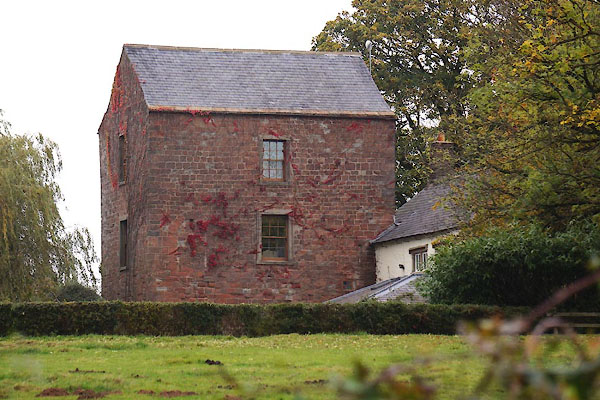 CEC96.jpg (taken 23.10.2015) |
||
|
|
||
| evidence:- | old map:- OS County Series (Cmd 17 13) placename:- Linstock Castle |
|
| source data:- | Maps, County Series maps of Great Britain, scales 6 and 25
inches to 1 mile, published by the Ordnance Survey, Southampton,
Hampshire, from about 1863 to 1948. "Linstock Castle" "Castle (Remains of)" |
|
|
|
||
| evidence:- | old map:- Saxton 1579 placename:- Lynstok Castle |
|
| source data:- | Map, hand coloured engraving, Westmorlandiae et Cumberlandiae Comitatus ie Westmorland
and Cumberland, scale about 5 miles to 1 inch, by Christopher Saxton, London, engraved
by Augustinus Ryther, 1576, published 1579-1645.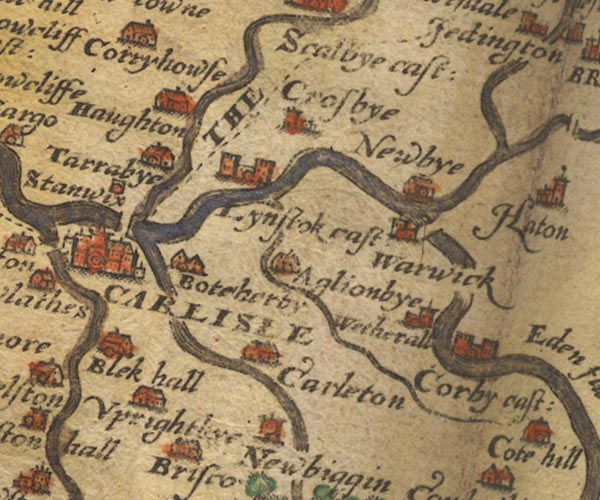 Sax9NY45.jpg Building with two towers, symbol for a castle. "Lynstok cast" item:- private collection : 2 Image © see bottom of page |
|
|
|
||
| evidence:- | old map:- Mercator 1595 (edn?) placename:- Lynstoke Castle |
|
| source data:- | Map, hand coloured engraving, Northumbria, Cumberlandia, et
Dunelmensis Episcopatus, ie Northumberland, Cumberland and
Durham etc, scale about 6.5 miles to 1 inch, by Gerard Mercator,
Duisberg, Germany, about 1595.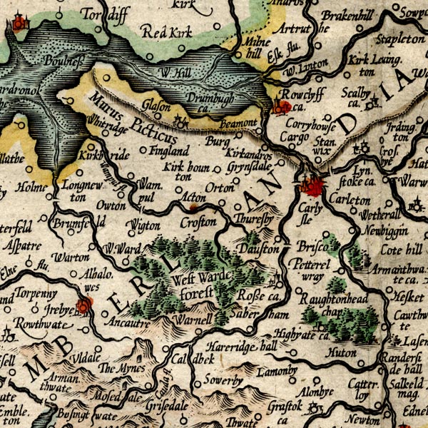 MER8CumC.jpg "Lynstoke ca." circle, building and tower item:- JandMN : 169 Image © see bottom of page |
|
|
|
||
| evidence:- | old map:- Speed 1611 (Cmd) placename:- Lynstik Castle |
|
| source data:- | Map, hand coloured engraving, Cumberland and the Ancient Citie
Carlile Described, scale about 4 miles to 1 inch, by John Speed,
1610, published by J Sudbury and George Humble, Popes Head
Alley, London, 1611-12.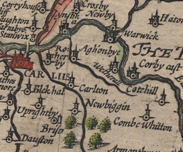 SP11NY45.jpg "Lynstik [c]a" circle, buildings, tower item:- private collection : 16 Image © see bottom of page |
|
|
|
||
| evidence:- | old map:- Jansson 1646 placename:- Lynstok Castle |
|
| source data:- | Map, hand coloured engraving, Cumbria and Westmoria, ie
Cumberland and Westmorland, scale about 3.5 miles to 1 inch, by
John Jansson, Amsterdam, Netherlands, 1646.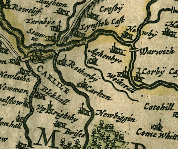 JAN3NY45.jpg "Lynstok Cast" Buildings and tower with flag. item:- JandMN : 88 Image © see bottom of page |
|
|
|
||
| evidence:- | old map:- Sanson 1679 placename:- Lynstok Castle |
|
| source data:- | Map, hand coloured engraving, Ancien Royaume de Northumberland
aujourdhuy Provinces de Nort, ie the Ancient Kingdom of
Northumberland or the Northern Provinces, scale about 9.5 miles
to 1 inch, by Nicholas Sanson, Paris, France, 1679. click to enlarge click to enlargeSAN2Cm.jpg "Lynstok C." circle, two towers, flag; castle item:- Dove Cottage : 2007.38.15 Image © see bottom of page |
|
|
|
||
| evidence:- | old map:- Morden 1695 (Cmd) placename:- Lynstock Castle |
|
| source data:- | Map, uncoloured engraving, Cumberland, scale about 4 miles to 1
inch, by Robert Morden, 1695, published by Abel Swale, the
Unicorn, St Paul's Churchyard, Awnsham, and John Churchill, the
Black Swan, Paternoster Row, London, 1695-1715.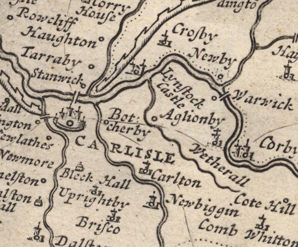 MD12NY45.jpg "Lynstock Castle" Circle, building with two towers. item:- JandMN : 90 Image © see bottom of page |
|
|
|
||
| evidence:- | descriptive text:- Simpson 1746 placename:- Linstock Castle |
|
| source data:- | Atlas, three volumes of maps and descriptive text published as
'The Agreeable Historian, or the Compleat English Traveller
...', by Samuel Simpson, 1746. goto source goto source"..." "Linstock, a Castle of the Bishop of Carlisle. The Barony was first given by King Henry I. to one Walter, his Chaplain, to hold of him and his Successors, the Kings of England; but Walter voluntarily taking upon him a religious Life, with the King's Licence in the Priory of St. Mary's at Carlisle, the King gave Linstock to the Canons in pure Alms. The Bishop's See was after erected at Carlisle by the same King in 1133; but the Lands were enjoy'd by the Bishop and Convents, who had the Power of Election in common, 'till Pandolf, the Pope's Legate, made a Division, and so the Barony of Linstock became the Possessions of the See of Carlisle, as it continues to this Day." |
|
|
|
||
| evidence:- | old map:- Donald 1774 (Cmd) placename:- Linstock Castle |
|
| source data:- | Map, hand coloured engraving, 3x2 sheets, The County of Cumberland, scale about 1
inch to 1 mile, by Thomas Donald, engraved and published by Joseph Hodskinson, 29
Arundel Street, Strand, London, 1774. D4NY45NW.jpg "Linstock Castle" large building; a castle item:- Carlisle Library : Map 2 Image © Carlisle Library |
|
|
|
||
| evidence:- | old text:- Clarke 1787 placename:- Lynstock Castle |
|
| source data:- | Guide book, A Survey of the Lakes of Cumberland, Westmorland,
and Lancashire, written and published by James Clarke, Penrith,
Cumberland, and in London etc, 1787; published 1787-93. goto source Page 105:- "..." "I do not find any ancient authors mention a castle here [Castlerigg], Speed, who speaks of twenty-five in Cumberland, hath found out every one I ever heard or knew of, except Kirkoswald; how that has escaped him I cannot tell. I shall here put down their names, and, as well as I can, their most ancient owners, and supposed founders." "..." goto sourcePage 106:- "..." "8. LYNSTOCK. Waldeof son of Gospatrick." "..." |
|
|
|
||
| evidence:- | old text:- Camden 1789 placename:- Linstock Castle placename:- Olenacum item:- placename, Linstock; Olenacum |
|
| source data:- | Book, Britannia, or A Chorographical Description of the Flourishing Kingdoms of England,
Scotland, and Ireland, by William Camden, 1586, translated from the 1607 Latin edition
by Richard Gough, published London, 1789. goto source Page 174:- "..." "... Linstock, a castle of the bishops of Carlisle, in the barony of Crosby, which barony Waltheof, son of earl Gospatric and lord of Allerdale, gave to the church of Carlisle, and which I take to be called by contraction from OLENACUM. For that place seems to have been on the wall where the first Ala Herculea served against the barbarians. ..." |
|
|
|
||
| evidence:- | old text:- Camden 1789 (Gough Additions) |
|
| source data:- | Book, Britannia, or A Chorographical Description of the Flourishing Kingdoms of England,
Scotland, and Ireland, by William Camden, 1586, translated from the 1607 Latin edition
by Richard Gough, published London, 1789. goto source Page 191:- "..." "Linstock was granted with Carleton by Henry I. to Walter his chaplain, who took upon him a religious habit in St. Mary's priory, Carlisle, and with the king's consent gave both manors to that in frank almoyne for ever, and became prior there. For some time the bishop and convent held all their lands in common: but when the first partition was made by Gualo the pope's legate this barony fell to the bishop, and this castle was his seat so late as 1293." |
|
|
|
||
| evidence:- | old text:- Gents Mag |
|
| source data:- | Magazine, The Gentleman's Magazine or Monthly Intelligencer or
Historical Chronicle, published by Edward Cave under the
pseudonym Sylvanus Urban, and by other publishers, London,
monthly from 1731 to 1922. goto source Gentleman's Magazine 1819 part 1 p.405 From the Compendium of County History:- "1307. From Lanercost priory, March 1, Edward I. and his Queen Margaret removed to Kirk Cambock; thence on the 4th to Linstock castle, where they were entertained for six days by John Halton Bp. of Carlisle; ..." |
|
|
|
||
| evidence:- | database:- Listed Buildings 2010 placename:- Linstock Castle |
|
| source data:- | courtesy of English Heritage "LINSTOCK CASTLE / / / STANWIX RURAL / CARLISLE / CUMBRIA / II[star] / 77660 / NY4289758484" |
|
| source data:- | courtesy of English Heritage "Farmhouse, formerly tower house. C12 or early C13 as palace for the Bishops of Carlisle, with C17-C20 additions and alterations. Tower has large blocks of red sandstone, mostly from Roman Wall nearby, for walls 2 metres thick; slate gabled roof. 3 storeys, one bay, tower. entrance to ground floor, has chamfered rounded arch with continuous hood-mould hidden by ivy: above left is original first-floor entrance with rounded arch, now filled. Windows inserted 1768 with plain freestone surrounds, sashes with glazing bars, C19 plank door. East face has 2 round-headed lancets and one flat-headed chamfered lancet, now all filled. Ground floor chamfered lancet to west face. C20 steel casement in north face. Interior has pointed arch vaulting to ground floor without stairs: first-floor room connected to 2 second-floor rooms by stair in thickness of the wall. Walls originally higher and flat roof, reduced and gabled 1768. Extension at right angles of 2 storeys, 2 bays has sandstone rubble walls partly covered by render, is probably early C17 incorporating parts of an earlier out building. Two C17 chamfered mullion windows with mixed C19 and C20 sashes, with with single glazing bars and steel casements. Further one bay early C19 extension of brick under same roof with C20 kitchen extension of single storey, 2 bays to side. Close to the castle are the remains of the encircling moat. Used as Bishops Palace c1219-early C14, then as prison and refuge for villagers in border raids. For 6 days in March 1307, Edward I, his Queen and Court were entertained here, whilst Parliament was held in Carlisle. See, Curwen, Castles & Towers of Cumberland &Westmorland, 1913, p. 298-9." |
|
|
|
||
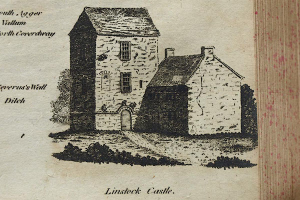 BOW98.jpg From Hutchinson 1794 map 2. |
||
|
|
||
| notes:- |
13th century pele tower, later hall, traces of a moat |
|
| Perriam, D R &Robinson, J: 1998: Medieval Fortified Buildings of Cumbria: CWAAS::
ISBN 1 873124 23 6; plan and illustrations |
||
|
|
||
| hearsay:- |
The ghost of Bishop Irton, died 1283, might be seen on the anniversary of his death. |
|
|
|
||
Lakes Guides menu.