 Old Cumbria Gazetteer
 |
 |
|
| Walney Island | ||
| Isle of Walney | ||
| Wanla | ||
| civil parish:- | Barrow-in-Furness (formerly Lancashire) | |
| county:- | Cumbria | |
| locality type:- | island | |
| 1Km square:- | SD1767 | |
| 10Km square:- | SD16 | |
|
|
||
| evidence:- | old map:- Mercator 1595 (edn?) placename:- Walney Chapelry |
|
| source data:- | Map, hand coloured engraving, Westmorlandia, Lancastria, Cestria
etc, ie Westmorland, Lancashire, Cheshire etc, scale about 10.5
miles to 1 inch, by Gerard Mercator, Duisberg, Germany, 1595,
edition 1613-16.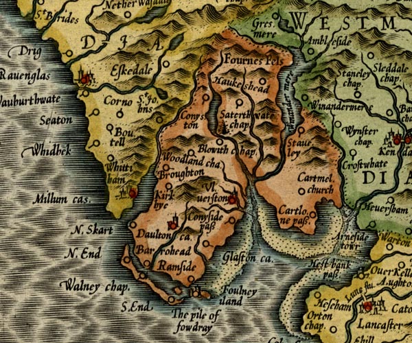 MER5LanA.jpg "Walney chap." circle; also the island item:- Armitt Library : 2008.14.3 Image © see bottom of page |
|
|
|
||
| evidence:- | old map:- Speed 1611 (Cum/EW) placename:- Walney Iland |
|
| source data:- | Map, hand coloured engraving, Kingdome of Great Britaine and
Ireland, scale about 36 miles to 1 inch, by John Speed, about
1610-11, published by Thomas Bassett, Fleet Street and Richard
Chiswell, St Paul's Churchyard, London, 1676? click to enlarge click to enlargeSPD6Cm.jpg "Walney Iland" island item:- private collection : 85 Image © see bottom of page |
|
|
|
||
| evidence:- | poem:- Drayton 1612/1622 text placename:- Isle of Walney |
|
| source data:- | Poem, Poly Olbion, by Michael Drayton, published by published by
John Marriott, John Grismand and Thomas Dewe, and others?
London, part 1 1612, part 2 1622. goto source goto sourcepage 136:- "... As first without her selfe [Furness] at Sea to make her strong, (Yet how soe'r expos'd, doth still to her belong) And fence her furthest poynt, from that rough Neptunes rage, The Isle of Walney lyes, whose longitude doth swage His fury when his waves, on Furnesse seeme to warre, Whose crooked back is arm'd with many a rugged scarre Against his boystrous shocks, which this defensive Isle Of Walney still assayle, that shee doth scorne the while, Which to assist her hath the Pyle of Fouldra set, And Fulney at her backe, a pretty Insuley, Which all their forces bend, their Furnesse safe to keep: ..." |
|
|
|
||
| evidence:- | old map:- Sanson 1679 placename:- Walney Island |
|
| source data:- | Map, hand coloured engraving, Ancien Royaume de Northumberland
aujourdhuy Provinces de Nort, ie the Ancient Kingdom of
Northumberland or the Northern Provinces, scale about 9.5 miles
to 1 inch, by Nicholas Sanson, Paris, France, 1679. click to enlarge click to enlargeSAN2Cm.jpg "Walney I." island item:- Dove Cottage : 2007.38.15 Image © see bottom of page |
|
|
|
||
| evidence:- | old map:- Morden 1695 (EW) placename:- Walney Island |
|
| source data:- | Map, hand coloured engraving, England, including Wales, scale
about 27 miles to 1 inch, by Robert Morden, published by Abel
Swale Awnsham and John Churchil, London, about 1695. click to enlarge click to enlargeMRD3Cm.jpg "Walney I." island item:- JandMN : 339 Image © see bottom of page |
|
|
|
||
| evidence:- | old text:- Mackenzie 1776 placename:- Walney Island |
|
| source data:- | Charts, and sailing directions, Nautical Descriptions of the
West Coast of Great Britain, Bristol Channel to Cape Wrath, by
Murdoch Mackenzie, published London, 1776. goto source Page 17:- "..." "A Description of the Tides, Rocks, Shoals, Sand-banks, Channels, Anchoring-places, and Harbours, between FORMBY POINT, and WALNEY ISLAND." "CHART X." "TIDES. Time of High-water. / From Formby, to St. Bee's Head, it is high water on the shore about eleven o'clock, on the full and change-days of the moon." "Rise of the Tide. / Spring-tide, on this part of the coast, rises 4½, or five fathoms perpendicular; neap-tide three. In the anchorage at Piel-of-Foudray, spring-tide, the second day after the change, rose six fathoms perpendicular" "Direction of the Stream. / The stream of flood along the coast, from Formby to Walney, runs northward; and, off the middle of that island, meets the stream which comes round the north coast of Ireland, and from thence runs southward through the Irish channel. The opposition of these two streams destroy each other's force, and renders their celerities scarce sensible in that neighbourhood; but, by accumulating the water in Piel-of-Foudray anchorage, occasions a greater rise of the tide there than in other parts." goto sourcePage 18:- "... ..." "The stream of tide, near the W. side of Walney, begins to run S.E. at the last quarter of flood on the shore, and continues till it is one quarter flowed, then runs nine hours N.E." |
|
|
|
||
| evidence:- | old map:- West 1784 map placename:- Walney Isle |
|
| source data:- | Map, hand coloured engraving, A Map of the Lakes in Cumberland,
Westmorland and Lancashire, scale about 3.5 miles to 1 inch,
engraved by Paas, 53 Holborn, London, about 1784. Ws02SD17.jpg  Ws02SD16.jpg "WALNEY ISLE" item:- Armitt Library : A1221.1 Image © see bottom of page |
|
|
|
||
| evidence:- | old text:- Camden 1789 placename:- Walney Island |
|
| source data:- | Book, Britannia, or A Chorographical Description of the Flourishing Kingdoms of England,
Scotland, and Ireland, by William Camden, 1586, translated from the 1607 Latin edition
by Richard Gough, published London, 1789. goto source Page 132:- "..." "Between this lake and the river Dudden runs out the point commonly called Fornesse, to which is opposed for a long way as a kind of breast-work Walney island, divided from it by a narrow channel, the entrance to which is guarded by the Pile of Fouldrey as it is called, built by one of the abbots of Fornesse on a rock in the midst of the sea 1 Edward III." |
|
|
|
||
| evidence:- | old text:- Camden 1789 (Gough Additions) |
|
| source data:- | Book, Britannia, or A Chorographical Description of the Flourishing Kingdoms of England,
Scotland, and Ireland, by William Camden, 1586, translated from the 1607 Latin edition
by Richard Gough, published London, 1789. goto source Page 142:- "..." "Walney isle at the extremity of Fourness has been lately improved by spreading sea-sand on the land, and now produces plentiful crops of wheat and other grain." |
|
|
|
||
| evidence:- | old map:- Cooke 1802 placename:- Walney Isle |
|
| source data:- | Map, Lancashire, scale about 18 miles to 1 inch, by George
Cooke, 1802, bound in Gray's New Book of Roads, 1824, published
by Sherwood, Jones and Co, Paternoster Road, London, 1824.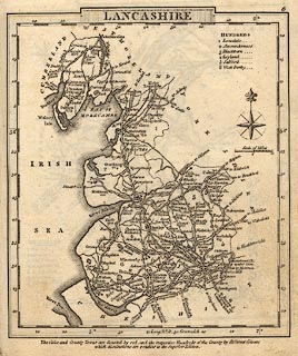 click to enlarge click to enlargeGRA1La.jpg "Walney Isle" island item:- Hampshire Museums : FA2000.62.6 Image © see bottom of page |
|
|
|
||
| evidence:- | old map:- Laurie and Whittle 1806 placename:- Walney Island |
|
| source data:- | Road map, Completion of the Roads to the Lakes, scale about 10
miles to 1 inch, by Nathaniel Coltman? 1806, published by Robert
H Laurie, 53 Fleet Street, London, 1834. click to enlarge click to enlargeLw18.jpg "Walney Island" island item:- private collection : 18.18 Image © see bottom of page |
|
|
|
||
| evidence:- | old map:- Otley 1818 placename:- Isle of Walney |
|
| source data:- | Map, uncoloured engraving, The District of the Lakes,
Cumberland, Westmorland, and Lancashire, scale about 4 miles to
1 inch, by Jonathan Otley, 1818, engraved by J and G Menzies,
Edinburgh, Scotland, published by Jonathan Otley, Keswick,
Cumberland, et al, 1833.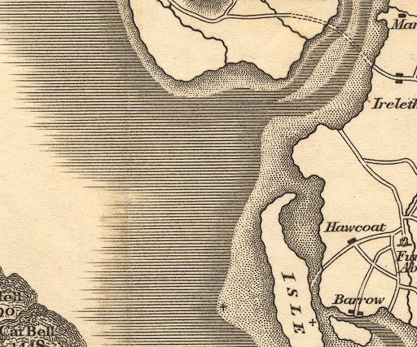 OT02SD17.jpg 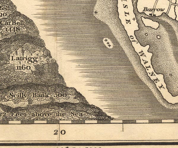 OT02SD16.jpg 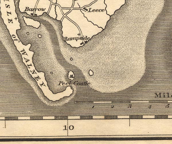 OT02SD26.jpg "ISLE of WALNEY" item:- JandMN : 48.1 Image © see bottom of page |
|
|
|
||
| evidence:- | old map:- Perrot 1823 placename:- Ile Walnay |
|
| source data:- | Map, hand coloured engraving, Cumberland and Westmoreland ie
Westmorland, scale about 38 miles to 1 inch, by Aristide Michel
Perrot, engraved by Migneret, 1823, published by Etienne Ledoux,
9 Rue Guenegaud, Paris, France, 1824-48. click to enlarge click to enlargePER2.jpg "I. Walnay" island item:- Dove Cottage : 2007.38.45 Image © see bottom of page |
|
|
|
||
| evidence:- | old map:- Ford 1839 map |
|
| source data:- | Map, uncoloured engraving, Map of the Lake District of
Cumberland, Westmoreland and Lancashire, scale about 3.5 miles
to 1 inch, published by Charles Thurnam, Carlisle, and by R
Groombridge, 5 Paternoster Row, London, 3rd edn 1843.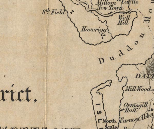 FD02SD17.jpg 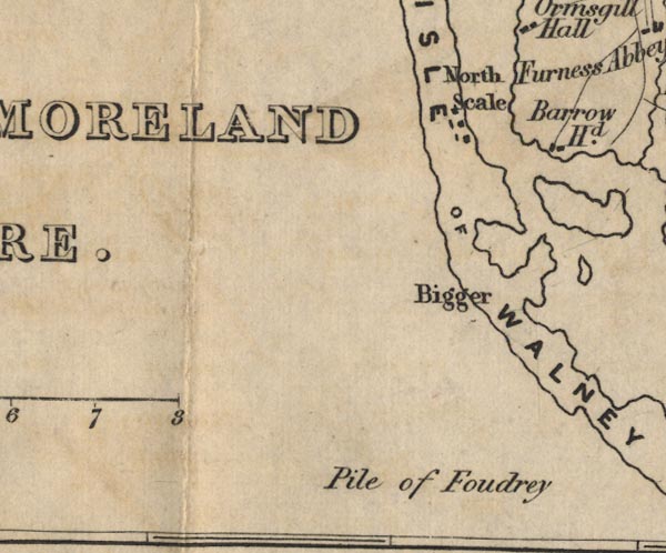 FD02SD16.jpg 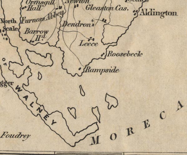 FD02SD26.jpg "ISLE OF WALNEY" item:- JandMN : 100.1 Image © see bottom of page |
|
|
|
||
| evidence:- | old map:- Hydrographic Office 1850s onwards placename:- Walney Island |
|
| source data:- | Chart, uncoloured engraving, England West Coast sheet XI,
Fleetwood to the Firth of Solway, scale about 2.5 miles to 1
inch, by H Denham and G Williams, 1846, engraved by J and C
Walker, published by the Hydrographic Office, 1850 corrected to
1863 coast views on Admiralty chart  click to enlarge click to enlargeHY01P2.jpg "Walney Elbow"  click to enlarge click to enlargeHY01P3.jpg "Walney Id." 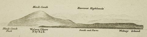 click to enlarge click to enlargeHY01P4.jpg "Walney Elbow / Walney Island" item:- Carlisle Library : Map 93 Images © Carlisle Library |
|
|
|
||
| evidence:- | old map:- Hydrograpic Office 1850s onwards placename:- Walney Island |
|
| source data:- | Chart, uncoloured engraving, England West Coast sheet XI,
Fleetwood to the Firth of Solway, scale about 2.5 miles to 1
inch, by H Denham and G Williams, 1846, engraved by J and C
Walker, published by the Hydrographic Office, 1850 corrected to
1863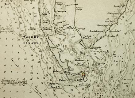 click to enlarge click to enlargeHY01P1.jpg "WALNEY ISLAND" item:- Carlisle Library : Map 93 Image © Carlisle Library |
|
|
|
||
| evidence:- | old map:- Garnett 1850s-60s H placename:- Walney Island |
|
| source data:- | Map of the English Lakes, in Cumberland, Westmorland and
Lancashire, scale about 3.5 miles to 1 inch, published by John
Garnett, Windermere, Westmorland, 1850s-60s.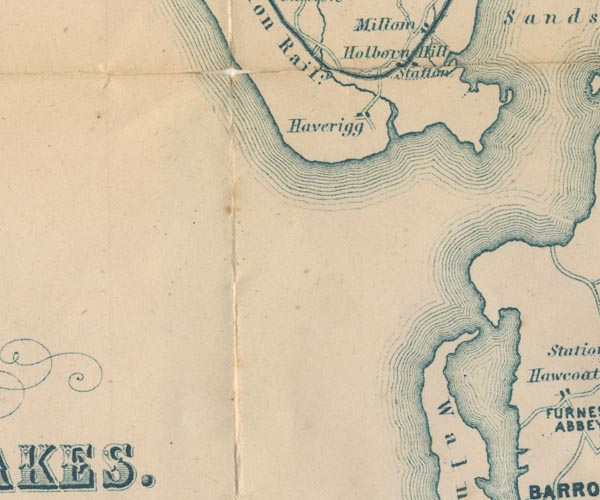 GAR2SD17.jpg "Walney Id." island 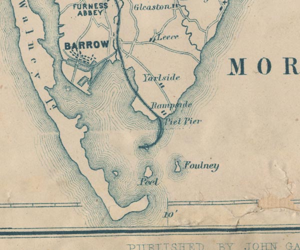 GAR2SD26.jpg item:- JandMN : 82.1 Image © see bottom of page |
|
|
|
||
| evidence:- | old text:- Admiralty 1933 placename:- Walney Island |
|
| source data:- | goto source Page 375:- "..." "APPROACH TO BARROW-IN-FURNESS DOCKS. - Aspect. - Walney island, within which is Piel harbour and the port of Barrow, is low throughout, the highest part, which is only 64 feet (19m5) high, being near the church abreast of Barrow, about 4 1/4 miles from the southern end of the island. The lighthouse, situated near the south-eastern extremity of the island, the look-out house, flagstaff and semaphore near Hilpsford point, at the south-western extremity of the island, the church remarked on above, and a mill, situated near the northern end of the island (chart 1826), are all conspicuous objects." goto sourcePage 383:- "..." "Dangers. - ... Foul ground extends for a distance of about a mile, generally, off the western coast of Walney island." |
|
|
|
||
| evidence:- | old print:- item:- fishing net |
|
| source data:- | Print, uncoloured engraving, Pile of Fouldrey Castle, Barrow-in-Furness, Lancashire,
drawn by G Pickering, engraved by Fenner and Co, published by Fisher, Son and Co,
London, 1830s?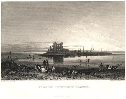 click to enlarge click to enlargePR0651.jpg From Walney Island; fishermen on the shore in the foreground with hand nets. printed at bottom left, right, centre:- "Drawn by G. Pickering. / Engraved by Fenner & Co. / PILE OF FOULDREY CASTLE. / FISHER, SON &Co. LONDON." item:- Dove Cottage : 2008.107.595 Image © see bottom of page |
|
|
|
||
| references:- |
||
| Cracknell, Basil E: 2005: Outrageous Waves: Phillimore and Co (Chichester, West Sussex)::
ISBN 1 86077 344 0 |
||
|
|
||
Lakes Guides menu.