 Old Cumbria Gazetteer
 |
 |
|
| Eden Bridge, Carlisle | ||
| Eden Bridge | ||
| Priest Beck Bridge | ||
| New Bridge | ||
| site name:- | Eden, River | |
| Street:- | Bridgewater Road | |
| locality:- | Carlisle | |
| civil parish:- | Carlisle (formerly Cumberland) | |
| county:- | Cumbria | |
| locality type:- | bridge | |
| coordinates:- | NY40075656 | |
| 1Km square:- | NY4056 | |
| 10Km square:- | NY45 | |
|
|
||
 CFL96.jpg (taken 7.9.2016) 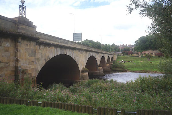 CFL98.jpg (taken 7.9.2016) |
||
|
|
||
| evidence:- | old map:- OS County Series (Cmd 23 3) placename:- Eden Bridge |
|
| source data:- | Maps, County Series maps of Great Britain, scales 6 and 25
inches to 1 mile, published by the Ordnance Survey, Southampton,
Hampshire, from about 1863 to 1948. |
|
|
|
||
| evidence:- | old map:- Saxton 1579 |
|
| source data:- | Map, hand coloured engraving, Westmorlandiae et Cumberlandiae Comitatus ie Westmorland
and Cumberland, scale about 5 miles to 1 inch, by Christopher Saxton, London, engraved
by Augustinus Ryther, 1576, published 1579-1645.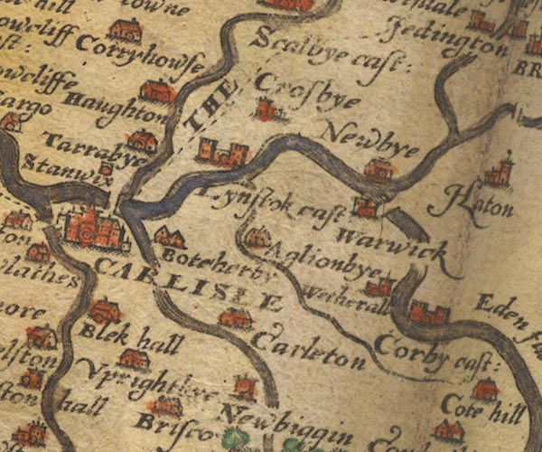 Sax9NY45.jpg Over River Eden. item:- private collection : 2 Image © see bottom of page |
|
|
|
||
| evidence:- | old map:- Burghley 1590 (facsimile) |
|
| source data:- | Facsimile map, A Platt of the Opposete Border of Scotland to ye West Marches of England,
parts of Cumberland and Scotland including the Debateable Land, from a manuscript
drawn for William Cecil, Lord Burghley, about 1590, published by R B Armstrong, 1897. courtesy of the National Library of Scotland 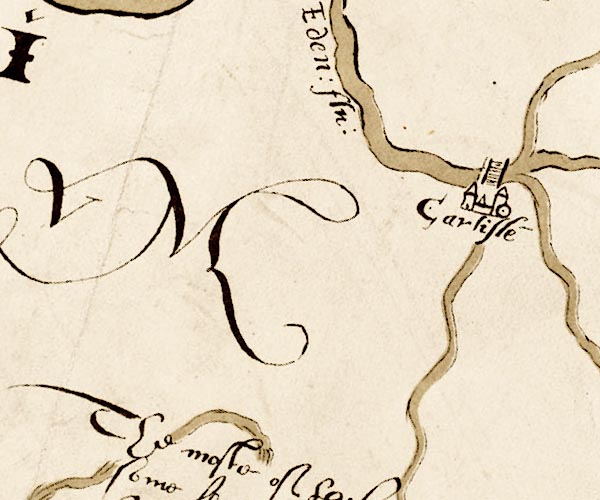 M048NY35.jpg "" bridge over the Eden at Carlisle item:- National Library of Scotland : MS6113 f.267 Image © National Library of Scotland |
|
|
|
||
| evidence:- | presumably old map:- Mercator 1595 (edn?) placename:- |
|
| source data:- | Map, hand coloured engraving, Northumbria, Cumberlandia, et
Dunelmensis Episcopatus, ie Northumberland, Cumberland and
Durham etc, scale about 6.5 miles to 1 inch, by Gerard Mercator,
Duisberg, Germany, about 1595.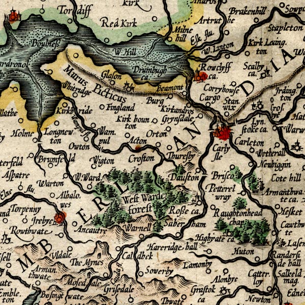 MER8CumC.jpg "" double across a stream; bridge, over the Eden at Carlisle, E of the Petteril, perhaps misplaced to be more visible? item:- JandMN : 169 Image © see bottom of page |
|
|
|
||
| evidence:- | old map:- Speed 1611 (Cmd) |
|
| source data:- | Map, hand coloured engraving, Cumberland and the Ancient Citie
Carlile Described, scale about 4 miles to 1 inch, by John Speed,
1610, published by J Sudbury and George Humble, Popes Head
Alley, London, 1611-12.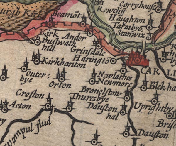 SP11NY35.jpg double line across the Eden, N side of Carlisle item:- private collection : 16 Image © see bottom of page |
|
|
|
||
| evidence:- | old map:- Ogilby 1675 (plate 62) |
|
| source data:- | Raod strip map, uncoloured engraving, the Road from Carlisle to
Barwick, scale about 1 inch to 1 mile, by John Ogilby, London,
1675.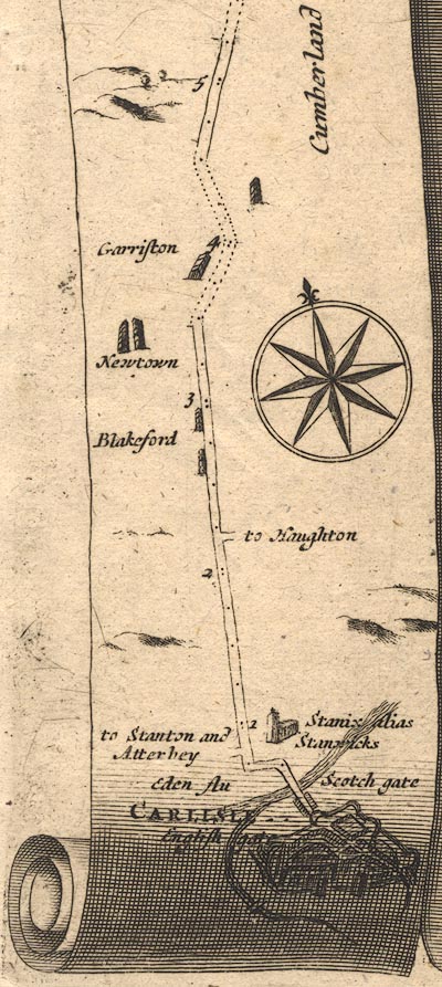 OG62m000.jpg In mile 0, Cumberland. road crosses:- "Eden flu" no bridge is drawn. item:- JandMN : 83 Image © see bottom of page |
|
|
|
||
| evidence:- | old map:- Ogilby 1675 (plate 86) |
|
| source data:- | Road strip map, uncoloured engraving, the Road from Tinmouth ...
to Carlisle, scale about 1 inch to 1 mile, by John Ogilby,
London, 1675.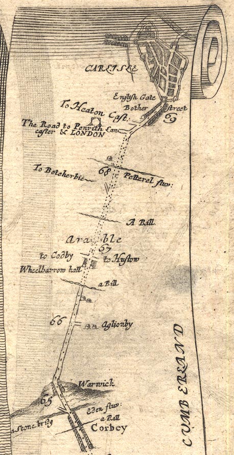 OG86m065.jpg In mile 69, Cumberland. Road crosses the river on the further side (north) of Carlisle. item:- JandMN : 73 Image © see bottom of page |
|
|
|
||
| evidence:- | old map:- Ogilby 1675 (plate 38) |
|
| source data:- | Road strip map, hand coloured engraving, continuation of the
Road from London to Carlisle, scale about 1 inch to 1 mile, by
John Ogilby, London, 1675.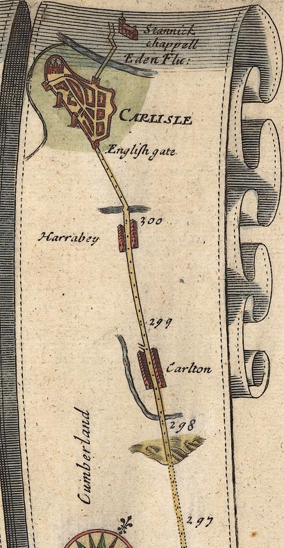 OG38m297.jpg In mile 301, Cumberland. Road crosses the:- "Eden Flu:" beyond (north) of the town, carrying the road to the north, no bridge drawn. item:- JandMN : 21 Image © see bottom of page |
|
|
|
||
| evidence:- | old map:- Morden 1695 (Cmd) |
|
| source data:- | Map, uncoloured engraving, Cumberland, scale about 4 miles to 1
inch, by Robert Morden, 1695, published by Abel Swale, the
Unicorn, St Paul's Churchyard, Awnsham, and John Churchill, the
Black Swan, Paternoster Row, London, 1695-1715. MD12NY45.jpg Double line over a stream, over the Eden at Carlisle. item:- JandMN : 90 Image © see bottom of page |
|
|
|
||
| evidence:- | old map:- Bowen 1720 (plate 161) |
|
| source data:- | Road strip map, uncoloured engraving, pl.161, part of The Road
from Carlisle to Barwick, scale about 2 miles to 1 inch, with
sections in Cumberland, and Scotland, published by Emanuel
Bowen, St Katherines, London, 1720. B161m00.jpg Over the Eden north of the city. item:- JandMN : 65.161 Image © see bottom of page |
|
|
|
||
| evidence:- | descriptive text:- Defoe 1724-26 |
|
| source data:- | Tour through England and Wales, by Daniel Defoe, published in
parts, London, 1724-26. "Here [Carlisle] is a bridge over the Eden, which soon lets you into Scotland; for the limits are not above eight miles off, or thereabout. The south part of Scotland, on this side, coming at least fifty miles farther into England, than at Berwick." |
|
|
|
||
| evidence:- | old map:- Bowen and Kitchin 1760 |
|
| source data:- | Map, hand coloured engraving, A New Map of the Counties of
Cumberland and Westmoreland Divided into their Respective Wards,
scale about 4 miles to 1 inch, by Emanuel Bowen and Thomas
Kitchin et al, published by T Bowles, Robert Sayer, and John
Bowles, London, 1760. BO18NY35.jpg double line across the Eden item:- Armitt Library : 2008.14.10 Image © see bottom of page |
|
|
|
||
| evidence:- | old map:- Donald 1774 (Cmd) |
|
| source data:- | Map, hand coloured engraving, 3x2 sheets, The County of Cumberland, scale about 1
inch to 1 mile, by Thomas Donald, engraved and published by Joseph Hodskinson, 29
Arundel Street, Strand, London, 1774. D44056D.jpg bridge over the N branch of the Eden; 5 arches, and cutwaters item:- Carlisle Library : Map 2 Image © Carlisle Library |
|
|
|
||
| evidence:- | old map:- Donald 1774 (Cmd) |
|
| source data:- | Map, hand coloured engraving, 3x2 sheets, The County of Cumberland, scale about 1
inch to 1 mile, by Thomas Donald, engraved and published by Joseph Hodskinson, 29
Arundel Street, Strand, London, 1774. D4NY45NW.jpg two bridges over the Eden. item:- Carlisle Library : Map 2 Image © Carlisle Library |
|
|
|
||
| evidence:- | old text:- Capper 1808 |
|
| source data:- | Gazetteer, A Topographical Dictionary of the United Kingdom,
compiled by Benjamin Pitts Capper, published by Richard
Phillips, Bridge Street, Blackfriars, London, 1808; published
1808-29. goto source goto source"[Carlisle] ... the bridges over the Eden are old-fashioned and very narrow; ..." |
|
|
|
||
| evidence:- | old print:- Farington 1816 placename:- Eden Bridge |
|
| source data:- | Print, uncoloured engraving and descriptive text, North East View of Carlisle, Cumberland,
drawn by Joseph Farington, engraved by W Woolnoth, published by T Cadell and W Davies,
Strand, London, 1815.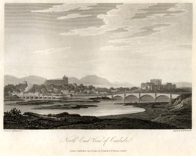 click to enlarge click to enlargeFA0425.jpg printed, bottom left, right, centre "Drawn by J. Farington R.A. / Engraved by W. Woolnoth. / North East View of Carlisle. / London Published Septr. 15, 1815, by T. Cadell &W. Davies, Strand." item:- Armitt Library : A6666.25 Image © see bottom of page |
|
|
|
||
| evidence:- | old print with text:- Farington 1816 placename:- Carlisle item:- Prestbecke Bridge |
|
| source data:- | Print, uncoloured engraving and descriptive text, Carlisle from Stanwix, Cumberland,
drawn by Joseph Farington, engraved by J Landseer, published by T Cadell and W Davies,
Strand, London, 1815.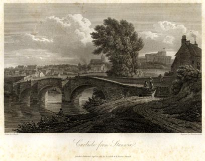 click to enlarge click to enlargeFA0426.jpg printed, bottom left, right, centre "Drawn by J. Farington R.A. / Engraved by J. Landseer A.R.A. / Carlisle from Stanwix. / London Published Septr. 15, 1815, by T. Cadell &W. Davies, Strand." Descriptive text, page 1:- VIEW OF THE ANCIENT CITY OF CARLISLE. "..." "The two bridges over the Eden at Carlisle, called Eden Bridge and Prestbecke Bridge, were of wood in the reign of Queen Elizabeth; when one of them having fallen down, and the other being in a state of great decay, an Act of Parliament passed for rebuilding them at the expence of the county in 1600, (3 Eliz) It is probable that they were then first constructed of stone. The Act of Parliament before-mentioned, passed in 1807, having empowered the county to rebuild Prestbecke Bridge, a new bridge was begun in the autumn of the year 1812, designed by, and under the direction of Robert Smirke, Esq. Jun. R.A. and has now lately been completed: it is built of white freestone from the neighbourhood of Gretna, in Scotland; and consists of five elliptical arches, each sixty-five feet in diameter. Government has advanced the sum of 10,000l. towards the building of this bridge, on account of it being in the direction of the intended new northern road to Port Patrick. Eden Bridge is to be removed, and a raised, and partly arched causeway to be formed, connecting the town with the new bridge." "..." item:- Armitt Library : A6666.26 Image © see bottom of page |
|
|
|
||
| evidence:- | old map:- Bell 1833 |
|
| source data:- | Map, hand coloured steel engraving, Westmoreland ie Westmorland,
scale about 5.5 miles to 1 inch, by James Bell? published by
Archibald Fullarton and Co, Glasgow, Strathclyde, about 1834. click to enlarge click to enlargeBEL3Vgn2.jpg Vignette on a map of Cumberland item:- JandMN : 3 Image © see bottom of page |
|
|
|
||
| evidence:- | old map:- Bell 1892 placename:- Eden Bridge |
|
| source data:- | Map, colour lithograph, Road Map of Cumberland, by George Joseph
Bell, scale about 2.5 miles to 1 inch, printed by Charles
Thurnam and Sons, Carlisle, Cumberland, 1892. BEL9NY35.jpg "EDEN BRIDGE" bridge symbol Road map of Cumberland showing County Bridges item:- Carlisle Library : Map 38 Image © Carlisle Library |
|
|
|
||
| evidence:- | old text:- Harper 1907 placename:- Eden Bridge item:- street lamp |
|
| source data:- | Guidebook, The Manchester and Glasgow Road, by Charles G Harper,
published by Chapman and Hall Ltd, London, 1907. HP01p150.txt Page 150:- "... the noble Eden Bridge, carrying the road across the river to Stanwix. The bridge, built a hundred years ago, is monumental, and even the lamp-standards, designed for it at the same time are fine. But the over-head trolley-wires are an offence to the spirit of the thing, and the city of Carlisle cares so little for it that ugly electric light standards are placed at intervals, and the fine old iron lamps that might so easily and handsomely been adapted, now serve no useful purpose." |
|
|
|
||
| evidence:- | old text:- Burrow 1920s |
|
| source data:- | Road book, strip maps with parts in Westmorland, Cumberland etc,
irregular scales about 1.5 miles to 1 inch, by E J Burrow and
Co, Cheltenham, Gloucestershire, 1920s. "... A modern but striking architectural work is the handsome bridge by which we cross the Eden to continue our northward journey." |
|
|
|
||
| evidence:- | old print:- placename:- Eden Bridge |
|
| source data:- | Print, halftone photograph, Eden Bridge, Carlisle, by J E Ryecroft, Carlisle, published
by Cumberland Motor Services, Tangier Street, Whitehaven, Cumberland, about 1926.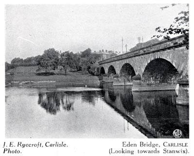 click to enlarge click to enlargeCS106.jpg On p.25 of Cumberland its Lakes and Mountains. lower right "WP" printed, bottom, left right "J. E. Ryecroft, Carlisle. Photo. / Eden Bridge, CARLISLE (Looking towards Stanwix)." item:- JandMN : 1022.6 Image © see bottom of page |
|
|
|
||
| evidence:- | database:- Listed Buildings 2010 placename:- Eden Bridge |
|
| source data:- | courtesy of English Heritage "EDEN BRIDGE / / / CARLISLE / CARLISLE / CUMBRIA / I / 386570 / NY4005556571" |
|
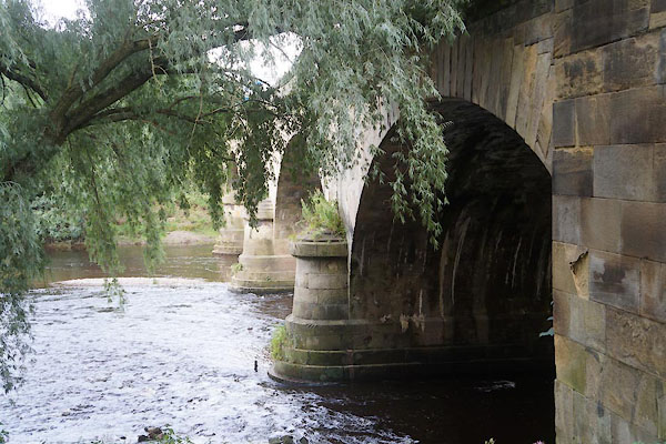
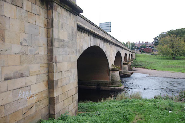
| source data:- | courtesy of English Heritage "Road bridge over River Eden. 1812-15, for the County of Cumberland by Robert Smirke, with various minor alterations and 1932 widening by Percy Dalton, City Engineer. Reeded calciferous sandstone ashlar. 5 segmental arches of double width, on rounded piers, with flush voussoirs, string course and solid parapet. North to south alignment. Abutments project at either side on the south and the north-west but replaced by steps on north-east as an entrance to Rickerby Park; the recesses in the parapets above the abutments have a stone seat with flanking rectangular cast-iron gas lamp brackets now surmounted by C20 electric light globes. A pedestrian tunnel was cut through the south in 1902, lined with white glazed bricks; external stone steps were added on the south-west side to reach the tunnel; a ramp gives access at the other side. Under the arches can be seen the cleaner stonework of the extension on the east side which has a face exactly matching that on the west but of new stone. Cut onto the south-west abutment are the various flood dates and levels, but most are now weathered - DEC 13TH 1852 and 1857 are visible. Fixed onto the bridge parapet are various bronze plaques giving a brief history and a central one recording the widening. Under the arches in the river bed are the remains of a C16 bridge and its associated piling discovered during dredging in 1951. For history of site see Hogg CWAAS, Trans.NS LII and Macdonald, CWAAS, Trans.NS LXXI. This was one of the two bridges built together but the southern channel of the river was left dry and gradually filled; the southern bridge was demolished in 1969-70 to make way for the inner ring road. A Scheduled Ancient Monument. (Cumb. & West. Antiquarian & Archaeological Soc., New Series: Hogg, Robert: LII: The Historic Crossings of the River Eden: P.131-159; Cumb. & West. Antiquarian &Archaeological Soc., New Series: MacDonald MIM: LXXI: The building of the New Eden Bridge: P.248-259)." |
|
|
|
||
| evidence:- | old print:- |
|
| source data:- | Print, uncoloured engraving, Carlisle from Rickerby Park, Carlisle, Cumberland, published
1900s?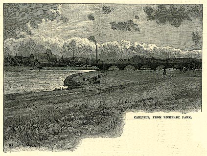 click to enlarge click to enlargePR0254.jpg On p.261 of Our Own Country. printed at lower right:- "HAR[ ]WOR[ ]" printed at bottom:- "CARLISLE, FROM RICKERBY PARK." item:- Dove Cottage : 2008.107.254 Image © see bottom of page |
|
|
|
||
| evidence:- | old print:- |
|
| source data:- | Print, uncoloured engraving, Carlisle, Cumberland, published by the Illustrated London
News, 12 August 1882.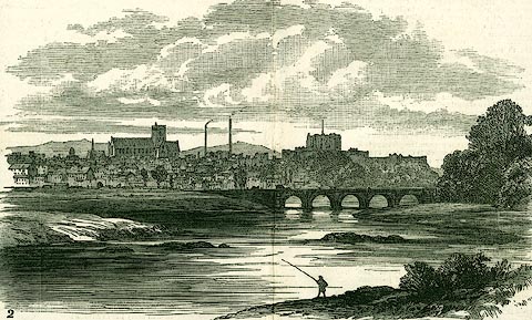 click to enlarge click to enlargePR0309.jpg Illustrations of place visited by the Royal Archaeological Institute. item:- Dove Cottage : 2008.107.309 Image © see bottom of page |
|
|
|
||
| evidence:- | old print:- |
|
| source data:- | Print, uncoloured engraving, View of the City of Carlisle, Cumberland, published late
19th century?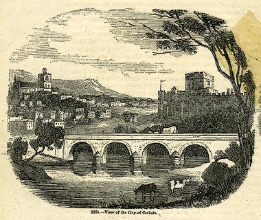 click to enlarge click to enlargePR0246.jpg printed at bottom:- "2255.- View of the City of Carlisle" item:- Dove Cottage : 2008.107.246 Image © see bottom of page |
|
|
|
||
| evidence:- | old print:- |
|
| source data:- | Print, uncoloured engraving, Carlisle, Cumberland, published late 19th century?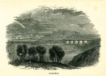 click to enlarge click to enlargePR0244.jpg printed at bottom:- "CARLISLE." item:- Dove Cottage : 2008.107.244 Image © see bottom of page |
|
|
|
||
| evidence:- | old print:- Harwood 1842 |
|
| source data:- | Print, uncoloured engraving, Carlisle, Cumberland, engraved and published by John
and Frederick Harwood, 26 Fenchurch Street, London, about 1842.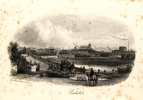 click to enlarge click to enlargeHRW220.jpg printed at bottom left, centre:- "London, J. Harwood, 26, Fenchurch Street. / Carlisle." item:- JandMN : 166.20 Image © see bottom of page |
|
|
|
||
| evidence:- | old print:- |
|
| source data:- | Print, uncoloured engraving, View of the City of Carlisle, Cumberland, published in
the Penny Magazine, by Charles Knight, 22 Ludgate Street and 13 Pall Mall East, London,
3 August 1833.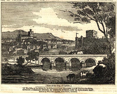 click to enlarge click to enlargePR0590.jpg printed at bottom:- "(View of the City of Carlisle.) / ..." item:- Dove Cottage : 2008.107.538 Image © see bottom of page |
|
|
|
||
| evidence:- | old print:- |
|
| source data:- | Print, uncoloured engraving, Carlisle, from the North, Cumberland, drawn by W Westall,
engraved by E Francis, about 1830s?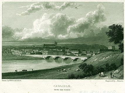 click to enlarge click to enlargePR0153.jpg printed at bottom left, right, centre:- "Drawn by W. Westall, A.R.A. / Engraved by _ Francis. / CARLISLE, / FROM THE NORTH." item:- Dove Cottage : 2008.107.153 Image © see bottom of page |
|
|
|
||
| evidence:- | old print:- |
|
| source data:- | Print, uncoloured engraving, Carlisle, Cumberland, engraved by Owen, published at
the Albion Press, London, 1818.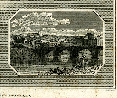 click to enlarge click to enlargePR0243.jpg Eden Bridge with the town in the background. printed at bottom:- "CARLISLE, CUMBERLAND." printed at lower on page:- "[ ]Albion Press, London, 1818. / Owen sculpt." item:- Dove Cottage : 2008.107.243 Image © see bottom of page |
|
|
|
||
| evidence:- | old print:- |
|
| source data:- | Print, uncoloured engraving, Carlisle, Cumberland, painted by G Arnald, engraved by
J Greig, published by Longman and Co, Paternoster Row, London, 1815.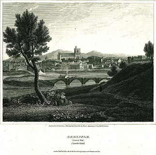 click to enlarge click to enlargePR0175.jpg Included in the Border Antiquities of England and Scotland. printed at bottom:- "Engraved by J. Greig, from a Painting by G. Arnald, for the Border Antiquities of England & Scotland. / CARLISLE. / (General View) / Cumberland. / London. Published Nov. 1. 1815, for the Proprietors by Longman &Co Paternoster Row." item:- Dove Cottage : 2008.107.175 Image © see bottom of page |
|
|
|
||
| evidence:- | old print:- |
|
| source data:- | Print, uncoloured engraving, Carlisle, Cumberland, drawn by Robert Carlile, engraved
and published by J Walker, 16 Rosomans Street, London, 1797.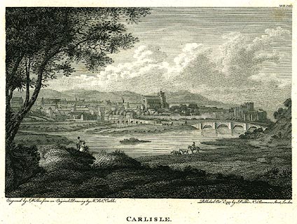 click to enlarge click to enlargePR0248.jpg printed at bottom left, right, centre:- "Engraved by J. Walker from an Original Drawing by Mr. Robt. Carlile. / Published Octr. 2d. 1797, by J. Walker, No.16 Rosomans Street, London. / CARLISLE." item:- Dove Cottage : 2008.107.248 Image © see bottom of page |
|
|
|
||
| evidence:- | old drawing:- item:- crane |
|
| source data:- | Drawing, Widening of Eden Bridge, Carlisle, Cumberland, by J Robinson, 1932.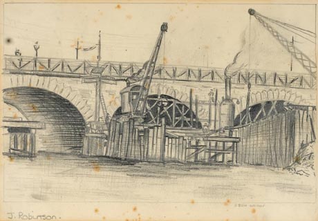 click to enlarge click to enlargePR1433.jpg Drawing of Eden Bridge from the bank of the river Eden below. It shows wooden platforms in the river in front of the bridge on which can be seen a crane and scaffolding where men are working. item:- Tullie House Museum : 2010.20 Image © Tullie House Museum |
|
|
|
||
| evidence:- | old print:- |
|
| source data:- | Print, White Cottages, Eden Bridge, Carlisle, Cumberland, by William Ashton, 1890s.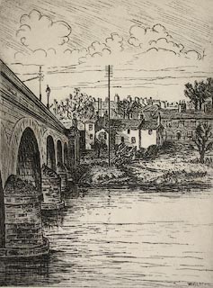 click to enlarge click to enlargePR1300.jpg signed at bottom right:- "W Ashton" inscribed at bottom left of paper:- "White Cottages Eden Bridge" signed at bottom right:- "W. Ashton." item:- Tullie House Museum : 1979.59.2 Image © Tullie House Museum |
|
|
|
||
| evidence:- | old painting:- item:- cattle |
|
| source data:- | Painting, watercolour, Carlisle from Greeny Bank, Cumberland, by Thomas Bushby, 1917.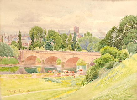 click to enlarge click to enlargePR1142.jpg View of Carlisle across the river Eden with Eden Bridge on right. On nearside, cattle graze beside the water. Two sketched figures walk along a path at the foot of Greeny Bank. signed &dated at bottom left:- "Thos. Bushby. 1917" inscribed at reverse:- "Carlisle from Greeny Bank Thos. Bushby Victoria Lodge Currock Carlisle 1917" item:- Tullie House Museum : 1972.4.14 Image © Tullie House Museum |
|
|
|
||
| evidence:- | old painting:- |
|
| source data:- | Painting, watercolour, Carlisle from Rickerby Park in the Year of Her Majesty's Diamond
Jubilee, Carlisle, Cumberland, by Thomas Bushby, 1897.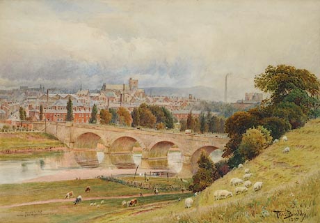 click to enlarge click to enlargePR1055.jpg Autumn; view of Carlisle from an elevated perspective on Greeny Banks beside Eden Bridge which crosses the composition diagonally. Sheep and cattle graze in the foreground beside a small area of land which is fenced off, with clothes hanging out to dry. The city stands beyond the far bank of the river, with the Cout Houses visible to left of composition, the cathedral in the centre and Dixon's chimney and the castle to right. Distant hills rise beyond. inscribed at bottom centre:- "Carlisle in 1897 the Year of Her Majesty's Jubilee" signed &dated at bottom right:- "Thos. Bushby 1897" item:- Tullie House Museum : 1970.34.2 Image © Tullie House Museum |
|
|
|
||
| evidence:- | old painting:- item:- cattle |
|
| source data:- | Painting, watercolour, Carlisle from the Sands, Cumberland, by William Henry Nutter,
1868.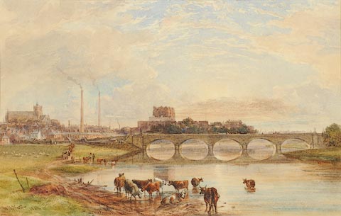 click to enlarge click to enlargePR0935.jpg View of Carlisle at sunset from beside the River Eden which flows to right of composition, cattle lingering in the shallows beside the left hand bank. It is spanned by Eden Bridge which crosses composition horizontally. The city lies beyond, reflected by the river. The cathedral stands to left of composition, factory chimneys to its right and the castle in the centre. signed &dated at bottom left:- "W.H. Nutter 1868" item:- Tullie House Museum : 1944.9.2 Image © Tullie House Museum |
|
|
|
||
| evidence:- | old painting:- |
|
| source data:- | Painting, watercolour, Eden Bridge, View of Carlisle from Stanwix, Cumberland, by
William Henry Nutter, 1842.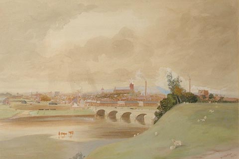 click to enlarge click to enlargePR0983.jpg Panoramic view of Carlisle from an elevated perspective on a dull autumn day. The city lies beyond the far bank of the River Eden, the bridge across which stands in centre of composition. Cattle stand in the shallows and a flock of sheep graze in the foreground meadow. Smoke is emitted from several of the factory chimneys. Hazy hills rise in the distance. signed &dated at bottom right:- "W H Nutter 1842" item:- Tullie House Museum : 1960.97 Image © Tullie House Museum |
|
|
|
||
| evidence:- | old print:- item:- stage coach; coach |
|
| source data:- | Print, A View of the City of Carlisle, Cumberland, by Robert Carlyle snr, about 1820.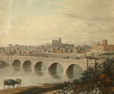 click to enlarge click to enlargePR1161.jpg Panoramic view of the city of Carlisle from across the River Eden in the shallows of which stand three horned cows. In the middle distance stands Eden Bridge across which carriages and carts pass to and from the city beyond which rise distant hills. An advertisement for this work appeared in Carlisle Patriot 23 September 1820. item:- Tullie House Museum : 1975.148 Image © Tullie House Museum |
|
|
|
||
| evidence:- | old print:- item:- fishing |
|
| source data:- | Print, hand coloured, View of Carlisle, and the River Eden, Cumberland, painted by
Paul Sandby, drawn by Frederick, Viscount Duncannon, engraved by Francis Chesham,
published by G Kearsley, Fleet Street, London, 1780.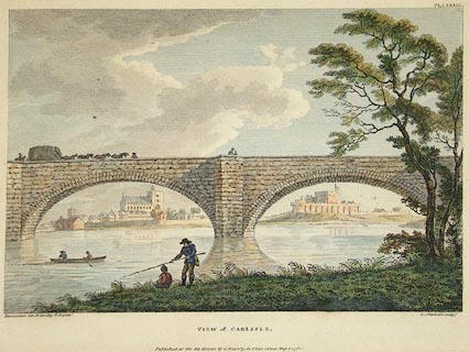 click to enlarge click to enlargePR0889.jpg In centre foreground are two fishermen, one standing whilst the other sits on the riverbank. To left, two other fishermen in a rowing boat haul in their nets. The wide river flows horizontally across composition; it is spanned by a stone bridge through which the city of Carlisle is viewed. inscribed at bottom left, on print:- "Duncannon del. P. Sandby R.A. pinxt." printed at bottom centre:- "VIEW of CARLISLE. Published as the Act directs by G. Kearsley, in Fleet Street, May 1, 1780." inscribed at bottom right, on print:- "F. Chesham sculpt." item:- Tullie House Museum : 1925.88.2 Image © Tullie House Museum |
|
|
|
||
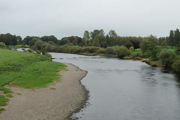 BRR19.jpg View of river. (taken 8.8.2007) |
||
|
|
||
 BRR16.jpg Upstream face - the 1932 widenning? (taken 29.9.2009) 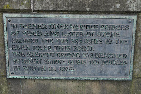 BRR18.jpg Plaque:- "IN FORMER TIMES VARIOUS BRIDGES / OF WOOD AND LATER OF STONE / SPANNED THE TWO BRANCHES OF THE / EDEN NEAR THIS POINT / THE PRESENT BRIDGE WAS DESIGNED / BY ROBERT SMIRKE IN 1815 AND DOUBLED / IN WIDTH IN 1932." (taken 29.9.2009) 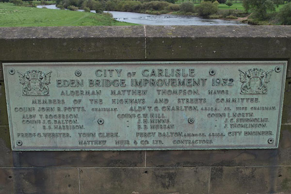 BRR17.jpg Plaque recording the widenning, Percy Dalton, City Engineer, contractor Matthew Muir and Co, 1932. (taken 29.9.2009) 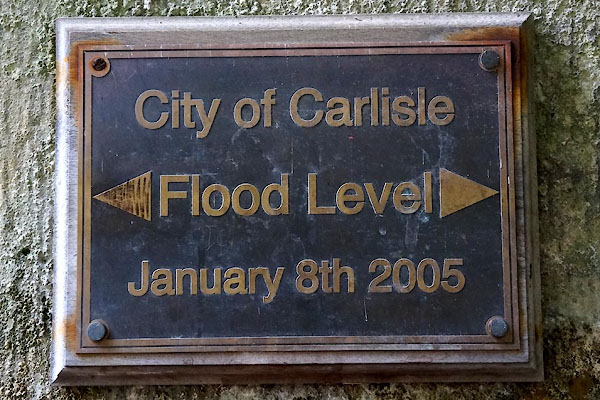 CFL97.jpg Flood level, 2005. (taken 7.9.2016) |
||
|
|
||
| hearsay:- |
There were once wooden bridges over two branches of the River Eden, the north branch
known as Priest Beck or Prest Beck. In 1356, Gilbert Welton, Bishop of Carlisle, issued
an indulgence of forty days to any who would contribute towards repairs of these bridges. |
|
| In 1600 an Act of Parliament was passed for rebuilding the two bridges in stone, paid
for by the county council; the north bridges was called Priest Beck Bridge, the south
bridge, Eden Bridge, which has now gone. |
||
| An act of 1807 was passed for rebuilding the bridges. The project was finiished in
1815. A single bridge designed by Robert Smirke, New Bridge or Eden Bridge, was built
over the northern branch of the river; the southern bridge became no more than a causeway.
As the bridge was part of a national route to the north, the government contributed
to the costs. |
||
|
|
||
| also see:- | Eden Bridge, Carlisle (2) |
|
|
|
||
Lakes Guides menu.