 Old Cumbria Gazetteer
 |
 |
|
|
| road, Carlisle to Brampton F | |||
| civil parish:- | Carlisle (formerly Cumberland) | ||
| civil parish:- | Wetheral (formerly Cumberland) | ||
| civil parish:- | Brampton (formerly Cumberland) | ||
| county:- | Cumbria | ||
| locality type:- | road route | ||
| 10Km square:- | NY35 | ||
| 10Km square:- | NY45 | ||
| 10Km square:- | NY55 | ||
| 10Km square:- | NY56 | ||
| SummaryText:- | via Ferry between Wetheral and Corby Castle | ||
|
|
|||
| evidence:- | old map:- Ogilby 1675 |
||
| source data:- | Road strip map, uncoloured engraving, the Road from Tinmouth ...
to Carlisle, scale about 1 inch to 1 mile, by John Ogilby,
London, 1675.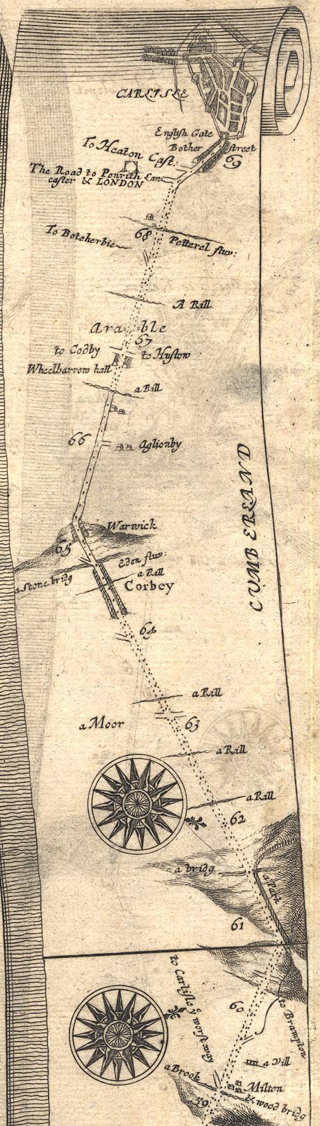 OG86BtoC.jpg "to Carlisle ye worst way" item:- JandMN : 73 Image © see bottom of page |
||
|
|
|||
| evidence:- | old map:- Morden 1695 (Cmd) |
||
| source data:- | Map, uncoloured engraving, Cumberland, scale about 4 miles to 1
inch, by Robert Morden, 1695, published by Abel Swale, the
Unicorn, St Paul's Churchyard, Awnsham, and John Churchill, the
Black Swan, Paternoster Row, London, 1695-1715.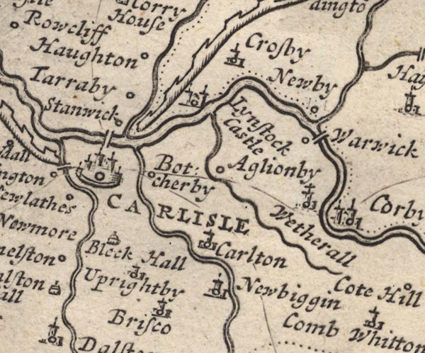 MD12NY45.jpg 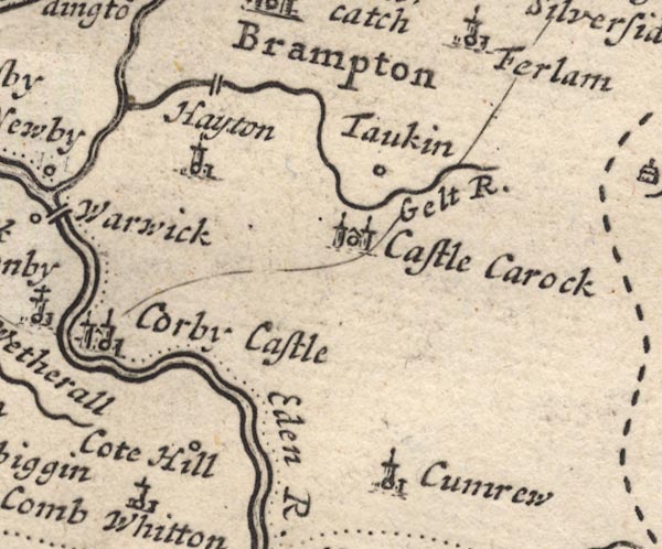 MD12NY55.jpg Morden may have misunderstood 'Corby' on Ogilby's route to be Corby Castle and he shows the most southerly route on this map. item:- JandMN : 90 Image © see bottom of page |
||
|
|
|||
| evidence:- | old map:- Badeslade 1742 |
||
| source data:- | Map, uncoloured engraving, A Map of Cumberland North from
London, scale about 11 miles to 1 inch, with descriptive text,
by Thomas Badeslade, London, engraved and published by William
Henry Toms, Union Court, Holborn, London, 1742. click to enlarge click to enlargeBD10.jpg "" double line; not using Warwick Bridge item:- JandMN : 115 Image © see bottom of page |
||
|
|
|||
| places:- |  Carlisle Wetheral Great Corby, Wetheral Brampton Carlisle Wetheral Great Corby, Wetheral Brampton |
||
|
|
|||
Lakes Guides menu.