 Old Cumbria Gazetteer
 |
 |
|
|
| road, through Stainton | |||
| Stainton road | |||
| Natland to Farleton | |||
| Farleton to Nataland | |||
| civil parish:- | Natland (formerly Westmorland) | ||
| civil parish:- | Sedgwick (formerly Westmorland) | ||
| civil parish:- | Stainton (formerly Westmorland) | ||
| civil parish:- | Preston Patrick (formerly Westmorland) | ||
| civil parish:- | Preston Richard (formerly Westmorland) | ||
| civil parish:- | Holme (formerly Westmorland) | ||
| county:- | Cumbria | ||
| locality type:- | road route | ||
| 10Km square:- | SD58 | ||
|
|
|||
| evidence:- | old map:- Jefferys 1770 (Wmd) |
||
| source data:- | Map, 4 sheets, The County of Westmoreland, scale 1 inch to 1
mile, surveyed 1768, and engraved and published by Thomas
Jefferys, London, 1770.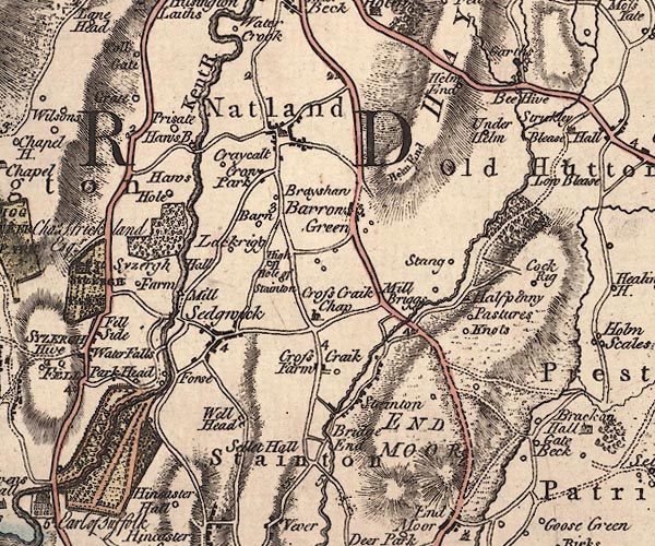 J5SD58NW.jpg 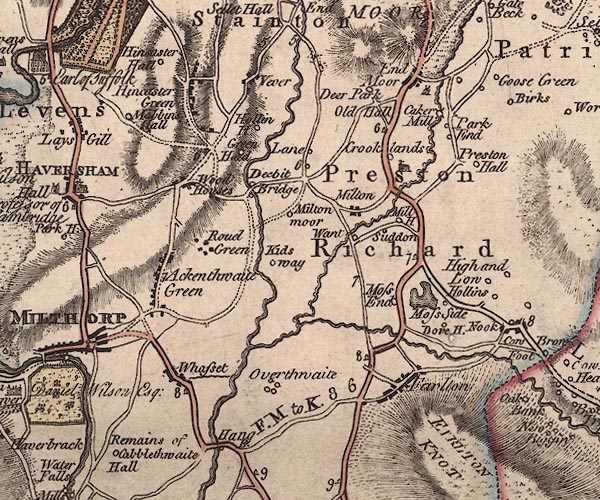 J5SD58SW.jpg double line; road, with mile numbers item:- National Library of Scotland : EME.s.47 Images © National Library of Scotland |
||
|
|
|||
| place:- | The southern part of this old route has been disturbed by canal and road building.  Natland Stainton Bridge, Stainton Wath Sutton Bridge, Preston Patrick Natland Stainton Bridge, Stainton Wath Sutton Bridge, Preston Patrick |
||
|
|
|||
Lakes Guides menu.