 Old Cumbria Gazetteer
 |
 |
|
| Wath Sutton Bridge, Preston Patrick | ||
| Wath Sutton Bridge | ||
| site name:- | Peasey Beck | |
| locality:- | Wath Sutton | |
| civil parish:- | Preston Patrick (formerly Westmorland) | |
| civil parish:- | Preston Richard (formerly Westmorland) | |
| county:- | Cumbria | |
| locality type:- | bridge | |
| coordinates:- | SD52928263 | |
| 1Km square:- | SD5282 | |
| 10Km square:- | SD58 | |
|
|
||
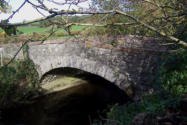 BMX75.jpg (taken 29.10.2006) |
||
|
|
||
| evidence:- | old map:- OS County Series (Wmd 43 13) placename:- Wath Sutton Bridge |
|
| source data:- | Maps, County Series maps of Great Britain, scales 6 and 25
inches to 1 mile, published by the Ordnance Survey, Southampton,
Hampshire, from about 1863 to 1948. |
|
|
|
||
| evidence:- | old map:- Ogilby 1675 (plate 38) |
|
| source data:- | Road strip map, hand coloured engraving, continuation of the
Road from London to Carlisle, scale about 1 inch to 1 mile, by
John Ogilby, London, 1675.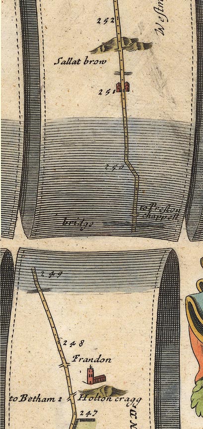 OG38m247.jpg In mile 249, Westmorland. River crossed by the road by a:- "bridge" item:- JandMN : 21 Image © see bottom of page |
|
|
|
||
| evidence:- | probably old map:- Bowen 1720 (plate 93) placename:- Pesa Bridge |
|
| source data:- | Strip maps, uncoloured engravings, road maps, The Road from
London to Carlisle, scale about 2 miles to 1 inch, with sections
in Lancashire and Westmorland, published by Emanuel Bowen, St
Katherines, London, 1720.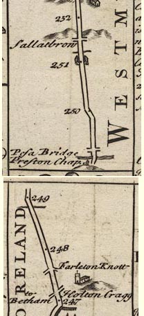 B093m247.jpg At mile 249 next scroll. item:- Dove Cottage : 2007.38.100 Image © see bottom of page |
|
|
|
||
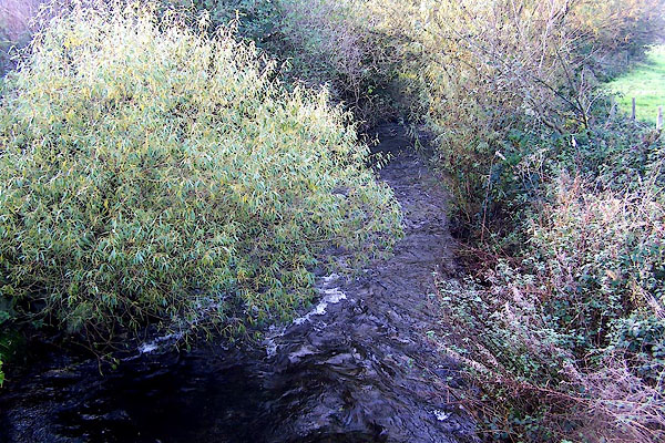 BMX76.jpg View of river. (taken 29.10.2006) |
||
|
|
||
 Lakes Guides menu.