 Old Cumbria Gazetteer
 |
 |
|
|
| included in:- |
 road, Penrith to Brampton road, Penrith to Brampton |
||
| road, Plumpton to Kirkoswald | |||
| Plumpton to Kirkoswald | |||
| Kirkoswald to Plumpton | |||
| A6413 | |||
| civil parish:- | Hesket (formerly Cumberland) | ||
| civil parish:- | Lazonby (formerly Cumberland) | ||
| civil parish:- | Kirkoswald (formerly Cumberland) | ||
| county:- | Cumbria | ||
| locality type:- | route | ||
| 10Km square:- | NY43 | ||
| 10Km square:- | NY53 | ||
| 10Km square:- | NY54 | ||
|
|
|||
| evidence:- | road map:- Cary 1790 (Cmd/edn 1789) |
||
| source data:- | Road map, hand coloured engraving, Cumberland, scale about 15
miles to 1 inch, by John Cary, 181 Strand, London, 1790, edn
1789.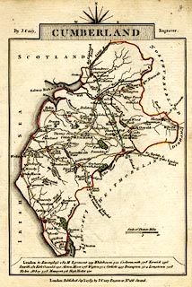 click to enlarge click to enlargeCY47.jpg double line item:- JandMN : 419 Image © see bottom of page |
||
|
|
|||
| places:- | Plumpton, Hesket Lazonby Kirkoswald |
||
|
|
|||
Lakes Guides menu.