 Old Cumbria Gazetteer
 |
 |
|
| road, Penrith to Brampton | ||
| Penrith to Brampton | ||
| Brampton to Penrith | ||
| locality:- | Penrith | |
| civil parish:- | Penrith (formerly Cumberland) | |
| county:- | Cumbria | |
| locality type:- | route | |
| locality:- | Brampton | |
| civil parish:- | Brampton (formerly Cumberland) | |
| county:- | Cumbria | |
| locality type:- | route | |
|
|
||
| route parts:- |  Penrith to Alston, as far as junction near Edenhall road, through Great Salkeld Plumpton to Kirkoswald from Lazonby Kirkoswald to Brampton Penrith to Alston, as far as junction near Edenhall road, through Great Salkeld Plumpton to Kirkoswald from Lazonby Kirkoswald to Brampton |
|
|
|
||
| route parts:- | alternative Penrith to Carlisle as far as Plumpton Plumpton to Kirkoswald Kirkoswald to Brampton |
|
|
|
||
| evidence:- | old map:- Donald 1774 (Cmd) |
|
| source data:- | Map, hand coloured engraving, 3x2 sheets, The County of Cumberland, scale about 1
inch to 1 mile, by Thomas Donald, engraved and published by Joseph Hodskinson, 29
Arundel Street, Strand, London, 1774. double line, narrower, solid or dotted with a dot and number at 1 mile intervals; road 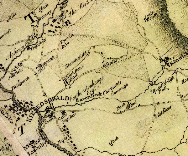 D4NY54SE.jpg 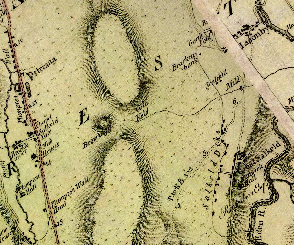 D4NY53NW.jpg "P. to K. 8:3:12" miles.furlongs.poles; Penrith to Kirkoswald 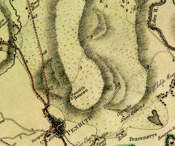 D4NY53SW.jpg item:- Carlisle Library : Map 2 Images © Carlisle Library |
|
|
|
||
| evidence:- | old map:- Laurie and Whittle 1806 |
|
| source data:- | Road map, Continuation of the Roads to Glasgow and Edinburgh,
scale about 10 miles to 1 inch, by Nathaniel Coltman? 1806,
published by Robert H Laurie, 53 Fleet Street, London, 1834. click to enlarge click to enlargeLw21.jpg light line; 'Other Direct Roads from LONDON' item:- private collection : 18.21 Image © see bottom of page |
|
|
|
||
 Lakes Guides menu.