 Old Cumbria Gazetteer
 |
 |
|
|
| included in:- |
 road, Carlisle to Alston road, Carlisle to Alston |
||
| road, Kirkoswald to Alston | |||
| Kirkoswald to Alston | |||
| Alston to Kirkoswald | |||
| civil parish:- | Kirkoswald (formerly Cumberland) | ||
| civil parish:- | Glassonby (formerly Cumberland) | ||
| civil parish:- | Alston Moor (formerly Cumberland) | ||
| county:- | Cumbria | ||
| locality type:- | route | ||
| 10Km square:- | NY54 | ||
| 10Km square:- | NY64 | ||
| 10Km square:- | NY74 | ||
|
|
|||
| evidence:- | road map:- Cary 1790 (Cmd/edn 1789) |
||
| source data:- | Road map, hand coloured engraving, Cumberland, scale about 15
miles to 1 inch, by John Cary, 181 Strand, London, 1790, edn
1789.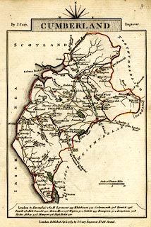 click to enlarge click to enlargeCY47.jpg double line item:- JandMN : 419 Image © see bottom of page |
||
|
|
|||
| evidence:- | old map:- Cooke 1802 |
||
| source data:- | Map, Cumberland, scale about 15.5 miles to 1 inch, by George
Cooke, 1802, bound in Gray's New Book of Roads, 1824, published
by Sherwood, Jones and Co, Paternoster Road, London, 1824. click to enlarge click to enlargeGRA1Cd.jpg double line, light dark dotted; unfenced road item:- Hampshire Museums : FA2000.62.2 Image © see bottom of page |
||
|
|
|||
| evidence:- | old map:- Wallis 1810 (Cmd) |
||
| source data:- | Road map, hand coloured engraving, Cumberland, scale about 16
miles to 1 inch, by James Wallis, 77 Berwick Stree, Soho,
London, 1810. click to enlarge click to enlargeWL13.jpg double line, light bold; 'Turnpike Road' item:- Dove Cottage : 2009.81.10 Image © see bottom of page |
||
|
|
|||
| evidence:- | old map:- Ford 1839 map |
||
| source data:- | Map, uncoloured engraving, Map of the Lake District of
Cumberland, Westmoreland and Lancashire, scale about 3.5 miles
to 1 inch, published by Charles Thurnam, Carlisle, and by R
Groombridge, 5 Paternoster Row, London, 3rd edn 1843.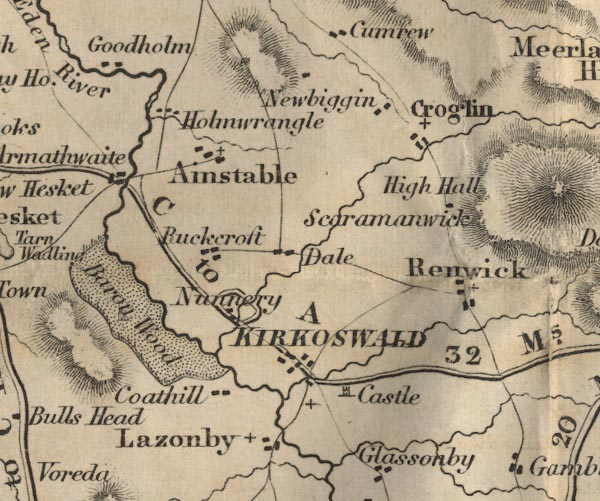 FD02NY54.jpg "C to A 32 Ms." 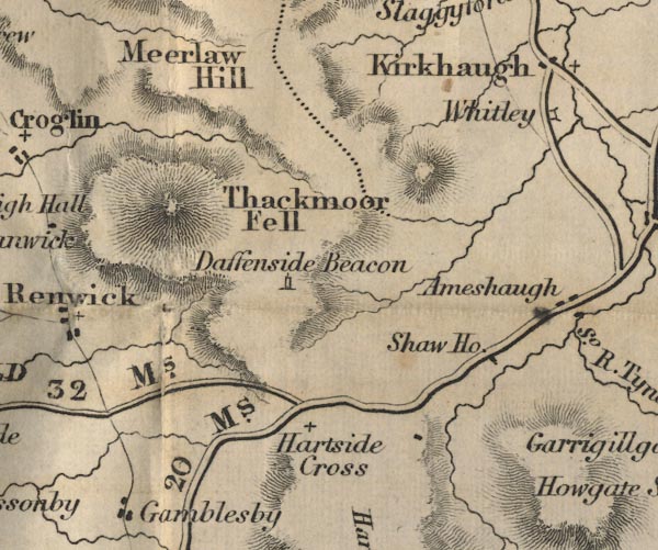 FD02NY64.jpg 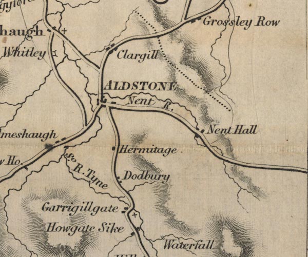 FD02NY74.jpg item:- JandMN : 100.1 Image © see bottom of page |
||
|
|
|||
| places:- | Kirkoswald Alston |
||
|
|
|||
Lakes Guides menu.