 Old Cumbria Gazetteer
 |
 |
|
|
| road, Cockermouth to Abbey Town | |||
| Cockermouth to Abbey Town | |||
| Abbey Town to Cockermouth | |||
| civil parish:- | Cockermouth (formerly Cumberland) | ||
| civil parish:- | Blindcrake (formerly Cumberland) | ||
| civil parish:- | Plumbland (formerly Cumberland) | ||
| civil parish:- | Aspatria (formerly Cumberland) | ||
| civil parish:- | Westnewton (formerly Cumberland) | ||
| civil parish:- | Holme St Cuthbert (formerly Cumberland) | ||
| civil parish:- | Holme Abbey (formerly Cumberland) | ||
| county:- | Cumbria | ||
| locality type:- | road route | ||
| 10Km square:- | NY13 | ||
| 10Km square:- | NY14 | ||
| 10Km square:- | NY15 | ||
| SummaryText:- | Unlikely route found on Cary 1787 (Cmd) copied by Cooke 1802 (Cmd) | ||
|
|
|||
| evidence:- | old map:- Donald 1774 (Cmd) |
||
| source data:- | Map, hand coloured engraving, 3x2 sheets, The County of Cumberland, scale about 1
inch to 1 mile, by Thomas Donald, engraved and published by Joseph Hodskinson, 29
Arundel Street, Strand, London, 1774. double line, narrower, solid or dotted with a dot and number at 1 mile intervals; road 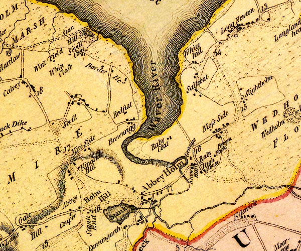 D4NY15SE.jpg 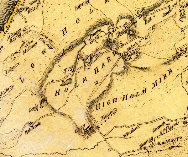 D4NY14NW.jpg 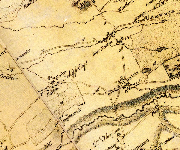 D4NY14SW.jpg 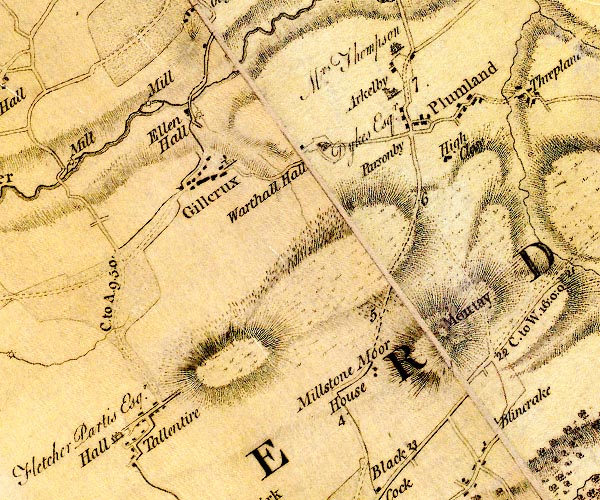 D4NY13NW.jpg 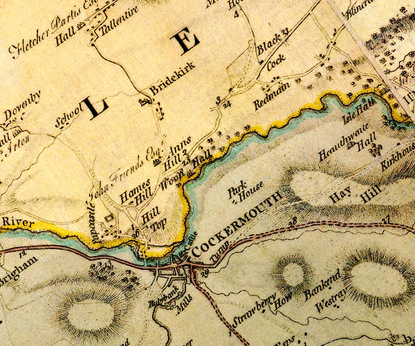 D4NY13SW.jpg item:- Carlisle Library : Map 2 Images © Carlisle Library |
||
|
|
|||
| evidence:- | road map:- Cary 1790 (Cmd/edn 1789) |
||
| source data:- | Road map, hand coloured engraving, Cumberland, scale about 15
miles to 1 inch, by John Cary, 181 Strand, London, 1790, edn
1789.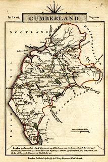 click to enlarge click to enlargeCY47.jpg double line item:- JandMN : 419 Image © see bottom of page |
||
|
|
|||
| evidence:- | old map:- Cooke 1802 |
||
| source data:- | Map, Cumberland, scale about 15.5 miles to 1 inch, by George
Cooke, 1802, bound in Gray's New Book of Roads, 1824, published
by Sherwood, Jones and Co, Paternoster Road, London, 1824. click to enlarge click to enlargeGRA1Cd.jpg double line, light dark solid; road item:- Hampshire Museums : FA2000.62.2 Image © see bottom of page |
||
|
|
|||
| evidence:- | old map:- Wallis 1810 (Cmd) |
||
| source data:- | Road map, hand coloured engraving, Cumberland, scale about 16
miles to 1 inch, by James Wallis, 77 Berwick Stree, Soho,
London, 1810. click to enlarge click to enlargeWL13.jpg double line, light bold; 'Turnpike Road' item:- Dove Cottage : 2009.81.10 Image © see bottom of page |
||
|
|
|||
| places:- |  Cockermouth Plumbland Aspatria Westnewton Pelutho, Holme St Cuthbert Abbey Town, Holme Abbey Cockermouth Plumbland Aspatria Westnewton Pelutho, Holme St Cuthbert Abbey Town, Holme Abbey |
||
|
|
|||
Lakes Guides menu.