 Old Cumbria Gazetteer
 |
 |
|
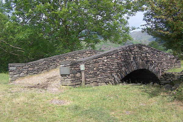
| New Bridge, Easedale | ||
| New Bridge | ||
| site name:- | Easedale Beck | |
| locality:- | Easedale | |
| locality:- | Grasmere | |
| civil parish:- | Lakes (formerly Westmorland) | |
| county:- | Cumbria | |
| locality type:- | bridge | |
| coordinates:- | NY32780826 | |
| 1Km square:- | NY3208 | |
| 10Km square:- | NY30 | |
|
|
||
 BSX38.jpg (taken 27.6.2010) 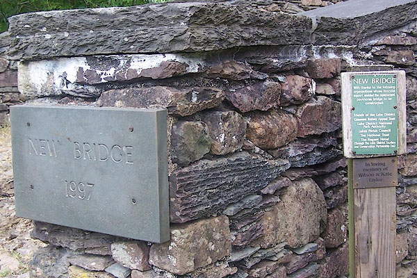 BSX39.jpg (taken 27.6.2010) |
||
| Replacement for a packhorse bridge. |
||
|
|
||
| evidence:- | old map:- OS County Series (Wmd 18 16) placename:- New Bridge placename:- Bridge, New |
|
| source data:- | Maps, County Series maps of Great Britain, scales 6 and 25
inches to 1 mile, published by the Ordnance Survey, Southampton,
Hampshire, from about 1863 to 1948. |
|
|
|
||
| evidence:- | probably old map:- Jefferys 1770 (Wmd) |
|
| source data:- | Map, 4 sheets, The County of Westmoreland, scale 1 inch to 1
mile, surveyed 1768, and engraved and published by Thomas
Jefferys, London, 1770.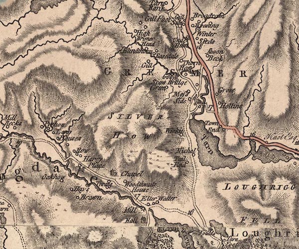 J5NY30NW.jpg double line, road, across a stream; bridge item:- National Library of Scotland : EME.s.47 Image © National Library of Scotland |
|
|
|
||
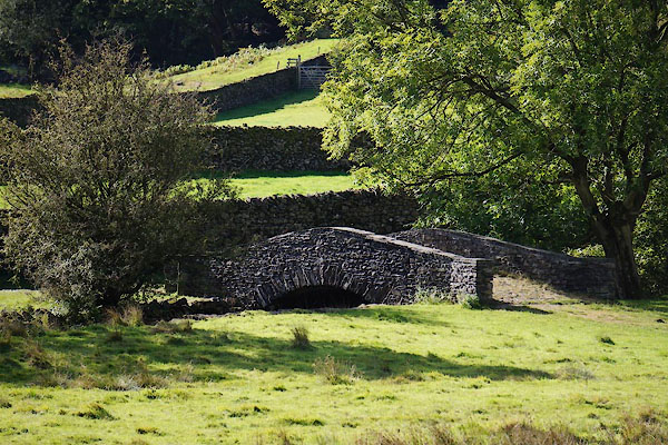 CBT88.jpg (taken 24.9.2014) |
||
|
|
||
 Lakes Guides menu.