Old Cumbria Gazetteer
 |
 |
|
|||||||||||||||||||||||||||
| included in:- |
 road, Lancaster to Kendal W road, Lancaster to Kendal W |
||||||||||||||||||||||||||||
| road, Milnthorpe to Kendal | |||||||||||||||||||||||||||||
| Milnthorpe to Kendal | |||||||||||||||||||||||||||||
| Kendal to Milnthorpe | |||||||||||||||||||||||||||||
| A6 | |||||||||||||||||||||||||||||
| civil parish:- | Milnthorpe (formerly Westmorland) | ||||||||||||||||||||||||||||
| civil parish:- | Heversham (formerly Westmorland) | ||||||||||||||||||||||||||||
| civil parish:- | Hincaster (formerly Westmorland) | ||||||||||||||||||||||||||||
| civil parish:- | Sedgwick (formerly Westmorland) | ||||||||||||||||||||||||||||
| civil parish:- | Helsington (formerly Westmorland) | ||||||||||||||||||||||||||||
| civil parish:- | Kendal (formerly Westmorland) | ||||||||||||||||||||||||||||
| county:- | Cumbria | ||||||||||||||||||||||||||||
| locality type:- | road route | ||||||||||||||||||||||||||||
| 10Km square:- | SD48 | ||||||||||||||||||||||||||||
| 10Km square:- | SD58 | ||||||||||||||||||||||||||||
| 10Km square:- | SD59 | ||||||||||||||||||||||||||||
|
|
|||||||||||||||||||||||||||||
| evidence:- | old map:- Jefferys 1770 |
||||||||||||||||||||||||||||
| source data:- | Map, 4 sheets, The County of Westmoreland, scale 1 inch to 1
mile, surveyed 1768, and engraved and published by Thomas
Jefferys, London, 1770.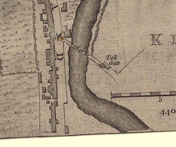 J55191U.jpg road item:- National Library of Scotland : EME.s.47 Image © National Library of Scotland |
||||||||||||||||||||||||||||
|
|
|||||||||||||||||||||||||||||
| evidence:- | old map:- Jefferys 1770 (Wmd) |
||||||||||||||||||||||||||||
| source data:- | Map, 4 sheets, The County of Westmoreland, scale 1 inch to 1
mile, surveyed 1768, and engraved and published by Thomas
Jefferys, London, 1770. J5SD59SW.jpg 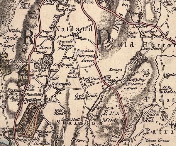 J5SD58NW.jpg 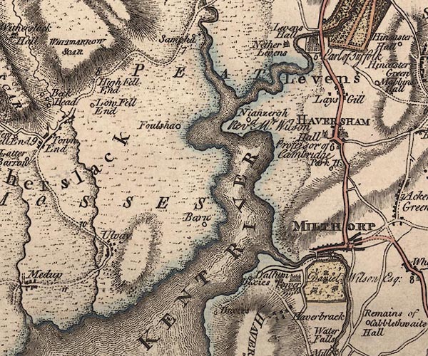 J5SD48SE.jpg double line; road, bold, main road, with mile numbers item:- National Library of Scotland : EME.s.47 Images © National Library of Scotland |
||||||||||||||||||||||||||||
|
|
|||||||||||||||||||||||||||||
| evidence:- | road map:- Cary 1790 (Wmd/edn 1792) |
||||||||||||||||||||||||||||
| source data:- | Road map, hand coloured engraving, Westmoreland, scale about
11.5 miles to 1 inch, by John Cary, 181 Strand, London, 1790,
edn 1792.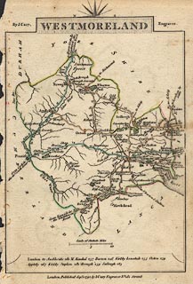 click to enlarge click to enlargeCY16.jpg double line, with road distances from Kendal item:- JandMN : 44 Image © see bottom of page |
||||||||||||||||||||||||||||
|
|
|||||||||||||||||||||||||||||
| evidence:- | old map:- Cooke 1802 |
||||||||||||||||||||||||||||
| source data:- | Map, Westmoreland ie Westmorland, scale about 12 miles to 1
inch, by George Cooke, 1802, published by Sherwood, Jones and
Co, Paternoster Road, London, 1824. click to enlarge click to enlargeGRA1Wd.jpg "to Lancaster" double line, light dark solid; road item:- Hampshire Museums : FA2000.62.4 Image © see bottom of page |
||||||||||||||||||||||||||||
|
|
|||||||||||||||||||||||||||||
| evidence:- | old map:- Cooper 1808 |
||||||||||||||||||||||||||||
| source data:- | Map, hand coloured engraving, Westmoreland ie Westmorland, scale
about 9 miles to 1 inch, by H Cooper, 1808, published by R
Phillips, Bridge Street, Blackfriars, London, 1808. click to enlarge click to enlargeCOP4.jpg double line; road item:- Dove Cottage : 2007.38.53 Image © see bottom of page |
||||||||||||||||||||||||||||
|
|
|||||||||||||||||||||||||||||
| evidence:- | old map:- Hall 1820 (Wmd) |
||||||||||||||||||||||||||||
| source data:- | Map, hand coloured engraving, Westmoreland ie Westmorland, scale
about 14.5 miles to 1 inch, by Sidney Hall, London, 1820,
published by Samuel Leigh, 18 Strand, London, 1820-31. click to enlarge click to enlargeHA18.jpg single line, solid; minor road; Milnthorpe, by Levens Park, by Sizergh Park, Kendal item:- Armitt Library : 2008.14.58 Image © see bottom of page |
||||||||||||||||||||||||||||
|
|
|||||||||||||||||||||||||||||
| evidence:- | descriptive text:- Ford 1839 (3rd edn 1843) |
||||||||||||||||||||||||||||
| source data:- | Guide book, A Description of Scenery in the Lake District, by
Rev William Ford, published by Charles Thurnam, Carlisle, by W
Edwards, 12 Ave Maria Lane, Charles Tilt, Fleet Street, William
Smith, 113 Fleet Street, London, by Currie and Bowman,
Newcastle, by Bancks and Co, Manchester, by Oliver and Boyd,
Edinburgh, and by Sinclair, Dumfries, 1839. goto source Page 151:- "..." "I. LANCASTER TO KENDAL, BY MILNTHORPE,- 21¼M."
|
||||||||||||||||||||||||||||
|
|
|||||||||||||||||||||||||||||
| evidence:- | old map:- Ford 1839 map |
||||||||||||||||||||||||||||
| source data:- | Map, uncoloured engraving, Map of the Lake District of
Cumberland, Westmoreland and Lancashire, scale about 3.5 miles
to 1 inch, published by Charles Thurnam, Carlisle, and by R
Groombridge, 5 Paternoster Row, London, 3rd edn 1843.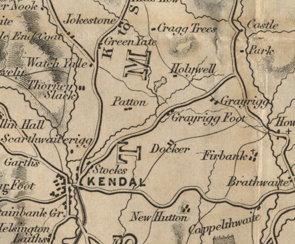 FD02SD59.jpg  FD02SD58.jpg item:- JandMN : 100.1 Image © see bottom of page |
||||||||||||||||||||||||||||
|
|
|||||||||||||||||||||||||||||
| evidence:- | old map:- Garnett 1850s-60s H |
||||||||||||||||||||||||||||
| source data:- | Map of the English Lakes, in Cumberland, Westmorland and
Lancashire, scale about 3.5 miles to 1 inch, published by John
Garnett, Windermere, Westmorland, 1850s-60s. GAR2SD59.jpg double line, bold light, major road  GAR2SD48.jpg item:- JandMN : 82.1 Image © see bottom of page |
||||||||||||||||||||||||||||
|
|
|||||||||||||||||||||||||||||
 Act of Parliament Act of Parliament |
|||||||||||||||||||||||||||||
|
|
|||||||||||||||||||||||||||||
| places:- | Milnthorpe Levens Bridge, Levens Kendal |
||||||||||||||||||||||||||||
|
|
|||||||||||||||||||||||||||||
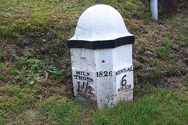
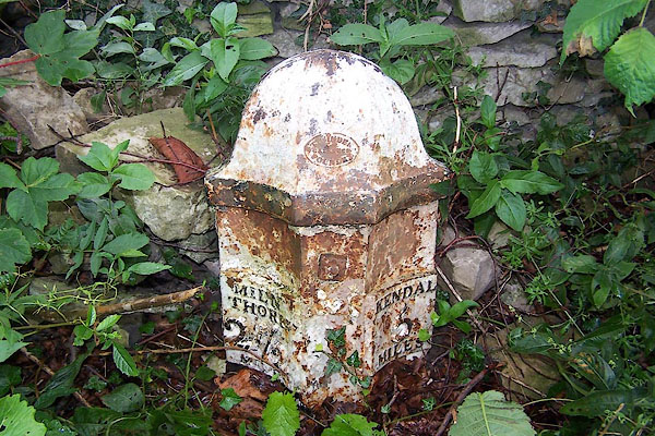
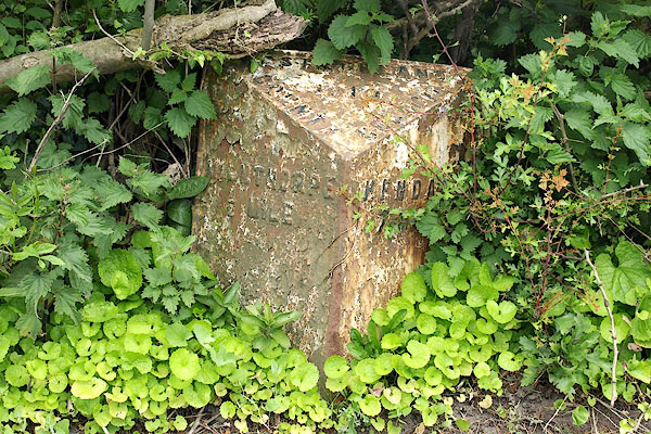
| milestones:- | All milestones known, various dates Milestones in order, on or close to present A6. milestone, Milnthorpe milestone, Heversham (2) on old road through Heversham milestone, Heversham on old road through Leasgill milestone, Levens (3) milestone, Levens milestone, Helsington (7) milestone, Helsington (6) on left side near road milestone, Helsington (2) milestone, Helsington (8) on loop of old road milestone, Helsington (5) milestone, Kendal (9) milestone, Kendal (2) |
||||||||||||||||||||||||||||
|
|
|||||||||||||||||||||||||||||
| places:- |
|
||||||||||||||||||||||||||||
|
|||||||||||||||||||||||||||||
|
|||||||||||||||||||||||||||||
|
|||||||||||||||||||||||||||||
|
|||||||||||||||||||||||||||||
|
|||||||||||||||||||||||||||||
|
|||||||||||||||||||||||||||||
|
|||||||||||||||||||||||||||||
|
|||||||||||||||||||||||||||||
|
|||||||||||||||||||||||||||||
|
|||||||||||||||||||||||||||||
|
|||||||||||||||||||||||||||||
|
|||||||||||||||||||||||||||||
|
|||||||||||||||||||||||||||||
Lakes Guides menu.