 Old Cumbria Gazetteer
 |
 |
|
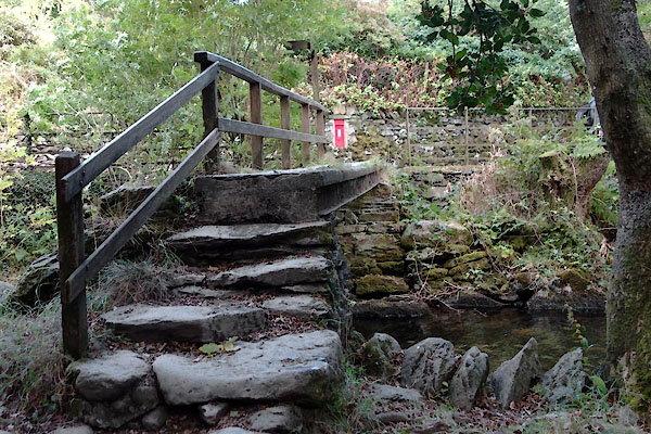
| Steel Bridge, Grasmere | ||
| Steel Bridge | ||
| site name:- | Easedale Beck | |
| locality:- | Grasmere | |
| civil parish:- | Lakes (formerly Westmorland) | |
| county:- | Cumbria | |
| locality type:- | bridge | |
| coordinates:- | NY33050818 | |
| 1Km square:- | NY3308 | |
| 10Km square:- | NY30 | |
|
|
||
 CBU37.jpg (taken 24.9.2014) |
||
|
|
||
| evidence:- | old map:- OS County Series (Wmd 18 16) placename:- Steel Bridge |
|
| source data:- | Maps, County Series maps of Great Britain, scales 6 and 25
inches to 1 mile, published by the Ordnance Survey, Southampton,
Hampshire, from about 1863 to 1948. |
|
|
|
||
| evidence:- | descriptive text:- Ford 1839 (3rd edn 1843) placename:- Steel Bridge |
|
| source data:- | Guide book, A Description of Scenery in the Lake District, by
Rev William Ford, published by Charles Thurnam, Carlisle, by W
Edwards, 12 Ave Maria Lane, Charles Tilt, Fleet Street, William
Smith, 113 Fleet Street, London, by Currie and Bowman,
Newcastle, by Bancks and Co, Manchester, by Oliver and Boyd,
Edinburgh, and by Sinclair, Dumfries, 1839. goto source goto sourcePage 44:- "... Steel Bridge is an artist-like subject; and Sour Milk Gill and Coldale Fell, as backgrounds to a bridge, compose admirable objects for the pencil. This water runs out of Easedale Tarn, ..." |
|
|
|
||
Lakes Guides menu.