 Old Cumbria Gazetteer
 |
 |
|
|
| road, Keswick to Wigton | |||
| Keswick to Wigton | |||
| Wigton to Keswick | |||
| locality:- | Keswick | ||
| civil parish:- | Keswick (formerly Cumberland) | ||
| county:- | Cumbria | ||
| locality type:- | route | ||
| locality:- | Wigton | ||
| civil parish:- | Wigton (formerly Cumberland) | ||
| county:- | Cumbria | ||
| locality type:- | route | ||
|
|
|||
| route parts:- |  Wigton to Penrith, as far as Red Dial Carlisle to Keswick, from Red Dial Wigton to Penrith, as far as Red Dial Carlisle to Keswick, from Red Dial |
||
|
|
|||
| evidence:- | old map:- Ford 1839 map |
||
| source data:- | Map, uncoloured engraving, Map of the Lake District of
Cumberland, Westmoreland and Lancashire, scale about 3.5 miles
to 1 inch, published by Charles Thurnam, Carlisle, and by R
Groombridge, 5 Paternoster Row, London, 3rd edn 1843.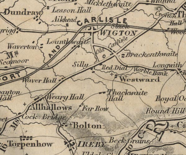 FD02NY24.jpg 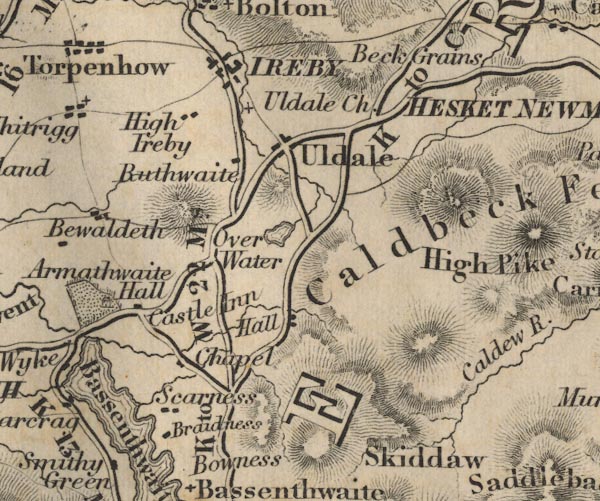 FD02NY23.jpg "K to W 22 Ms." 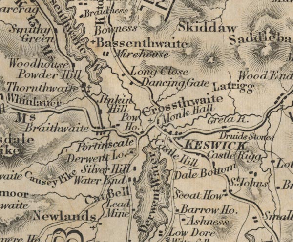 FD02NY22.jpg item:- JandMN : 100.1 Image © see bottom of page |
||
|
|
|||
| place:- |  Keswick Bothel Red Dial, Westward Wigton Keswick Bothel Red Dial, Westward Wigton |
||
|
|
|||
Lakes Guides menu.