 Old Cumbria Gazetteer
 |
 |
|
| Bongate, Appleby | ||
| Bongate | ||
| Old Appleby | ||
| locality:- | Appleby | |
| civil parish:- | Appleby-in-Westmorland (formerly Westmorland) | |
| county:- | Cumbria | |
| locality type:- | locality | |
| locality type:- | street | |
| coordinates:- | NY689199 (etc) | |
| 1Km square:- | NY6819 | |
| 10Km square:- | NY61 | |
|
|
||
| evidence:- | hearth tax returns:- Hearth Tax 1675 placename:- Bondgate in the Barony of Appleby |
|
| source data:- | Records, hearth tax survey returns, Westmorland, 1674/75. "Bondgate in the Barony of Appleby" |
|
|
|
||
| evidence:- | hearth tax returns:- Hearth Tax 1670 placename:- Bond Gate |
|
| source data:- | Records, hearth tax returns, exchequer duplicates, Westmorland,
1670. "Bond Gate" |
|
|
|
||
| evidence:- | old map:- Jefferys 1770 (Wmd) placename:- Bondgate |
|
| source data:- | Map, 4 sheets, The County of Westmoreland, scale 1 inch to 1
mile, surveyed 1768, and engraved and published by Thomas
Jefferys, London, 1770.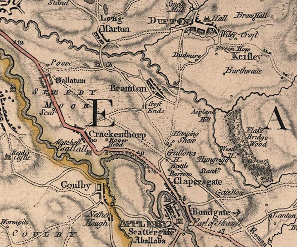 J5NY62SE.jpg "Bondgate" blocks, labelled in upright lowercase text; settlement; town?, suburb of Appleby item:- National Library of Scotland : EME.s.47 Image © National Library of Scotland |
|
|
|
||
| evidence:- | old text:- Pennant 1773 placename:- Bondgate item:- placename, Bongate |
|
| source data:- | Book, A Tour from Downing to Alston Moor, 1773, by Thomas
Pennant, published by Edward Harding, 98 Pall Mall, London, 1801. goto source goto sourcePennant's Tour 1773, page 138 "... I passed by the little church of Bondgate, so called from its having been in feudal times" goto sourcePennant's Tour 1773, page 139 "the seat of the villains or bondsmen attendant on the castle. ..." |
|
|
|
||
| evidence:- | old map:- Cary 1789 (edn 1805) placename:- Bondgate |
|
| source data:- | Map, uncoloured engraving, Westmoreland, scale about 2.5 miles
to 1 inch, by John Cary, London, 1789; edition 1805.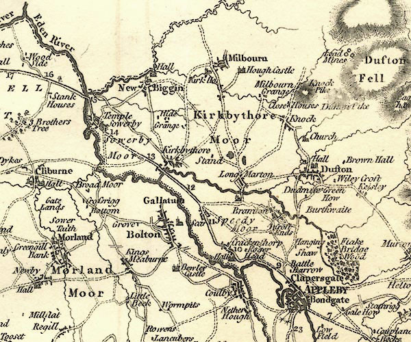 CY24NY62.jpg "Bondgate" blocks, no church symbol, labelled in upright lowercase; village item:- JandMN : 129 Image © see bottom of page |
|
|
|
||
| evidence:- | old text:- Capper 1808 placename:- Bongate item:- population |
|
| source data:- | Gazetteer, A Topographical Dictionary of the United Kingdom,
compiled by Benjamin Pitts Capper, published by Richard
Phillips, Bridge Street, Blackfriars, London, 1808; published
1808-29. goto source "..." "BONGATE, a township to the parish of St. Michael's Appleby, East ward, Westmoreland, being part of the town of Appleby, distance 270 miles from London; containing 139 houses and 908 inhabitants." "..." |
|
|
|
||
| evidence:- | old map:- Cooper 1808 placename:- Bongate |
|
| source data:- | Map, hand coloured engraving, Westmoreland ie Westmorland, scale
about 9 miles to 1 inch, by H Cooper, 1808, published by R
Phillips, Bridge Street, Blackfriars, London, 1808. click to enlarge click to enlargeCOP4.jpg "Bongate" circle; village or hamlet item:- Dove Cottage : 2007.38.53 Image © see bottom of page |
|
|
|
||
| evidence:- | old map:- Ford 1839 map placename:- Bongate |
|
| source data:- | Map, uncoloured engraving, Map of the Lake District of
Cumberland, Westmoreland and Lancashire, scale about 3.5 miles
to 1 inch, published by Charles Thurnam, Carlisle, and by R
Groombridge, 5 Paternoster Row, London, 3rd edn 1843.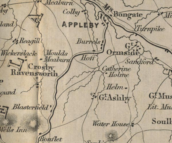 FD02NY61.jpg "Bongate" item:- JandMN : 100.1 Image © see bottom of page |
|
|
|
||
 sundial, Bongate Cemetary sundial, Bongate Cemetary |
||
|
|
||
Lakes Guides menu.