 Old Cumbria Gazetteer
 |
 |
|
| Caldbeck Bridges, Caldbeck | ||
| Caldbeck Bridges | ||
| site name:- | Cald Beck | |
| locality:- | Caldbeck | |
| civil parish:- | Caldbeck (formerly Cumberland) | |
| county:- | Cumbria | |
| locality type:- | bridge | |
| coordinates:- | NY32353989 | |
| 1Km square:- | NY3239 | |
| 10Km square:- | NY33 | |
|
|
||
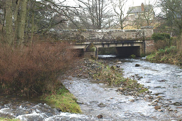 BOT18.jpg (taken 1.3.2008) 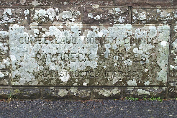 BOT19.jpg Plaque:- "CUMBERLAND COUNTY COUNCIL / CALDBECK BRIDGES / CONSTRUCTED 1927-28" before this there was a ford. (taken 1.3.2008) |
||
|
|
||
| evidence:- | probably old map:- Bell 1892 placename:- Caldbeck Mill Bridge |
|
| source data:- | Map, colour lithograph, Road Map of Cumberland, by George Joseph
Bell, scale about 2.5 miles to 1 inch, printed by Charles
Thurnam and Sons, Carlisle, Cumberland, 1892.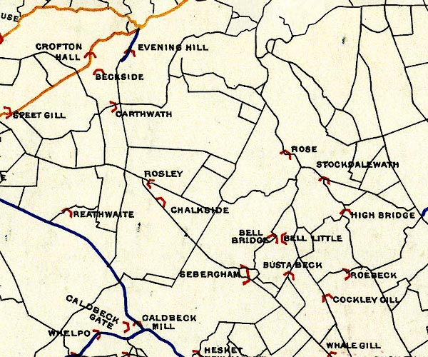 BEL9NY34.jpg "CALDBECK MILL" bridge symbol Road map of Cumberland showing County Bridges item:- Carlisle Library : Map 38 Image © Carlisle Library |
|
|
|
||
 Lakes Guides menu.