 Old Cumbria Gazetteer
 |
 |
|
| Stickle Tarn, Lakes | ||
| runs into:- |  Stickle Ghyll Stickle Ghyll |
|
|
|
||
| Stickle Tarn | ||
| civil parish:- | Lakes (formerly Westmorland) | |
| county:- | Cumbria | |
| locality type:- | tarn | |
| coordinates:- | NY28720768 (etc) | |
| 1Km square:- | NY2807 | |
| 10Km square:- | NY20 | |
| altitude:- | 1539 feet | |
| altitude:- | 469m | |
|
|
||
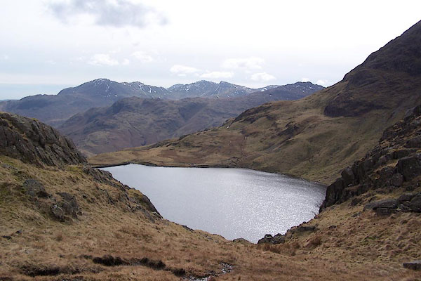 BSJ06.jpg (taken 23.3.2010) 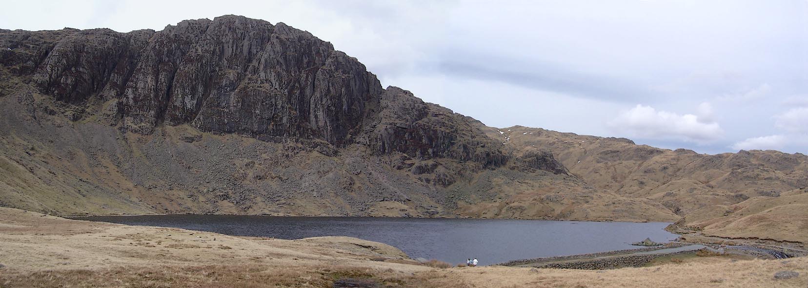 Click to enlarge BSJ02.jpg (taken 23.3.2010) |
||
|
|
||
| evidence:- | old map:- OS County Series (Wmd 25 2) placename:- Stickle Tarn |
|
| source data:- | Maps, County Series maps of Great Britain, scales 6 and 25
inches to 1 mile, published by the Ordnance Survey, Southampton,
Hampshire, from about 1863 to 1948. |
|
|
|
||
| evidence:- | old map:- Jefferys 1770 (Wmd) |
|
| source data:- | Map, 4 sheets, The County of Westmoreland, scale 1 inch to 1
mile, surveyed 1768, and engraved and published by Thomas
Jefferys, London, 1770.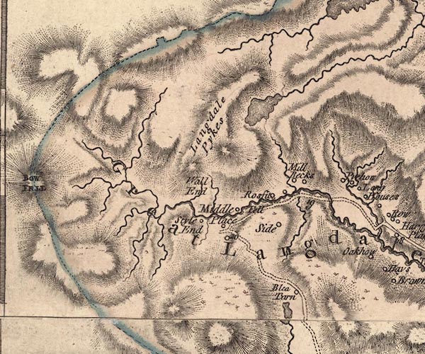 J5NY20NE.jpg outline with form lines; lake or tarn item:- National Library of Scotland : EME.s.47 Image © National Library of Scotland |
|
|
|
||
| evidence:- | descriptive text:- West 1778 (11th edn 1821) |
|
| source data:- | Guide book, A Guide to the Lakes, by Thomas West, published by
William Pennington, Kendal, Cumbria once Westmorland, and in
London, 1778 to 1821. goto source Page 104:- "... under it [Pavey-ark] is Stickle-tarn, a large bason of water, formed in the bosom of the rock, and which pours down in a cataract at Mill-beck. ..." |
|
|
|
||
| evidence:- | old map:- Cary 1789 (edn 1805) |
|
| source data:- | Map, uncoloured engraving, Westmoreland, scale about 2.5 miles
to 1 inch, by John Cary, London, 1789; edition 1805.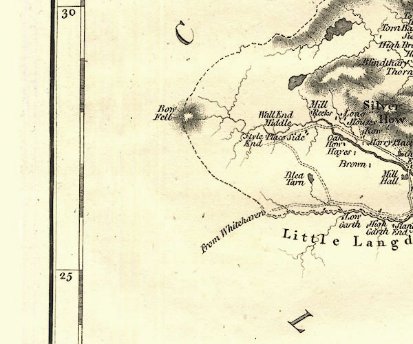 CY24NY20.jpg outline with shore form lines; lake or tarn item:- JandMN : 129 Image © see bottom of page |
|
|
|
||
| evidence:- | old text:- Green 1810 placename:- Stickle Tarn |
|
| source data:- | Set of prints, soft ground etchings, Sixty Studies from Nature,
by William Green, Ambleside, Westmorland, drawn 1808-10,
published 1810. goto source page 104:- "..." "Should the traveller wish to ascend to the top of that Pike of Langdale which is called Stickle Pike, or to Stickle Tarn, he must commence his labours at Mill Beck. The Ambleside guide, or a person from Mill Beck, will, perhaps, take him by Dungeon Gill, and from the top of the Dungeon, to the top of the Pike or to the Tarn; but some parts of the road are so steep as to be painfully unpleasant to such as have not been much accustomed to scrambling. ... The Tarn is a pretty circular piece of water, having soft turf on three fourths of its margin; from the other fourth rises Pavey Ark, which is, perhaps, the grandest range of" page 105:- "rocks in Westmorland, and a good point to view them from, is the outlet of the lake; which, beautifully clear, will serve to dilute the traveller's Cogniac brandy, or old Jamaica rum, a most grateful potation after his labourious ascent, or to wash down the hard eggs and hung mutton presented by his hostess. Leaving the foot of the Tarn on the edge of the hill, a peat or turf road soon appears, on which descend to Mill Beck; ..." "..." goto sourcepage 106:- "As the peat road is a better ascent to the Tarn, than by Dungeon Gill, some will prefer it both for ascent and descent." |
|
|
|
||
| evidence:- | old map:- Otley 1818 |
|
| source data:- | Map, uncoloured engraving, The District of the Lakes,
Cumberland, Westmorland, and Lancashire, scale about 4 miles to
1 inch, by Jonathan Otley, 1818, engraved by J and G Menzies,
Edinburgh, Scotland, published by Jonathan Otley, Keswick,
Cumberland, et al, 1833.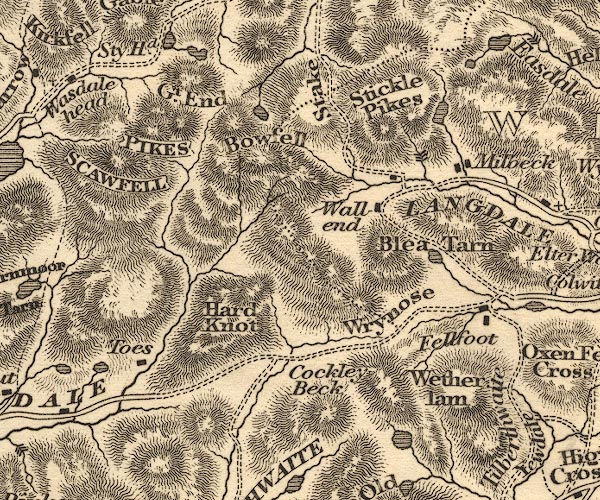 OT02NY20.jpg item:- JandMN : 48.1 Image © see bottom of page |
|
|
|
||
| evidence:- | old print:- Fielding and Walton 1821 (plate 18) placename:- Stickle Tarn |
|
| source data:- | Print, coloured aquatint, Stickle Tarn, near the Top of Langdale Pikes, Westmorland,
drawn by Theodore H A Fielding, published by R Ackermann, 101 Strand, London, 1821.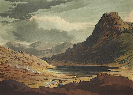 click to enlarge click to enlargeFW0118.jpg Tipped in opposite p.91 in A Picturesque Tour of the English Lakes. item:- Dove Cottage : 1993.R566.18 Image © see bottom of page |
|
|
|
||
| evidence:- | descriptive text:- Otley 1823 (5th edn 1834) item:- fishing; trout |
|
| source data:- | Guide book, A Concise Description of the English Lakes, the
mountains in their vicinity, and the roads by which they may be
visited, with remarks on the mineralogy and geology of the
district, by Jonathan Otley, published by the author, Keswick,
Cumberland now Cumbria, by J Richardson, London, and by Arthur
Foster, Kirkby Lonsdale, Cumbria, 1823; published 1823-49,
latterly as the Descriptive Guide to the English Lakes. goto source Page 33:- "... Stickle Tarn, at the foot of Pavey-ark, a huge rock in connection with Langdale Pikes - is famous for the quality of its trout. The stream falling into Langdale, at Millbeck, in a foaming cataract, may be seen at a distance." |
|
|
|
||
| evidence:- | descriptive text:- Ford 1839 (3rd edn 1843) placename:- Stickle Tarn |
|
| source data:- | Guide book, A Description of Scenery in the Lake District, by
Rev William Ford, published by Charles Thurnam, Carlisle, by W
Edwards, 12 Ave Maria Lane, Charles Tilt, Fleet Street, William
Smith, 113 Fleet Street, London, by Currie and Bowman,
Newcastle, by Bancks and Co, Manchester, by Oliver and Boyd,
Edinburgh, and by Sinclair, Dumfries, 1839. goto source Page 38:- "..." "Stickle Tarn is a circular piece of water in the bosom of the mountain, having soft turf on three fourths of its margin, and reflecting in its calm surface the dark and towering crags of Pavey Ark, which rise from its brink, and are perhaps the most magnificent range of rocks in the country: a good point to view them from is the outlet of the lake." |
|
|
|
||
| evidence:- | old map:- Garnett 1850s-60s H placename:- Stickle Tarn |
|
| source data:- | Map of the English Lakes, in Cumberland, Westmorland and
Lancashire, scale about 3.5 miles to 1 inch, published by John
Garnett, Windermere, Westmorland, 1850s-60s.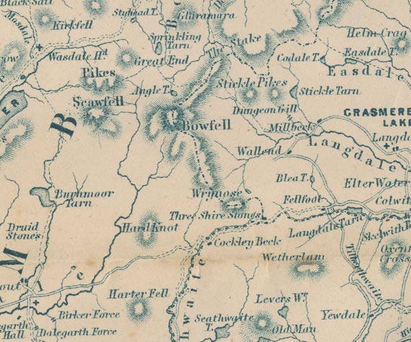 GAR2NY20.jpg "Stickle Tarn" outline with shore form lines, lake or tarn item:- JandMN : 82.1 Image © see bottom of page |
|
|
|
||
| evidence:- | old text:- Martineau 1855 |
|
| source data:- | Guide book, A Complete Guide to the English Lakes, by Harriet
Martineau, published by John Garnett, Windermere, Westmorland,
and by Whittaker and Co, London, 1855; published 1855-76. goto source Page 148:- "... The guide from Milbeck will take the traveller up the peat road to Stickle Tarn,- famous for its trout, and much beloved by anglers. Its circular basin, brimming with clear water, lies finely under the steep rocks of Pavey Ark. There is nothing amidst this mountain scenery more interesting than its tarns. ..." |
|
|
|
||
| evidence:- | old photograph:- Payn 1867 placename:- Stickle Tarn |
|
| source data:- | Photograph, sepia, Stickle Tarn and Pavey Ark, Westmorland, by Garnett and Sproat,
published by J Garnett, Windermere, Westmorland, 1867.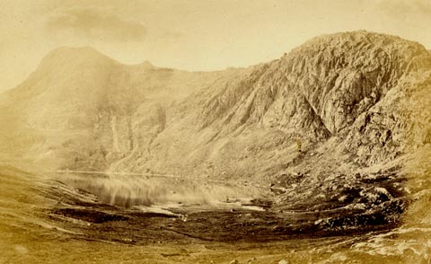 click to enlarge click to enlargePN0325.jpg Tipped in opposite p.48 of The Lakes in Sunshine, text by James Payn. printed at bottom:- "STICKLE TARN AND PAVEY ARK." item:- Fell and Rock Climbing Club : 184.25 Image © see bottom of page |
|
|
|
||
| evidence:- | old photograph:- Bell 1880s-1940s |
|
| source data:- | Photograph, black and white, Stickle Tarn and Harrison Stickle, Great Langdale, Westmorland,
by Herbert Bell, photographer, Ambleside, Westmorland, 1890s.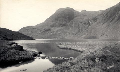 click to enlarge click to enlargeHB0642.jpg internegative at lower right:- "H. Bell" stamped on reverse:- "HERBERT BELL / Photographer / AMBLESIDE" item:- Armitt Library : ALPS305 Image © see bottom of page |
|
|
|
||
| evidence:- | old photograph:- Bell 1880s-1940s |
|
| source data:- | Photograph, black and white, Stickle Tarn and Pavey Ark, Great Langdale, Westmorland,
by Herbert Bell, photographer, Ambleside, Westmorland, 1890s.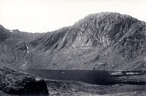 click to enlarge click to enlargeHB0643.jpg stamped on reverse:- "HERBERT BELL / Photographer / AMBLESIDE" item:- Armitt Library : ALPS306 Image © see bottom of page |
|
|
|
||
| evidence:- | old print:- MacBride 1922 placename:- Stickle Tarn |
|
| source data:- | Print, colour, Stickle Tarn, Langdale, by Alfred Heaton Cooper, published by Adam
and Charles Black, 4-6 Soho Square, London, 2nd edn 1928.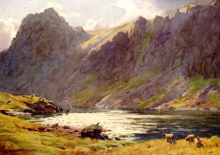 click to enlarge click to enlargeMB0113.jpg Tipped in opposite p.85 in Wild Lakeland by MacKenzie MacBride. printed at bottom:- "STICKLE TARN, LANGDALE" signed at lower left:- "A. HEATON COOPER" item:- JandMN : 195.15 Image © see bottom of page |
|
|
|
||
| evidence:- | old print:- Goodwin 1887 (edn 1890) placename:- Stickle Tarn |
|
| source data:- | Print, etching? Stickle Tarn, Westmorland, by Harry Goodwin, published by Swan Sonnenschein
and Co, Paternoster Square, London, 1890.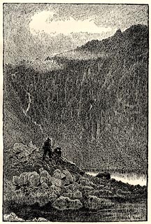 click to enlarge click to enlargePR1605.jpg Tipped in opposite p.182 of Through the Wordsworth Country, by William Knight. printed at lower right:- "Stickle Tarn" item:- JandMN : 382.35 Image © see bottom of page |
|
|
|
||
| evidence:- | old print:- Garnett 1850s-60s F placename:- Stickle Tarn |
|
| source data:- | Print, uncoloured engraving, Stickle Tarn, Langdale Pikes, Westmorland, engraved by
William Banks and Son, Edinburgh, published by John Garnett, Windermere, Westmorland,
1850s-60s?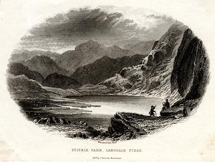 click to enlarge click to enlargeGAR726.jpg Found with Views of the English Lakes. printed at bottom:- "W. Banks &Son, Edinr. / STICKLE TARN, LANGDALE PIKES. / Pubd. by J. Garnett, Windermere." item:- JandMN : 165.26 Image © see bottom of page |
|
|
|
||
| evidence:- | old print:- Rose 1832-35 |
|
| source data:- | Print, engraving, Stickle Tarn, Langdale Pikes, from Pavey Arc, Westmorland, by Thomas
Allom, engraved by le Petit, 1833.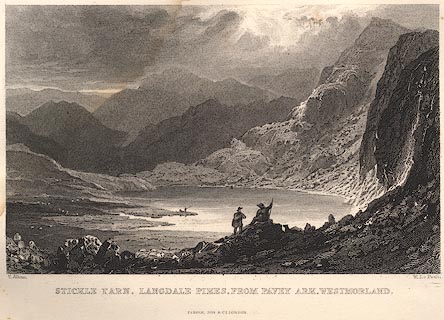 click to enlarge click to enlargeR162.jpg item:- JandMN : 66.55 Image © see bottom of page |
|
|
|
||
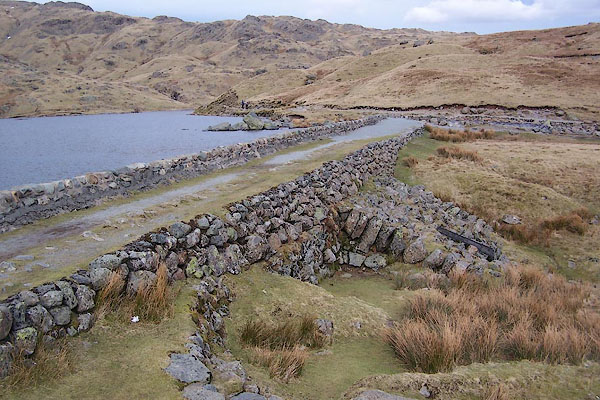 BSJ03.jpg Dam; notice the flooding. (taken 23.3.2010) 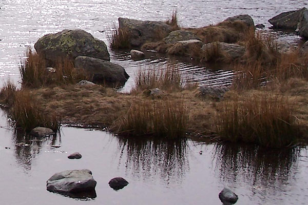 BSJ04.jpg (taken 23.3.2010) 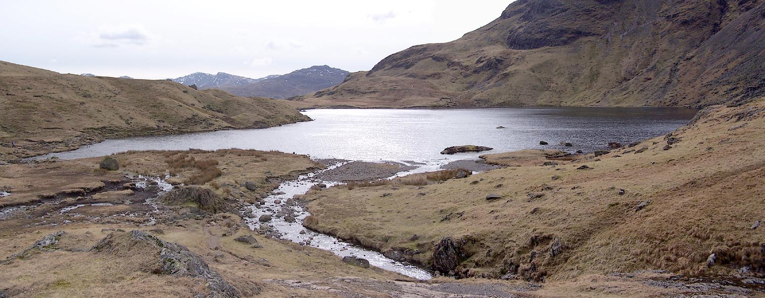 Click to enlarge BSJ05.jpg (taken 23.3.2010) 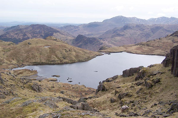 BSJ07.jpg (taken 23.3.2010) 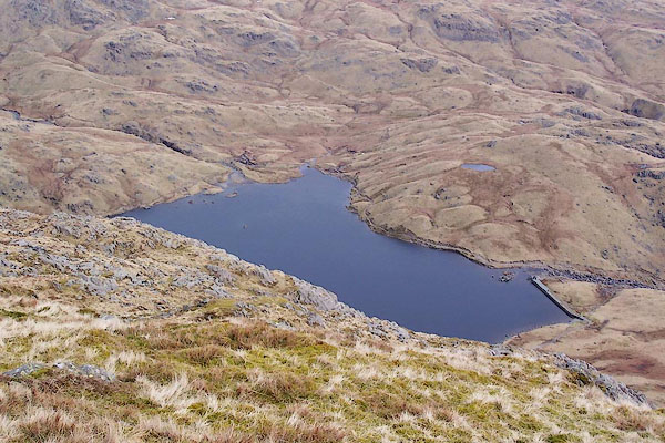 BSJ08.jpg (taken 23.3.2010) |
||
|
|
||
Lakes Guides menu.