Old Cumbria Gazetteer
 |
 |
|
||
| Skelwith Bridge, Lakes | ||||
| Skelwith Bridge | ||||
| civil parish:- | Lakes (formerly Westmorland) | |||
| civil parish:- | Skelwith (formerly Lancashire) | |||
| county:- | Cumbria | |||
| locality type:- | locality | |||
| locality type:- | buildings | |||
| coordinates:- | NY34420343 (etc) | |||
| 1Km square:- | NY3403 | |||
| 10Km square:- | NY30 | |||
|
|
||||
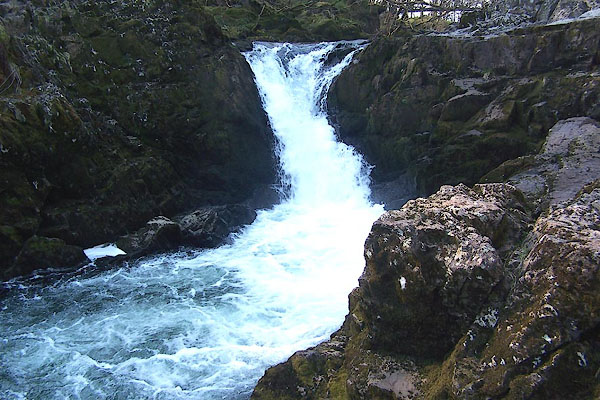
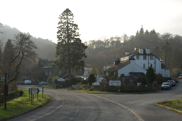 BVR49.jpg (taken 15.11.2011) |
||||
|
|
||||
| evidence:- | old map:- OS County Series (Wmd 26 9) placename:- Skelwith Bridge |
|||
| source data:- | Maps, County Series maps of Great Britain, scales 6 and 25
inches to 1 mile, published by the Ordnance Survey, Southampton,
Hampshire, from about 1863 to 1948. |
|||
|
|
||||
| evidence:- | hearth tax returns:- Hearth Tax 1675 placename:- Skelleth bridge end |
|||
| source data:- | Records, hearth tax survey returns, Westmorland, 1674/75. "Skelleth bridge end" in "Loughrigge and Rydall" |
|||
|
|
||||
| evidence:- | old map:- Jefferys 1770 (Wmd) placename:- Skellet Bridge |
|||
| source data:- | Map, 4 sheets, The County of Westmoreland, scale 1 inch to 1
mile, surveyed 1768, and engraved and published by Thomas
Jefferys, London, 1770.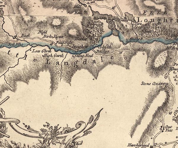 J5NY30SW.jpg "Skellet B." circle, labelled in italic lowercase text; settlement, farm, house, or hamlet? item:- National Library of Scotland : EME.s.47 Image © National Library of Scotland |
|||
|
|
||||
| evidence:- | old map:- Otley 1818 placename:- Skelwith |
|||
| source data:- | Map, uncoloured engraving, The District of the Lakes,
Cumberland, Westmorland, and Lancashire, scale about 4 miles to
1 inch, by Jonathan Otley, 1818, engraved by J and G Menzies,
Edinburgh, Scotland, published by Jonathan Otley, Keswick,
Cumberland, et al, 1833. OT02NY30.jpg item:- JandMN : 48.1 Image © see bottom of page |
|||
|
|
||||
| evidence:- | descriptive text:- Otley 1823 (5th edn 1834) item:- geology; glacial erratic |
|||
| source data:- | Guide book, A Concise Description of the English Lakes, the
mountains in their vicinity, and the roads by which they may be
visited, with remarks on the mineralogy and geology of the
district, by Jonathan Otley, published by the author, Keswick,
Cumberland now Cumbria, by J Richardson, London, and by Arthur
Foster, Kirkby Lonsdale, Cumbria, 1823; published 1823-49,
latterly as the Descriptive Guide to the English Lakes. goto source goto sourcePage 164:- "... a large block near Skelwith Bridge on the road to Grasmere - one near Coniston Waterhead, and another near Gosforth, as well as many others of smaller dimensions - are far more interesting to the geologist; yielding sufficient scope for conjecture as to the place of their origin, and the mode of their removal." |
|||
|
|
||||
| evidence:- | old drawing:- Aspland 1840s-60s placename:- Skelwith |
|||
| source data:- | Drawing, pencil, Skelwith etc, Lancashire, by Theophilus Lindsey Aspland, about 1849.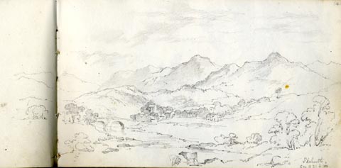 click to enlarge click to enlargeAS0119.jpg "Skelwith / ..." item:- Armitt Library : 1958.487.19 Image © see bottom of page |
|||
|
|
||||
| evidence:- | old print:- Pearson 1900s placename:- Skelwith Bridge |
|||
| source data:- | Print, halftone photograph, Skelwith Bridge from Skelwith Fold, Lancashire, published
by C Arthur Pearson, Henrietta Street, London, 1900s.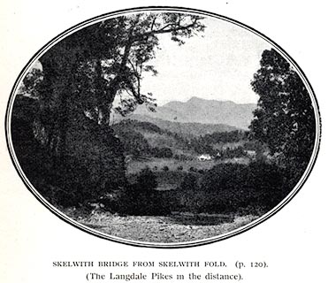 click to enlarge click to enlargePS1E03.jpg On p.5 of Pearson's Gossipy Guide to the English Lakes and Neighbouring Districts. printed at bottom:- "SKELWITH BRIDGE FROM SKELWITH FOLD. (p.120). / (The Langdale Pikes in the distance)." item:- Armitt Library : A1188.10 Image © see bottom of page |
|||
|
|
||||
| evidence:- | outline view:- Black 1856 (23rd edn 1900) placename:- Skelwith |
|||
| source data:- | Print, lithograph, Outline Views, Windermere - Mountains as seen from the North End
of Belle Isle, Windermere, and Mountains as seen from Biscay How, Bowness, by J Flintoft,
Keswick, Cumberland, engraved by R Mason, Edinburgh, Lothian, about 1900. click to enlarge click to enlargeBC08E1.jpg "... 8 Skelwith ..." item:- JandMN : 37.4 Image © see bottom of page |
|||
|
|
||||
| evidence:- | outline view:- Black 1841 (3rd edn 1846) placename:- Skelwith |
|||
| source data:- | Print, engraving, outline view, Mountains as seen from the North End of Belle Isle,
Windermere, and Mountains as seen from Bisket How, Bowness, by J Flintoft, Keswick,
Cumberland, engraved by R Mason, Edinburgh, about 1844.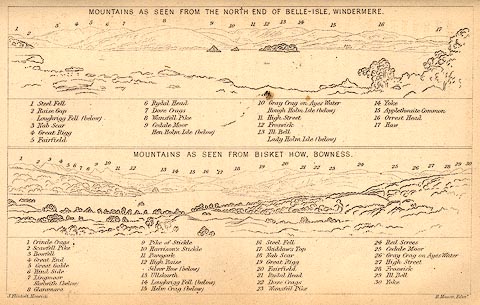 click to enlarge click to enlargeBC02E1.jpg "... 8 Skelwith ..." item:- JandMN : 32.3 Image © see bottom of page |
|||
|
|
||||
| evidence:- | old print:- Rose 1832-35 |
|||
| source data:- | Print, engraving, Skelwith Bridge, Westmorland, by Thomas Allom, engraved by T H Shepherd,
1835.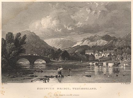 click to enlarge click to enlargeR368.jpg item:- JandMN : 66.42 Image © see bottom of page |
|||
|
|
||||
| evidence:- | old map:- Ford 1839 map placename:- Skelwith |
|||
| source data:- | Map, uncoloured engraving, Map of the Lake District of
Cumberland, Westmoreland and Lancashire, scale about 3.5 miles
to 1 inch, published by Charles Thurnam, Carlisle, and by R
Groombridge, 5 Paternoster Row, London, 3rd edn 1843.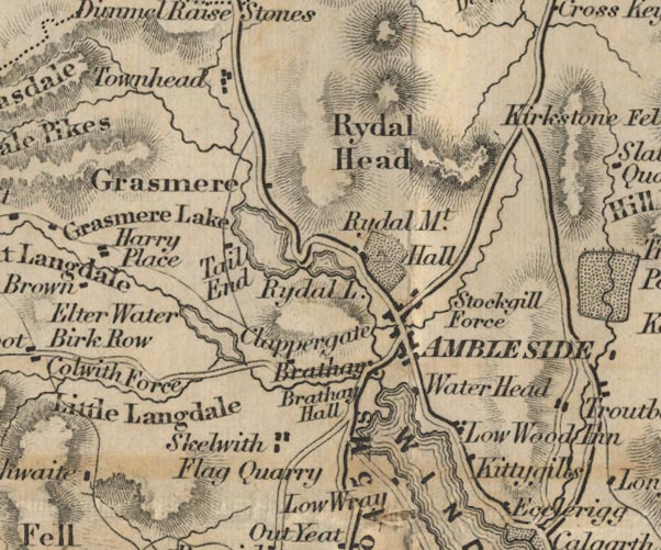 FD02NY30.jpg "Skelwith" item:- JandMN : 100.1 Image © see bottom of page |
|||
|
|
||||
| evidence:- | old map:- Post Office 1850s-1900s placename:- Skelwith Bridge |
|||
| source data:- | Post road maps, General Post Office Circulation Map for England
and Wales, for the General Post Office, London, 1850s-1900s. click to enlarge click to enlargePOF7Cm.jpg "Skelwith Br." map date 1909 |
|||
|
|
||||
| :- |
images courtesy of the British Postal Museum and Hampshire CC Museums |
|||
|
|
||||
| evidence:- | old print:- Pearson 1900s placename:- Skelwith Bridge |
|||
| source data:- | Print, halftone photograph, Skelwith Bridge from Skelwith Fold, Lancashire, published
by C Arthur Pearson, Henrietta Street, London, 1900s. click to enlarge PS1E03.jpg On p.5 of Pearson's Gossipy Guide to the English Lakes and Neighbouring Districts. printed at bottom:- "SKELWITH BRIDGE FROM SKELWITH FOLD. (p.120). / (The Langdale Pikes in the distance)." item:- Armitt Library : A1188.10 Image © see bottom of page |
|||
|
|
||||
| evidence:- | outline view:- Black 1856 (23rd edn 1900) placename:- Skelwith |
|||
| source data:- | Print, lithograph, Outline Views, Windermere - Mountains as seen from the North End
of Belle Isle, Windermere, and Mountains as seen from Biscay How, Bowness, by J Flintoft,
Keswick, Cumberland, engraved by R Mason, Edinburgh, Lothian, about 1900. click to enlarge BC08E1.jpg "... 8 Skelwith ..." item:- JandMN : 37.4 Image © see bottom of page |
|||
|
|
||||
| evidence:- | outline view:- Black 1841 (3rd edn 1846) placename:- Skelwith |
|||
| source data:- | Print, engraving, outline view, Mountains as seen from the North End of Belle Isle,
Windermere, and Mountains as seen from Bisket How, Bowness, by J Flintoft, Keswick,
Cumberland, engraved by R Mason, Edinburgh, about 1844. click to enlarge BC02E1.jpg "... 8 Skelwith ..." item:- JandMN : 32.3 Image © see bottom of page |
|||
|
|
||||
| evidence:- | old print:- Rose 1832-35 |
|||
| source data:- | Print, engraving, Skelwith Bridge, Westmorland, by Thomas Allom, engraved by T H Shepherd,
1835. click to enlarge R368.jpg item:- JandMN : 66.42 Image © see bottom of page |
|||
|
|
||||
| places:- |
|
|||
|
||||
|
||||
|
||||
|
||||
|
||||
|
||||
|
||||
|
||||
|
||||
|
||||
|
||||
|
||||
|
||||
Lakes Guides menu.