 Old Cumbria Gazetteer
 |
 |
|
| roman fort, Stone Carr | ||
| locality:- | Stone Carr | |
| civil parish:- | Hutton (formerly Cumberland) | |
| county:- | Cumbria | |
| locality type:- | roman fort (?) | |
| locality type:- | earthwork | |
| coordinates:- | NY41962832 (about) | |
| 1Km square:- | NY4128 | |
| 10Km square:- | NY42 | |
|
|
||
| evidence:- | old map:- OS County Series (Cmd 57 12) placename:- Stone Carr |
|
| source data:- | Maps, County Series maps of Great Britain, scales 6 and 25
inches to 1 mile, published by the Ordnance Survey, Southampton,
Hampshire, from about 1863 to 1948. "Stone Carr / CAMP" |
|
|
|
||
| evidence:- | descriptive text:- West 1778 (11th edn 1821) item:- roman altar; altar, roman |
|
| source data:- | Guide book, A Guide to the Lakes, by Thomas West, published by
William Pennington, Kendal, Cumbria once Westmorland, and in
London, 1778 to 1821. goto source goto sourcePage 146:- "... Also, on the banks of the Petteral, a few roods from the south corner of the station, a curious altar was lately found. It was three feet four inches in height, and near sixteen inches square. It had been thrown down from the upper ground, and the corners broken off in the fall. The front had been filled with an inscription; the letters short and square, but not one word remains legible. On the right hand side is the patera, with a handle, and underneath the secespita. On the opposite side is the ampula, and from its lip a serpent or viper descends in waves. The back part is rude, as if intended to stand against a wall. The emblems are in excellent preservation [1]." "[1] This curious altar, after being some time in the possession of the late Dr. James, of Arthuret, was removed into the valuable collection of antiquities at Netherby." goto sourcePage 147:- "The castrum is 168 paces from south to north, by 110 within the foss; which was also surrounded with a stone-wall. The stones have been removed to the fence-wall on the road side, and being in Plumpton, is called Plumpton-wall." "The station is a vast heap of ruins, of stone building. The walls are of great thickness, and cemented. The town has surrounded the station, except on the side of the Petteral. But whether the station took its name from the river, as being upon its banks, and was called the Petriana, or whether the station gave name to the river (which is perhaps the least probable) let him who can determine." "The station is twelve miles and three quarters from Carlisle; five and a quarter from Penrith; about seven from Brougham-castle; and about eighteen from Keswick, ..." |
|
|
|
||
| evidence:- | old map:- West 1784 map |
|
| source data:- | Map, hand coloured engraving, A Map of the Lakes in Cumberland,
Westmorland and Lancashire, scale about 3.5 miles to 1 inch,
engraved by Paas, 53 Holborn, London, about 1784.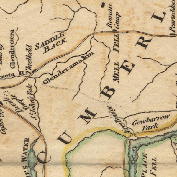 Ws02NY32.jpg "Roman Camp" item:- Armitt Library : A1221.1 Image © see bottom of page |
|
|
|
||
| evidence:- | old text:- Clarke 1787 placename:- Stone Carron placename:- Redstone Camp item:- roman inscription; inscription, roman; human bones; urn; stone coffin |
|
| source data:- | Guide book, A Survey of the Lakes of Cumberland, Westmorland,
and Lancashire, written and published by James Clarke, Penrith,
Cumberland, and in London etc, 1787; published 1787-93. goto source Page 50:- "..." "... a fort upon this common, near the end of Whitbarrow Fields. It is called by Horsley Redstone Camp, and by Cambden Stone-Carron, which I think is the original name; for the ground from the school-house to this camp is called at this day Stone-Carr. I cannot, however, find in the Notitia such a name as either, or any certain or satisfactory account of it. But be this as it will, certainly there has been an encampment of the Romans at this place, for the military road leads exactly to and from it: within these two years also, several bones, urns, stone-coffins, &c. have been found here by people digging for stones. Some of these I am in possession of, but were generally broke, so that it was impossible to make them out. One I saw which had T.S. and I think there had been other letters." |
|
|
|
||
Lakes Guides menu.