 Old Cumbria Gazetteer
 |
 |
|
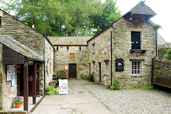
| Priests Mill, Caldbeck | ||
| Priests Mill | ||
| Low Mill | ||
| Caldbeck Mining Museum | ||
| site name:- | Cald Beck | |
| locality:- | Caldbeck | |
| civil parish:- | Caldbeck (formerly Cumberland) | |
| county:- | Cumbria | |
| locality type:- | craft shop | |
| locality type:- | museum (gone) | |
| locality type:- | mill (ex) | |
| locality type:- | water mill | |
| locality type:- | corn mill | |
| locality type:- | saw mill | |
| coordinates:- | NY32613990 | |
| 1Km square:- | NY3239 | |
| 10Km square:- | NY33 | |
|
|
||
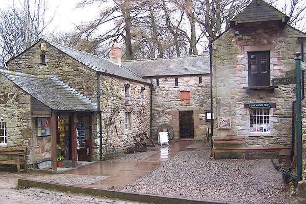 BLR90.jpg (taken 24.3.2006) |
||
|
|
||
| evidence:- | old map:- OS County Series (Cmd 37 12) |
|
| source data:- | Maps, County Series maps of Great Britain, scales 6 and 25
inches to 1 mile, published by the Ordnance Survey, Southampton,
Hampshire, from about 1863 to 1948. "Corn Mill" |
|
|
|
||
| evidence:- | old map:- Donald 1774 (Cmd) |
|
| source data:- | Map, hand coloured engraving, 3x2 sheets, The County of Cumberland, scale about 1
inch to 1 mile, by Thomas Donald, engraved and published by Joseph Hodskinson, 29
Arundel Street, Strand, London, 1774.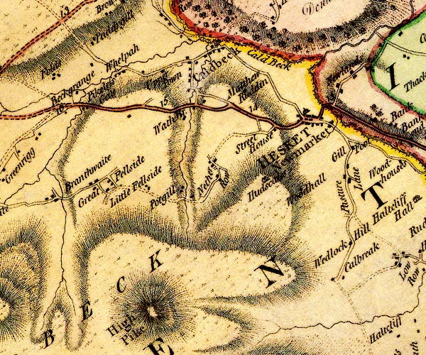 D4NY33NW.jpg circle with rays, mill wheel; a water mill at Caldbeck item:- Carlisle Library : Map 2 Image © Carlisle Library |
|
|
|
||
| evidence:- | database:- Listed Buildings 2010 placename:- Low Mill item:- date stone (1702) |
|
| source data:- | courtesy of English Heritage "LOW MILL / / / CALDBECK / ALLERDALE / CUMBRIA / II / 72358 / NY3261439895" |
|
|
|
||
 BRC62.jpg (taken 20.7.2009) 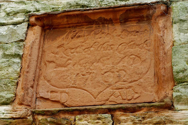 BRC61.jpg Plaque, date stone:- "[ of this ] / 1702 / ED AD" (taken 20.7.2009) |
||
|
|
||
| hearsay:- |
Built by Jeffrey Wybergh, rector of Caldbeck, 1702. It was a corn mill to 1933, then
used as a sawmill and joiner's workshop. Its dam was destroyed by a flood in 1965. |
|
|
|
||
 Lakes Guides menu.