 Old Cumbria Gazetteer
 |
 |
|
| Kidsty Pike, Bampton | ||
| Kidsty Pike | ||
| civil parish:- | Bampton (formerly Westmorland) | |
| civil parish:- | Martindale (formerly Westmorland) | |
| county:- | Cumbria | |
| locality type:- | hill | |
| coordinates:- | NY44741258 | |
| 1Km square:- | NY4412 | |
| 10Km square:- | NY41 | |
| altitude:- | 2559 feet | |
| altitude:- | 780m | |
|
|
||
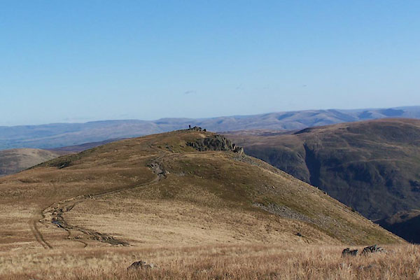
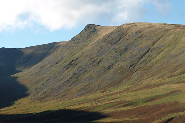 BTR93.jpg (taken 20.10.2010) 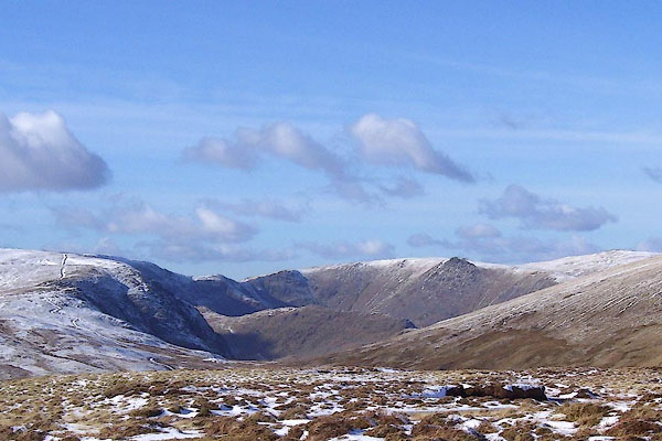 BOT61.jpg Beyond Riggindale. (taken 4.3.2008) |
||
|
|
||
| evidence:- | old map:- OS County Series (Wmd 20 1) placename:- Kidsty Pike |
|
| source data:- | Maps, County Series maps of Great Britain, scales 6 and 25
inches to 1 mile, published by the Ordnance Survey, Southampton,
Hampshire, from about 1863 to 1948. |
|
|
|
||
| evidence:- | old map:- Jefferys 1770 (Wmd) placename:- Kidsway Pyke |
|
| source data:- | Map, 4 sheets, The County of Westmoreland, scale 1 inch to 1
mile, surveyed 1768, and engraved and published by Thomas
Jefferys, London, 1770.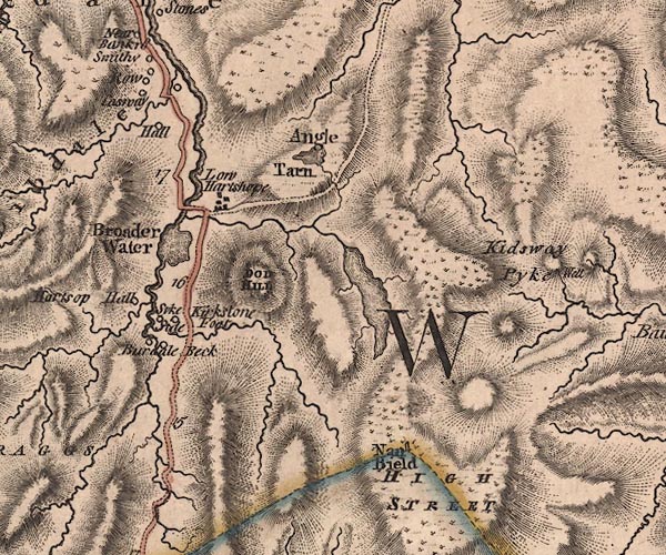 J5NY41SW.jpg "Kidsway Pyke" hill hachuring; hill or mountain item:- National Library of Scotland : EME.s.47 Image © National Library of Scotland |
|
|
|
||
| evidence:- | descriptive text:- West 1778 (11th edn 1821) placename:- Kidstow Pike |
|
| source data:- | Guide book, A Guide to the Lakes, by Thomas West, published by
William Pennington, Kendal, Cumbria once Westmorland, and in
London, 1778 to 1821. goto source goto sourcePage 165:- "... above all is seen Kidstow-pike, on whose summit the clouds weep into a crater of rock that is never empty. ..." |
|
|
|
||
| evidence:- | old map:- West 1784 map placename:- Kidsey Pike |
|
| source data:- | Map, hand coloured engraving, A Map of the Lakes in Cumberland,
Westmorland and Lancashire, scale about 3.5 miles to 1 inch,
engraved by Paas, 53 Holborn, London, about 1784.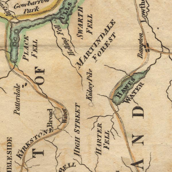 Ws02NY41.jpg Shown by a tiny circle of hachuring. item:- Armitt Library : A1221.1 Image © see bottom of page |
|
|
|
||
| evidence:- | old text:- Clarke 1787 placename:- Kidstow Pike |
|
| source data:- | Guide book, A Survey of the Lakes of Cumberland, Westmorland,
and Lancashire, written and published by James Clarke, Penrith,
Cumberland, and in London etc, 1787; published 1787-93. goto source Page 116:- "... the highest of our northern Alps, Helvellyn." "Cambden speaking of Helvellyn calls it Lauvellin, and says that the country people had a proverb concerning it." ""Skiddow, Lauvellin, and Casticand, Are the highest hills in all England."" ""But the bye-word (as he calls it,) that he was taught when a child, and which continues the same still, is," ""Kidstowpike, Castycam, Helveyllin and Skiddow-man, Are the highest hills ever clumb by Englishmen."" |
|
|
|
||
| evidence:- | old map:- Cary 1789 (edn 1805) placename:- Kidway Pike |
|
| source data:- | Map, uncoloured engraving, Westmoreland, scale about 2.5 miles
to 1 inch, by John Cary, London, 1789; edition 1805.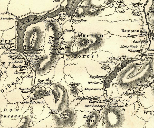 CY24NY41.jpg "Kidway Pike" hill hachuring item:- JandMN : 129 Image © see bottom of page |
|
|
|
||
| evidence:- | old map:- Cooke 1802 placename:- Kidsey Pike |
|
| source data:- | Map, The Lakes, Westmorland and Cumberland, scale about 8.5
miles to 1 inch, engravedby Neele and Son, published by
Sherwood, Jones and Co, Paternoster Road, London, 1824. click to enlarge click to enlargeGRA1Lk.jpg "Kidsey Pike" hillock; mountain item:- Hampshire Museums : FA2000.62.5 Image © see bottom of page |
|
|
|
||
| evidence:- | old text:- Green 1814 placename:- Kidstay |
|
| source data:- | Set of prints, soft ground etchings, Sixty Small Prints, with
text, A Description of a Series of Sixty Small Prints, by
William Green, Ambleside, Westmorland, 1814. goto source page 34:- "..." "Branstree, Harter Fell, Riggendale, High Street, Kidstay, and Whelter, are all grand mountains lying at the head of the lake [Hawes Water] ..." |
|
|
|
||
| evidence:- | old map:- Otley 1818 placename:- Kidsay Pike |
|
| source data:- | Map, uncoloured engraving, The District of the Lakes,
Cumberland, Westmorland, and Lancashire, scale about 4 miles to
1 inch, by Jonathan Otley, 1818, engraved by J and G Menzies,
Edinburgh, Scotland, published by Jonathan Otley, Keswick,
Cumberland, et al, 1833.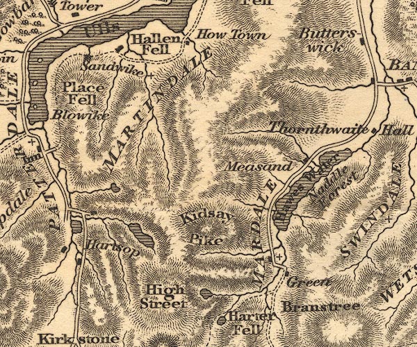 OT02NY41.jpg item:- JandMN : 48.1 Image © see bottom of page |
|
|
|
||
| evidence:- | outline view:- Otley 1823 (8th edn 1849) placename:- Kidsey Pike |
|
| source data:- | Engraving, outline view of mountains, Hawes Water from Measand Beck, drawn by T Binns,
engraved by O Jewitt, opposite p.16 of A Descriptive Guide of the English Lakes, by
Jonathan Otley, 8th edition, 1849.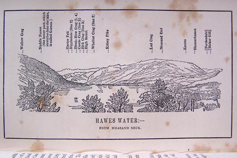 click to enlarge click to enlargeO80E09.jpg item:- Armitt Library : A1180.10 Image © see bottom of page |
|
|
|
||
| evidence:- | descriptive text:- Otley 1823 (5th edn 1834) placename:- Kidstow Pike |
|
| source data:- | Guide book, A Concise Description of the English Lakes, the
mountains in their vicinity, and the roads by which they may be
visited, with remarks on the mineralogy and geology of the
district, by Jonathan Otley, published by the author, Keswick,
Cumberland now Cumbria, by J Richardson, London, and by Arthur
Foster, Kirkby Lonsdale, Cumbria, 1823; published 1823-49,
latterly as the Descriptive Guide to the English Lakes. goto source Page 115:- "... and High Street. From ... which a narrow ridge, called Long Stile, projects ... and beyond this rises the apex of Kidstow Pike. ..." |
|
|
|
||
| evidence:- | old map:- Garnett 1850s-60s H placename:- Kidsty Pike |
|
| source data:- | Map of the English Lakes, in Cumberland, Westmorland and
Lancashire, scale about 3.5 miles to 1 inch, published by John
Garnett, Windermere, Westmorland, 1850s-60s. GAR2NY41.jpg "Kidsty Pike" hill hachuring item:- JandMN : 82.1 Image © see bottom of page |
|
|
|
||
| evidence:- | outline view:- LMS 1920s |
|
| source data:- | Hill Outline from Shap Station, published in the LMS Route Book No.3, The Track of
the Royal Scot, by the London, Midland and Scottish Railway, LMS, 1920s.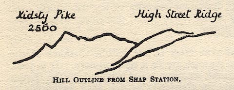 click to enlarge click to enlargeLS1E37.jpg item:- JandMN : 95.10 Image © see bottom of page |
|
|
|
||
| evidence:- | outline view:- Black 1856 (23rd edn 1900) placename:- Kidsey Pike |
|
| source data:- | Print, lithograph, Outline Views, Haws and Wastwater - Mountains as seen from Burn-Banks
near the Foot of Hawes Water, and Mountains as seen near Nether Wastdale at the First
Bridge on the road to Wast-Water, by J Flintoft, Keswick, Cumberland, engraved by
R Mason, Edinburgh, Lothian, about 1900.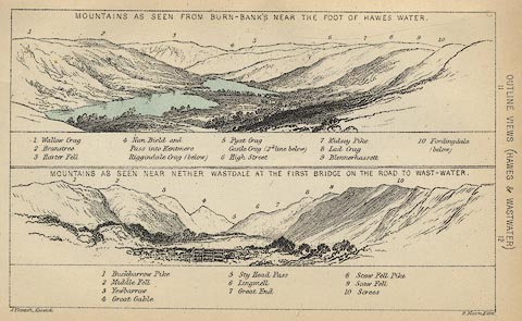 click to enlarge click to enlargeBC08E6.jpg "... 7 Kidsey Pike ..." item:- JandMN : 37.21 Image © see bottom of page |
|
|
|
||
| evidence:- | outline view:- Black 1841 (3rd edn 1846) placename:- Kidsey Pike |
|
| source data:- | Print, engraving, outline view, Mountains as seen from Burn Banks near the Foot of
Hawes Water, and Mountains as seen near Strands in Wastdale at the First bridge on
the Road to Wast Water, by J Flintoft, Keswick, Cumberland, engraved by R Mason, Edinburgh,
Lothian, about 1846.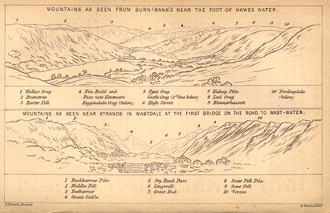 click to enlarge click to enlargeBC02E8.jpg "... 7 Kidsey Pike ..." item:- JandMN : 32.12 Image © see bottom of page |
|
|
|
||
| evidence:- | outline view:- Tattersall 1836 (version 1869) placename:- Kidsay Pike |
|
| source data:- | Print, hand coloured, Hawes Water, from Thwaite Force, Westmorland, drawn by George
Tattersall, 1836, engraved by W F Topham, published by T J Allman, 463 Oxford Street,
London, 1869.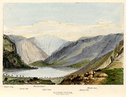 click to enlarge click to enlargeTAT217.jpg Included in The Lakes of England, by W F Topham. printed at bottom:- "HAWES-WATER, / from Thwaite Force." printed at bottom:- "Wallow Crag. / Harter Fell. / Mardale Chapel. / High Street. / Kidsay Pike. / Whelter Crag." item:- Armitt Library : A1067.17 Image © see bottom of page |
|
|
|
||
| evidence:- | outline view:- Tattersall 1836 placename:- Kidsay Pike |
|
| source data:- | Print, engraving, Hawes Water, from Thwaite Force, Westmorland, drawn by George Tattersall,
engraved by W F Topham, published by Sherwood and Co, Paternoster Row, London, about
1836.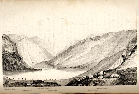 click to enlarge click to enlargeTAT139.jpg The print is captioned with mountain names and acts as an outline view. Tipped in opposite p.109 of The Lakes of England, by George Tattersall. printed at bottom:- "HAWES-WATER, / from Thwaite Force." printed at bottom left to right:- "Wallow Crag. / Harter Fell. / Mardale Chapel. / High Street. / Kidsay Pike. / Whelter Crag." item:- Armitt Library : A1204.40 Image © see bottom of page |
|
|
|
||
 BTS81.jpg (taken 20.10.2010) 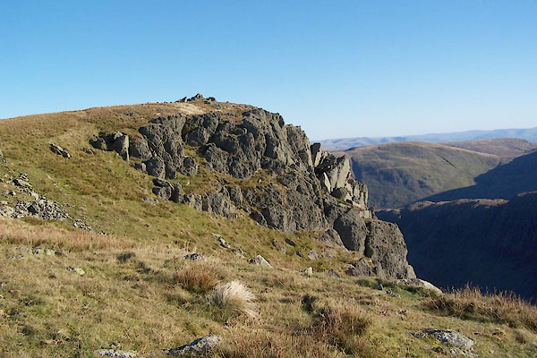 BTS82.jpg (taken 20.10.2010) 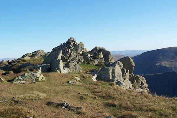 BTS83.jpg (taken 20.10.2010) 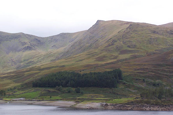 BJW35.jpg From across Haweswater. (taken 29.9.2005) |
||
|
|
||
Lakes Guides menu.