 Old Cumbria Gazetteer
 |
 |
|
| Gilsland | ||
| civil parish:- | Solport (formerly Cumberland) | |
| civil parish:- | Nicholforest (formerly Cumberland) | |
| civil parish:- | Bewcastle (formerly Cumberland) | |
| county:- | Cumbria | |
| locality type:- | locality | |
| 1Km square:- | NY4070 (etc) | |
| 10Km square:- | NY47 | |
|
|
||
| evidence:- | old map:- OS County Series (Cmd 13 5) placename:- Gilsland |
|
| source data:- | Maps, County Series maps of Great Britain, scales 6 and 25
inches to 1 mile, published by the Ordnance Survey, Southampton,
Hampshire, from about 1863 to 1948. |
|
|
|
||
| evidence:- | old map:- Lloyd 1573 placename:- Gyllysland |
|
| source data:- | Map, hand coloured copper plate engraving, Angliae Regni,
Kingdom of England, with Wales, scale about 24 miles to 1 inch, authored by Humphrey
Lloyd, Denbigh, Clwyd, drawn and engraved
by Abraham Ortelius, Netherlands, 1573. click to enlarge click to enlargeLld1Cm.jpg "Gyllysland" item:- Hampshire Museums : FA1998.69 Image © see bottom of page |
|
|
|
||
| evidence:- | old map:- Saxton 1579 placename:- Gilsland |
|
| source data:- | Map, hand coloured engraving, Westmorlandiae et Cumberlandiae Comitatus ie Westmorland
and Cumberland, scale about 5 miles to 1 inch, by Christopher Saxton, London, engraved
by Augustinus Ryther, 1576, published 1579-1645.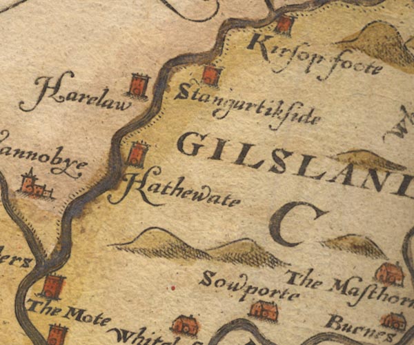 Sax9NY47.jpg "GILSLAND" item:- private collection : 2 Image © see bottom of page |
|
|
|
||
| evidence:- | old map:- Mercator 1595 (edn?) placename:- Gilslande |
|
| source data:- | Map, hand coloured engraving, Northumbria, Cumberlandia, et
Dunelmensis Episcopatus, ie Northumberland, Cumberland and
Durham etc, scale about 6.5 miles to 1 inch, by Gerard Mercator,
Duisberg, Germany, about 1595. MER8CumA.jpg "Gilslande" area item:- JandMN : 169 Image © see bottom of page |
|
|
|
||
| evidence:- | old map:- Speed 1611 (Cmd) placename:- Gilsland |
|
| source data:- | Map, hand coloured engraving, Cumberland and the Ancient Citie
Carlile Described, scale about 4 miles to 1 inch, by John Speed,
1610, published by J Sudbury and George Humble, Popes Head
Alley, London, 1611-12.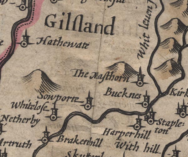 SP11NY47.jpg "Gilsland" area item:- private collection : 16 Image © see bottom of page |
|
|
|
||
| evidence:- | old map:- Drayton 1612/1622 placename:- Gilslande |
|
| source data:- | Map, hand coloured engraving, Cumberlande and Westmorlande, by
Michael Drayton, probably engraved by William Hole, scale about
4 or 5 miles to 1 inch, published by John Mariott, John
Grismand, and Thomas Dewe, London, 1622.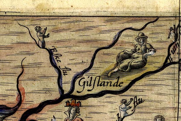 DRY501.jpg "Gilslande" Sitting lady. item:- JandMN : 168 Image © see bottom of page |
|
|
|
||
| evidence:- | old map:- Jansson 1646 placename:- Gilsland |
|
| source data:- | Map, hand coloured engraving, Cumbria and Westmoria, ie
Cumberland and Westmorland, scale about 3.5 miles to 1 inch, by
John Jansson, Amsterdam, Netherlands, 1646.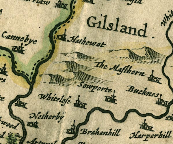 JAN3NY47.jpg "Gilsland." Labelling an area, no symbol. item:- JandMN : 88 Image © see bottom of page |
|
|
|
||
| evidence:- | old map:- Seller 1694 (Cmd) placename:- Gilsland |
|
| source data:- | Map, uncoloured engraving, Cumberland, scale about 12 miles to 1
inch, by John Seller, 1694. click to enlarge click to enlargeSEL9.jpg "Gilsland" circle, italic lowercase text; settlement or house item:- Dove Cottage : 2007.38.89 Image © see bottom of page |
|
|
|
||
| evidence:- | old map:- Bowen and Kitchin 1760 placename:- Gillsland |
|
| source data:- | Map, hand coloured engraving, A New Map of the Counties of
Cumberland and Westmoreland Divided into their Respective Wards,
scale about 4 miles to 1 inch, by Emanuel Bowen and Thomas
Kitchin et al, published by T Bowles, Robert Sayer, and John
Bowles, London, 1760. BO18NY57.jpg "GILLSLAND" area item:- Armitt Library : 2008.14.10 Image © see bottom of page |
|
|
|
||
| evidence:- | old text:- Camden 1789 (Gough Additions) placename:- Gillesland item:- placename, Gilsland |
|
| source data:- | Book, Britannia, or A Chorographical Description of the Flourishing Kingdoms of England,
Scotland, and Ireland, by William Camden, 1586, translated from the 1607 Latin edition
by Richard Gough, published London, 1789. goto source goto sourcePage 201:- "Gillesland might also take its name from Hubert de Vallibus or Vaux, since de Vallibus and Gills mean the same, or from the river Gelt which runs through the middle of it. The bottom wherein the brook runs is the Gill. Its boundary may be seen in Burn, II. p.479." |
|
|
|
||
| evidence:- | old text:- Gents Mag |
|
| source data:- | Magazine, The Gentleman's Magazine or Monthly Intelligencer or
Historical Chronicle, published by Edward Cave under the
pseudonym Sylvanus Urban, and by other publishers, London,
monthly from 1731 to 1922. goto source Gentleman's Magazine 1819 part 1 p.505 From the Compendium of County History:- "1311. Gilsland ravaged by Robert Bruce King of Scotland." "..." "1319. Gilsland laid waste by the Scots under James Douglas and Thomas Randolph." |
|
|
|
||
| evidence:- | old text:- Gents Mag 1819 item:- fire, Gilsland |
|
| source data:- | goto source Gentleman's Magazine 1819 part 1 p.506 "1388. In Gilsland, on Lord Dacre's demesne, 200 decrepit persons, women and children, shut up in houses, and burnt by the Scots." |
|
|
|
||
| also see:- | Barony of Gilsland, Cumberland |
|
|
|
||
Lakes Guides menu.