 Old Cumbria Gazetteer
 |
 |
|
| Esk Estuary (2) | ||
| Esk Estuary | ||
| Irt Estuary | ||
| Mite Estuary | ||
| site name:- | Esk, River (2) | |
| civil parish:- | Muncaster (formerly Cumberland) | |
| civil parish:- | Bootle (formerly Cumberland) | |
| civil parish:- | Waberthwaite (formerly Cumberland) | |
| county:- | Cumbria | |
| locality type:- | estuary | |
| locality type:- | river estuary | |
| coordinates:- | SD08169573 (etc) | |
| 1Km square:- | SD0895 | |
| 10Km square:- | SD09 | |
| SummaryText:- | The Esk, Mite and Irt share one estuary. | |
|
|
||
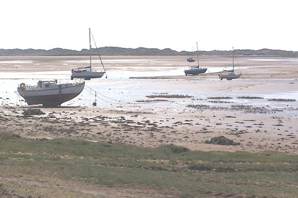 BMC04.jpg The Mite. (taken 11.5.2006) 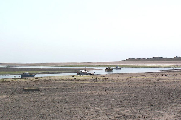 BMC08.jpg The Esk. (taken 11.5.2006) |
||
|
|
||
| evidence:- | old map:- Bowen and Kitchin 1760 |
|
| source data:- | Map, hand coloured engraving, A New Map of the Counties of
Cumberland and Westmoreland Divided into their Respective Wards,
scale about 4 miles to 1 inch, by Emanuel Bowen and Thomas
Kitchin et al, published by T Bowles, Robert Sayer, and John
Bowles, London, 1760.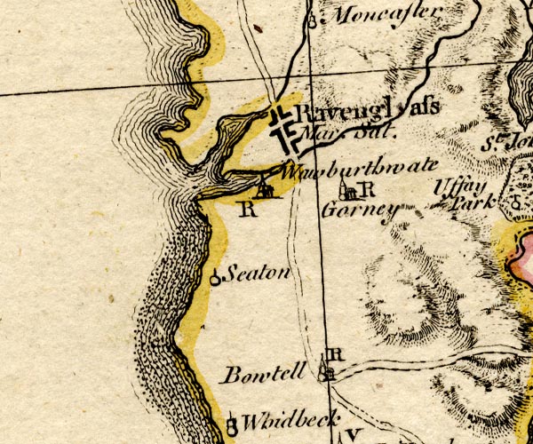 BO18SD08.jpg river mouth item:- Armitt Library : 2008.14.10 Image © see bottom of page |
|
|
|
||
| evidence:- | old map:- Donald 1774 (Cmd) |
|
| source data:- | Map, hand coloured engraving, 3x2 sheets, The County of Cumberland, scale about 1
inch to 1 mile, by Thomas Donald, engraved and published by Joseph Hodskinson, 29
Arundel Street, Strand, London, 1774.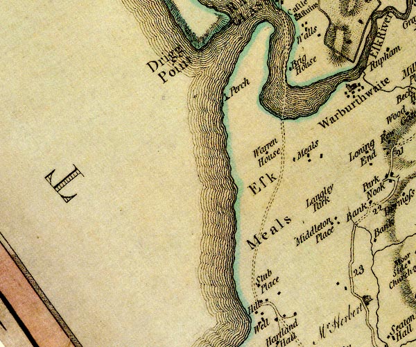 D4SD09SE.jpg single or double wiggly line; a river, estuary into the sea item:- Carlisle Library : Map 2 Image © Carlisle Library |
|
|
|
||
| evidence:- | old map:- West 1784 map |
|
| source data:- | Map, hand coloured engraving, A Map of the Lakes in Cumberland,
Westmorland and Lancashire, scale about 3.5 miles to 1 inch,
engraved by Paas, 53 Holborn, London, about 1784.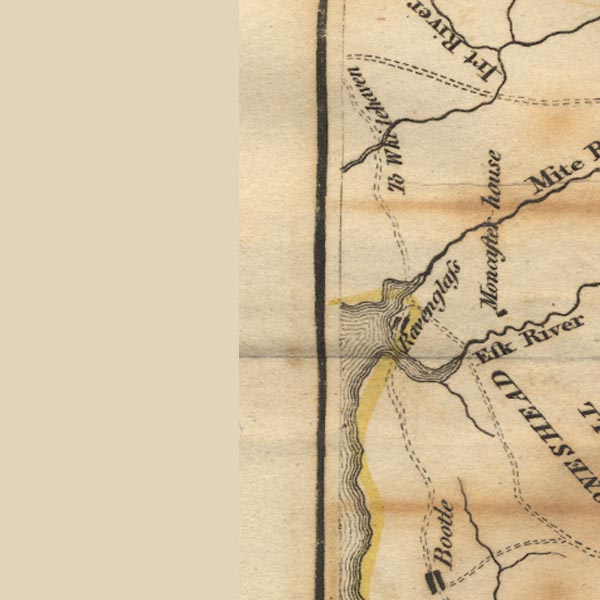 Ws02SD09.jpg item:- Armitt Library : A1221.1 Image © see bottom of page |
|
|
|
||
| evidence:- | old map:- Garnett 1850s-60s H |
|
| source data:- | Map of the English Lakes, in Cumberland, Westmorland and
Lancashire, scale about 3.5 miles to 1 inch, published by John
Garnett, Windermere, Westmorland, 1850s-60s.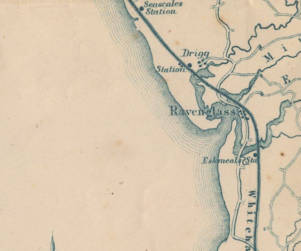 GAR2SD09.jpg area item:- JandMN : 82.1 Image © see bottom of page |
|
|
|
||
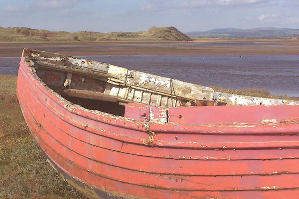 BMT11.jpg Boat in the river estuary near the Eskmeals Viaduct. (taken 30.9.2006) |
||
|
|
||
| notes:- |
This was a place for fishing for flounders. A three tined fork was used, and you carry
a bag on your back for the catch. |
|
|
|
||
| see:- |  sands road, Esk Estuary (2) sands road, Esk Estuary (2) |
|
|
|
||
Lakes Guides menu.