 Old Cumbria Gazetteer
 |
 |
|
| sands road, Esk Estuary (2) | ||
| site name:- | Esk, River (2) | |
| locality:- | Esk Estuary (2) | |
| civil parish:- | Waberthwaite (formerly Cumberland) | |
| civil parish:- | Bootle (formerly Cumberland) | |
| civil parish:- | Muncaster (formerly Cumberland) | |
| county:- | Cumbria | |
| locality type:- | sands road | |
| locality type:- | ford | |
| coordinates:- | SD08699438 (etc) | |
| 1Km square:- | SD0894 | |
| 10Km square:- | SD09 | |
|
|
||
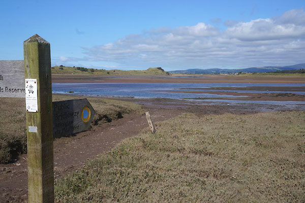 CDV90.jpg At low tide. (taken 6.9.2015) 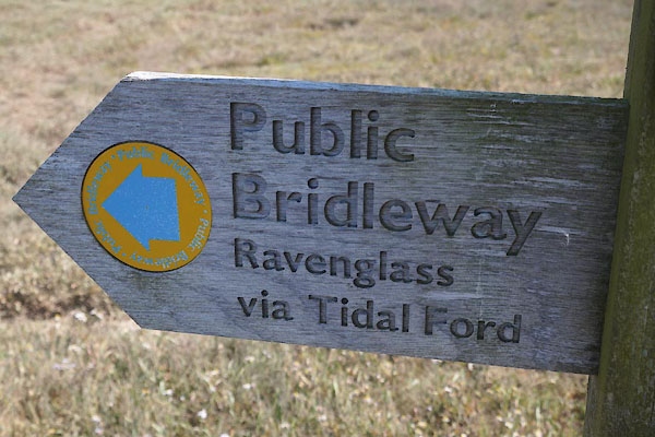 CDV91.jpg Sign. (taken 6.9.2015) |
||
|
|
||
| evidence:- | old map:- Donald 1774 (Cmd) |
|
| source data:- | Map, hand coloured engraving, 3x2 sheets, The County of Cumberland, scale about 1
inch to 1 mile, by Thomas Donald, engraved and published by Joseph Hodskinson, 29
Arundel Street, Strand, London, 1774.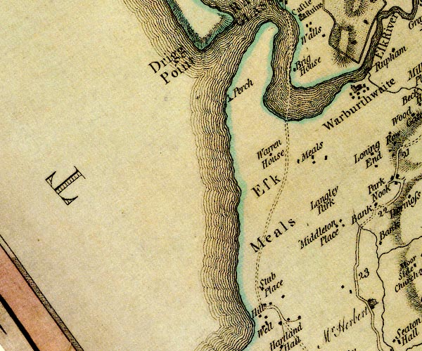 D4SD09SE.jpg double dotted lines, sands road across the Esk item:- Carlisle Library : Map 2 Image © Carlisle Library |
|
|
|
||
 Lakes Guides menu.