


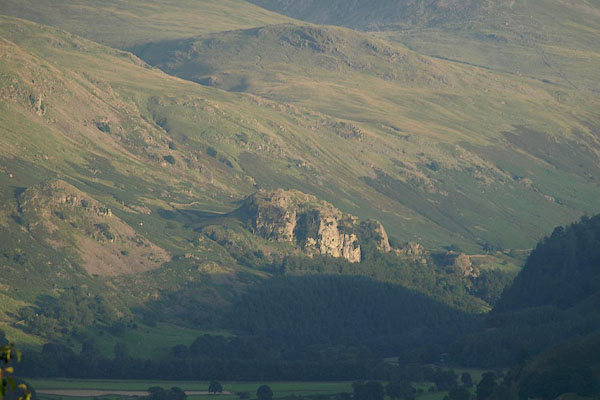
BPQ15.jpg (taken 24.8.2008)
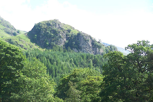
BMH49.jpg (taken 29.3.2006)
placename:- Castle Rock
item:- Arthurian legend; Bridal of Triermain
The narrow dale lay smooth and still;
And down its verdant bosom led,
A winding brooklet found its bed.
But, midmost of the vale, a mound
Arose with airy turrets crown'd,
Buttress, and rampire's circling bound,
And mighty keep and tower;
Seem'd some primeval giant's hand
The castle's massive walls had plann'd,
A ponderous bulwark to withstand
Ambitious Nimrod's power.
Rocks upon rocks incumbent hung,
And torrents down the valley flung;
Now diving deep from human ken,
And raving down their darksome glen;
The monarch judged this descent wild,
With such romantic ruin piled,
Was a theatre, by nature's hand,
For feat of high achievement planned."
Later King Arthur, having broken from the witch's spell, rides out and looks back:- "The Monarch, breathless and amazed,
Back on the fatal castle gazed:
Nor tower nor donjon could he spy;
Darkening against the morning sky;
But, on the spot where once they frown'd,
The lonely streamlet brawl'd around
A tufted knoll, where dimly shone
Fragments of rock and rifted stone ..."
"Know, too, that when a pilgrim strays,
In morning mist or evening maze,
Along the mountain lone,
That fairy fortress often mocks
To gaze upon the castled rocks
Of the Valley of Saint John; ..."
placename:- Rock of St John
 goto source
Page 85:- "... the narrow green vale of Legberthwaite, divided into small inclosures, peopled with a few cots, and nobly terminated by the castle-like rock of St. John."
placename:- Green Cragg
 goto source
Page 61:- "... Green Cragg, which at this distance [from Riddings] exactly resembles an old castle, standing on the side of a mountain, whilst the more distant mountains form a beautiful back ground to the whole."
placename:- Green Cragg
item:- storm, 1749; rain; flood, 1749; brewing
 goto source
Page 116:- "..."
"... the violence of the water-spout A.D. 1749, ... of which we gave some account before. ... Lame John's, escaped by the water breaking on a rock above it called Green Cragg; ... The mountains above were covered with water, which flowed down their sides in an awful and irresistible torrent, leaving not a trace of vegetation behind it: in many parts it even carried away the soil, leaving the naked rocks like an immense ruin to testify its violence. Green Cragg alone shewed any signs of verdure, and there were very small, as it is almost a naked rock: the contrast, however, must have been extremely striking between this and the dark red soil of the adjacent mountains: at this time the hills have almost recovered their vegetation, and probably in a few years the only marks of this dreadful devastation will be the enormous heaps of great stones which the water tore from the mountains, hurried away with its impetuous current, and then left upon the more level valleys."
"..."
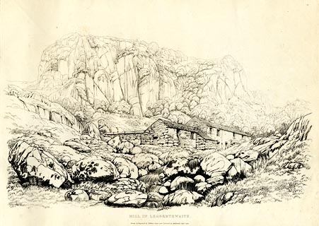 click to enlarge
GN1229.jpg
The crag behind is Castle Rock.
Plate 29 in Sixty Studies from Nature, 1810.
printed at top right:- "29"
printed at bottom:- "MILL IN LEGBERTHWAITE. / Drawn &Engraved by William Green, and Published at Ambleside, Augst. 1, 1809."
watermark:- "J WHATMAN / 1813"
item:- Armitt Library : A6641.29
Image © see bottom of page
placename:- Green Crag
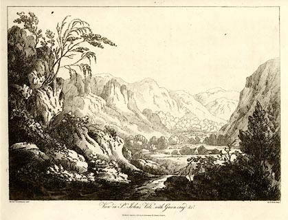 click to enlarge
WKN120.jpg
Plate 20 in Select Views in Cumberland, Westmoreland, and Lancashire.
printed at bottom left, right, centre:- "The Revd. Jos: Wilkinson delt. / W. F. Wells Sculpt. / View in St. John's Vale, with Green-crag &c. / Publish'd March 1. 1810. by R. Ackerman. 101. Strand. London."
item:- Fell and Rock Climbing Club : MN4.20
Image © see bottom of page
placename:- Green Crag
placename:- Enchanted Castle
placename:- Castle Rock of St John's
item:- thunderstorm; flood, 1749
 goto source
Page 80:- "THE CRAGS."
"... Green Crag in Legberthwaite, sometimes called the Enchanted Castle or Castle Rock of St. John's; ..."
 goto source
Page 111:- "... a road turns off on the right towards Threlkeld, passing under the massive rock of Green Crag, sometimes called the Castle Rock of St. John's. Near this, a tremendous thunderstorm in 1749, swept away a mill, and buried one of the millstones amongst the ruins, so that it has never yet been discovered."
placename:- St John's Crag
placename:- Green Crag
 goto source
Page 62:- "..."
"... to the rock of St. John's or Green Crag. The approach into the valley from Threlkeld displays this rock in the most poetical point of view, and under some states of atmosphere it requires no stretch of the imagination to transform its grey perpendicular masses into an impregnable castle, whose walls and turrets"
 goto source
Page 63:- "waving with ivy and other parasitical plants, form the prison of the immortal Merlin. ..."
placename:- Castle Rock
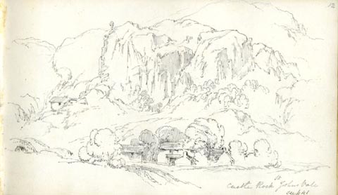 click to enlarge
AS0515.jpg
"Castle Rock St Johns Vale / see p 41"
page number "12"
item:- Armitt Library : 1958.389.15
Image © see bottom of page
placename:- Castle Rock
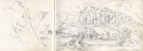 click to enlarge
AS0516.jpg
"Castle Rock . / best see p 41"
page number "13"
item:- Armitt Library : 1958.389.16
Image © see bottom of page
placename:- Castle Rock
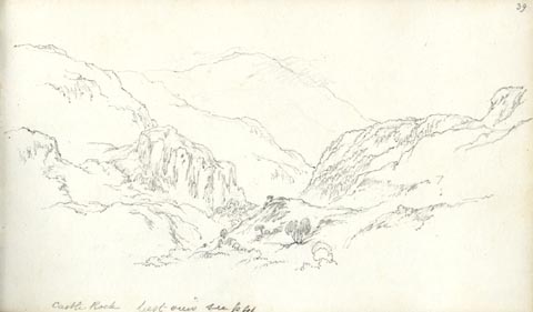 click to enlarge
AS0549.jpg
"Castle Rock best view see p 41"
page number "39"
item:- Armitt Library : 1958.389.49
Image © see bottom of page
placename:- Castle Rock
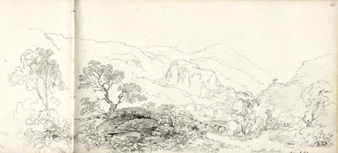 click to enlarge
AS0551.jpg
"Castle Rock / see p 41"
page number "40"
item:- Armitt Library : 1958.389.51
Image © see bottom of page
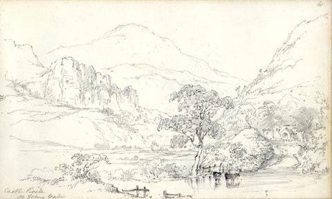 click to enlarge
AS0553.jpg
page number "41"
item:- Armitt Library : 1958.389.53
Image © see bottom of page
placename:- Green Crag
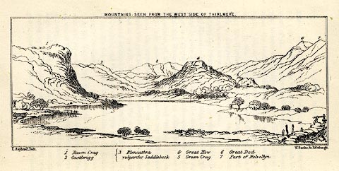 click to enlarge
MNU110.jpg
Plate opposite p.69 in A Complete Guide to the English Lakes, by Harriet Martineau. "MOUNTAINS SEEN FROM THE WEST SIDE OF THIRLMERE."
"L Aspland Delt. / W Banks Sc Edinr."
The view is captioned, numbers referring to mountains in the image:- "1 Raven Crag, 2 Castlerigg, 3 Blancathra vulgariter Saddleback, 4 Great How, 5 Green Crag, 6, Great Dod, 7 Part of Helvellyn."
item:- Armitt Library : A1159.10
Image © see bottom of page
item:- witchery
 goto source
Page 70:- "[Vale of St. John] ... The Castle Rock, in its disenchanted condition, is a prominent object in approaching the vale from Legberthwaite, or by the road just described; and there are lights and gloomy moments in which it looks as like as may be to a scene of witchery,- now engrossing the sunshine when the range to which it belongs is all in shadow; and now perversely gloomy, because there is a single cloud in the sky. ..."
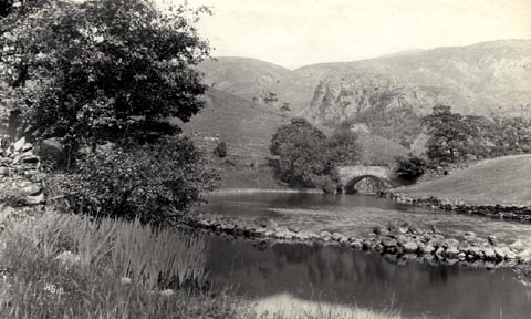 click to enlarge
HB0717.jpg
internegative at lower left:- "H. Bell"
item:- Armitt Library : ALPS381
Image © see bottom of page
placename:- Castle of St John
item:- book; Bridal of Triermaen
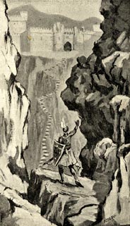 click to enlarge
BGG102.jpg
Included on p.3 of Lakeland and Ribblesdale, by Edmund Bogg; Illustration of a scene from the Bridal of Triermaen by Sir Walter Scott.
item:- JandMN : 231.2
Image © see bottom of page
placename:- Castle Crag
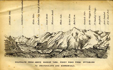 click to enlarge
MW1E02.jpg
Tipped in before p.1 of The English Lakes, Peaks and Passes, from Kendal to Keswick, by George King Matthew.
printed at bottom:- "HELVELLYN FROM ABOVE HARROP TARN, PONEY ROAD FROM WYTHBURN TO WHATENDLATH AND BORROWDALE."
printed at caption to mountains:- "... Castle Crag Vale of St. Joh[n] ..."
item:- Armitt Library : A1168.2
Image © see bottom of page
placename:- Castle Rock
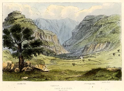 click to enlarge
TAT208.jpg
Included in The Lakes of England, by W F Topham.
printed at bottom:- "VALE OF ST. JOHN, / from the South."
printed at bottom:- "Naddle Fell. / Saddleback. / Pt. of White Pike. / Castle Rock."
item:- Armitt Library : A1067.8
Image © see bottom of page
placename:- Castle Rock
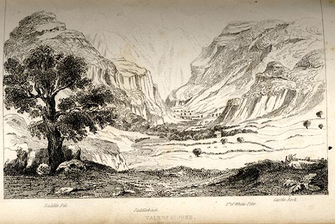 click to enlarge
TAT119.jpg
The print is captioned with mountain names and acts as an outline view.
Tipped in opposite p.56 of The Lakes of England, by George Tattersall.
printed at bottom:- "VALE OF ST. JOHN. / from the South."
printed at bottom left to right:- "Middle Fell. / Saddleback. / Pt.of White Pike. / Castle Rock."
item:- Armitt Library : A1204.20
Image © see bottom of page
placename:- Castle Rock
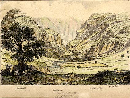 click to enlarge
PR0372.jpg
Objects in the view are identified by a caption at the bottom - Naddle Fell, Saddleback, Pt. of White Pike, Castle Rock.
printed at bottom:- "VALE of ST. JOHN, / from the South. / London, Pubd. April 15th 1836 by Sherwood &Co."
item:- Dove Cottage : 2008.107.372
Image © see bottom of page
placename:- Castle Rock
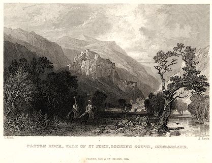 click to enlarge
PR0044.jpg
vol.3 pl.33 in the set of prints, Westmorland, Cumberland, Durham and Northumberland Illustrated. And two medieval looking knights riding up the glen.
printed at bottom left, right, centre:- "T. Allom. / J. Sands. / CASTLE ROCK, VALE OF ST. JOHN, LOOKING SOUTH, CUMBERLAND. / FISHER, SON &CO. LONDON, 1835."
item:- Dove Cottage : 2008.107.44
Image © see bottom of page
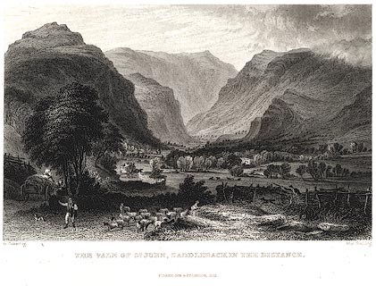 click to enlarge
PR0038.jpg
vol.3 pl.24 in the set of prints, Westmorland, Cumberland, Durham and Northumberland Illustrated.
printed at bottom left, right, centre:- "G. Pickering. / M. J. Starling. / THE VALE OF ST. JOHN, SADDLEBACK IN THE DISTANCE. / FISHER, SON &CO. LONDON, 1835."
item:- Dove Cottage : 2008.107.38
Image © see bottom of page
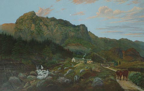 click to enlarge
PR1350.jpg
A remote farmstead stands in centre of composition, in the middle distance, smoke rising from its chimney. It stands at the foot of a towering ricky escarpment with a forest of fir trees to left, beside which a mountain stream tumbles downhill over huge boulders. The track to the farm, which leads into composition from lower right hand corner, is blocked by two highland cattle.
This painting is a copy of 'Castle Rock, Cumberland' 1877 watercolour by Henry Clarence Whaite in the Walker Art Gallery, Liverpool.
signed &dated at bottom left:- "Joseph Barnes. 1886."
item:- Tullie House Museum : 1997.882
Image © Tullie House Museum
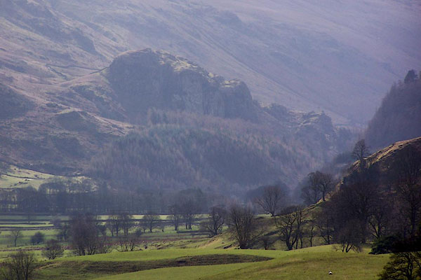
BLT68.jpg (taken 3.4.2006)
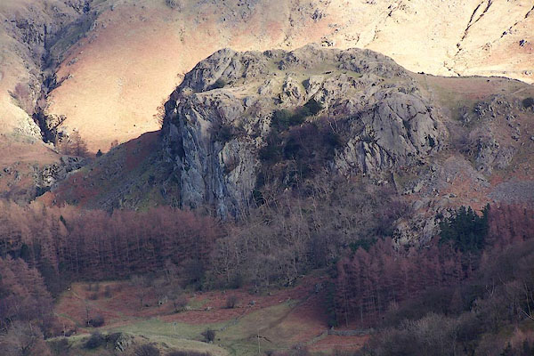
BND87.jpg (taken 5.2.2007)
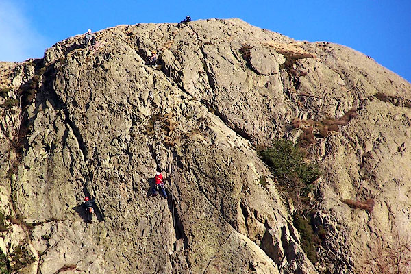
BND90.jpg Climbers on the rock face.
(taken 5.2.2007)
