Old Cumbria Gazetteer
 |
 |
|
||
| Barbon Beck | ||||
| runs into:- |  Lune, River Lune, River |
|||
|
|
||||
| civil parish:- | Barbon (formerly Westmorland) | |||
| county:- | Cumbria | |||
| locality type:- | river | |||
| 1Km square:- | SD6482 | |||
| 10Km square:- | SD68 | |||
|
|
||||
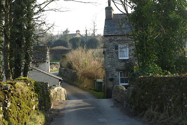
 BNH56.jpg (taken 2.3.2007) 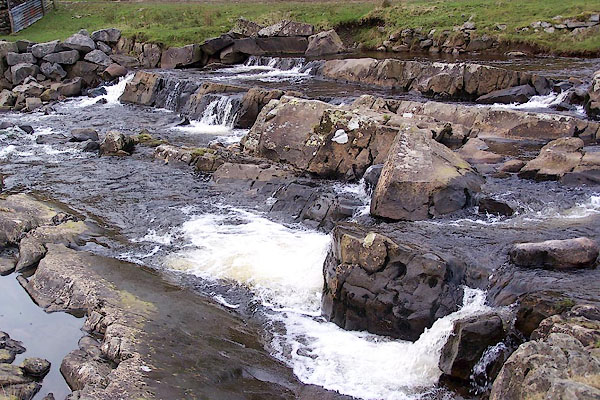 BNH55.jpg By the sheepfold. (taken 2.3.2007) |
||||
|
|
||||
| evidence:- | old map:- OS County Series (Wmd 43 16) placename:- Barbon Beck |
|||
| source data:- | Maps, County Series maps of Great Britain, scales 6 and 25
inches to 1 mile, published by the Ordnance Survey, Southampton,
Hampshire, from about 1863 to 1948. OS County Series (Wmd 44 13) |
|||
|
|
||||
| evidence:- | old map:- Saxton 1579 |
|||
| source data:- | Map, hand coloured engraving, Westmorlandiae et Cumberlandiae Comitatus ie Westmorland
and Cumberland, scale about 5 miles to 1 inch, by Christopher Saxton, London, engraved
by Augustinus Ryther, 1576, published 1579-1645.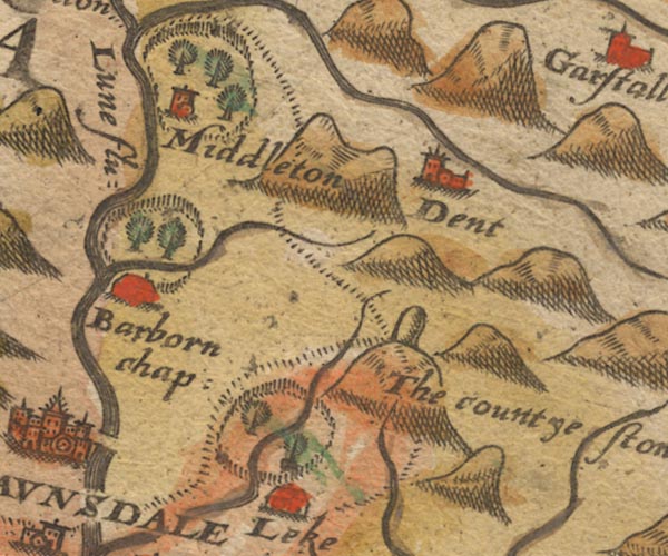 Sax9SD68.jpg item:- private collection : 2 Image © see bottom of page |
|||
|
|
||||
| evidence:- | old map:- Speed 1611 (Wmd) |
|||
| source data:- | Map, hand coloured engraving, The Countie Westmorland and
Kendale the Cheif Towne, scale about 2.5 miles to 1 inch, by
John Speed, 1610, published by George Humble, Popes Head Alley,
London, 1611-12.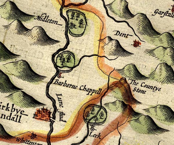 SP14SD68.jpg double line, into the Lune item:- Armitt Library : 2008.14.5 Image © see bottom of page |
|||
|
|
||||
| evidence:- | old map:- Jansson 1646 |
|||
| source data:- | Map, hand coloured engraving, Cumbria and Westmoria, ie
Cumberland and Westmorland, scale about 3.5 miles to 1 inch, by
John Jansson, Amsterdam, Netherlands, 1646.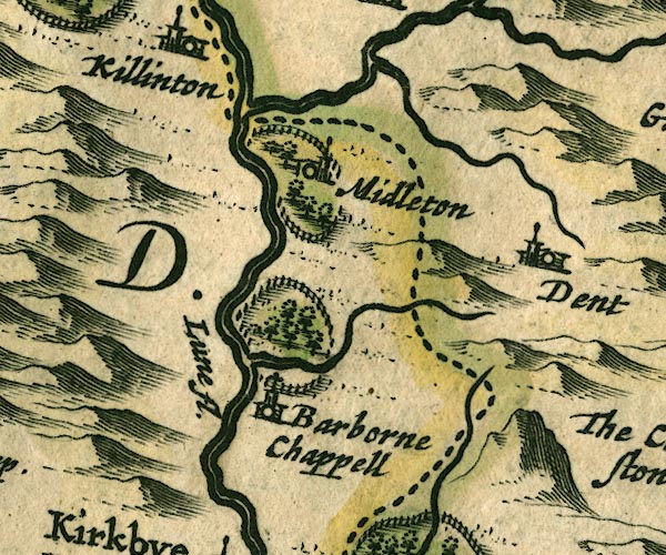 JAN3SD68.jpg Single wiggly line. item:- JandMN : 88 Image © see bottom of page |
|||
|
|
||||
| evidence:- | old map:- Morden 1695 (Wmd) |
|||
| source data:- | Map, hand coloured engraving, Westmorland, scale about 2.5 miles to 1 inch, by Robert
Morden, published by Abel Swale, the Unicorn, St Paul's Churchyard, Awnsham, and John
Churchill, the Black Swan, Paternoster Row, London, 1695.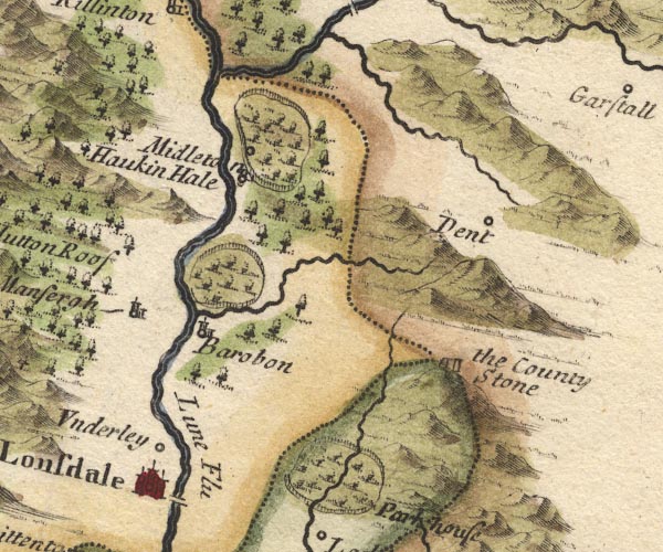 MD10SD68.jpg Running into the Lune at Barbon. item:- JandMN : 24 Image © see bottom of page |
|||
|
|
||||
| evidence:- | old map:- Simpson 1746 map (Wmd) |
|||
| source data:- | Map, uncoloured engraving, Westmorland, scale about 8 miles to 1
inch, printed by R Walker, Fleet Lane, London, 1746.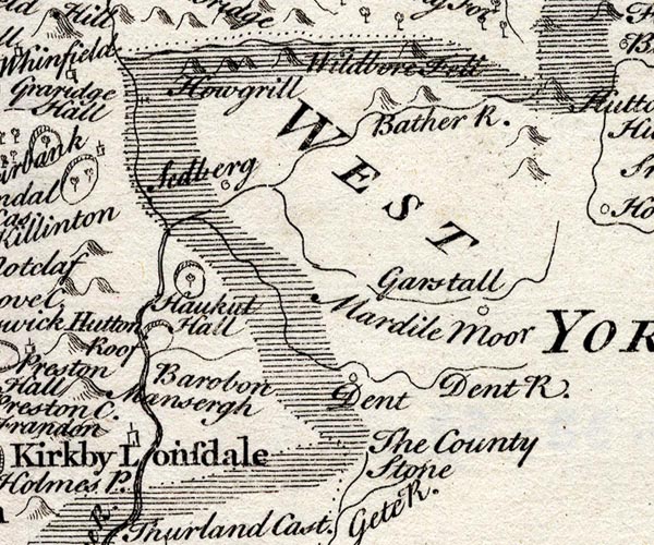 SMP2SDU.jpg Wiggly line item:- Dove Cottage : 2007.38.59 Image © see bottom of page |
|||
|
|
||||
| evidence:- | old map:- Bowen and Kitchin 1760 |
|||
| source data:- | Map, hand coloured engraving, A New Map of the Counties of
Cumberland and Westmoreland Divided into their Respective Wards,
scale about 4 miles to 1 inch, by Emanuel Bowen and Thomas
Kitchin et al, published by T Bowles, Robert Sayer, and John
Bowles, London, 1760.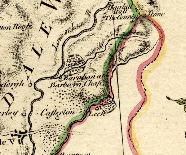 BO18SD68.jpg wiggly line, into the Lune item:- Armitt Library : 2008.14.10 Image © see bottom of page |
|||
|
|
||||
| evidence:- | old map:- Jefferys 1770 (Wmd) |
|||
| source data:- | Map, 4 sheets, The County of Westmoreland, scale 1 inch to 1
mile, surveyed 1768, and engraved and published by Thomas
Jefferys, London, 1770.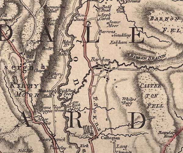 J5SD68SW.jpg single or double wiggly line; river item:- National Library of Scotland : EME.s.47 Image © National Library of Scotland |
|||
|
|
||||
| evidence:- | old map:- Cary 1789 (edn 1805) |
|||
| source data:- | Map, uncoloured engraving, Westmoreland, scale about 2.5 miles
to 1 inch, by John Cary, London, 1789; edition 1805.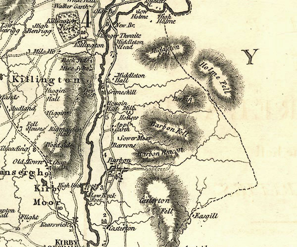 CY24SD68.jpg river running into the Lune item:- JandMN : 129 Image © see bottom of page |
|||
|
|
||||
| evidence:- | old map:- Cooper 1808 |
|||
| source data:- | Map, hand coloured engraving, Westmoreland ie Westmorland, scale
about 9 miles to 1 inch, by H Cooper, 1808, published by R
Phillips, Bridge Street, Blackfriars, London, 1808. click to enlarge click to enlargeCOP4.jpg tapering wiggly line; river item:- Dove Cottage : 2007.38.53 Image © see bottom of page |
|||
|
|
||||
| evidence:- | old map:- Balderston c1890 map placename:- Barbon Beck |
|||
| source data:- | Map, the hills in the Ingleton area, probably by Robert R
Balderston, engraved by Goodall and Suddick, Leeds, West
Yorkshire, about 1890.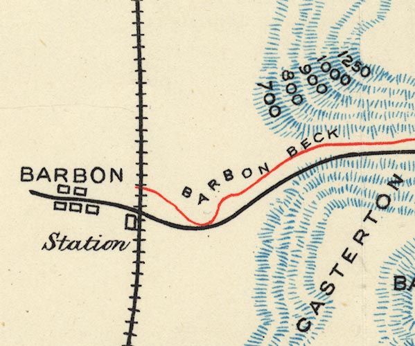 BS1SD68G.jpg "BARBON BECK" item:- private collection : 27.1 Image © see bottom of page |
|||
|
|
||||
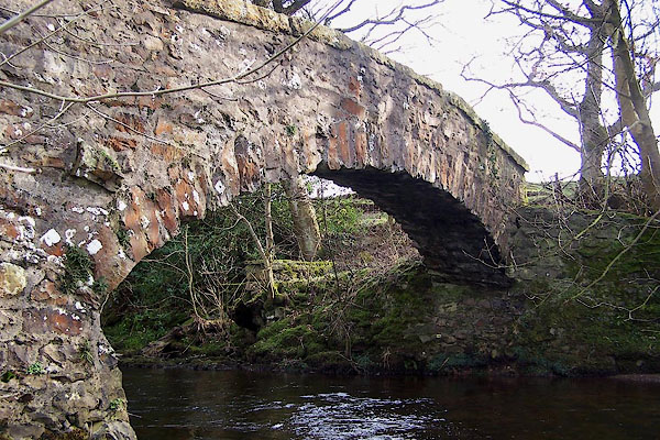
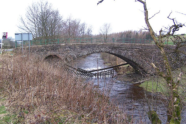
 BXW77.jpg at Beckgate Bridge, Barbon, (taken 18.2.2013) 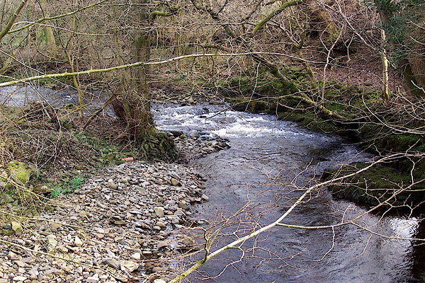 BNH46.jpg At the packhorse bridge, Beckfoot. (taken 2.3.2007) |
||||
|
|
||||
| MN photo:- |
||||
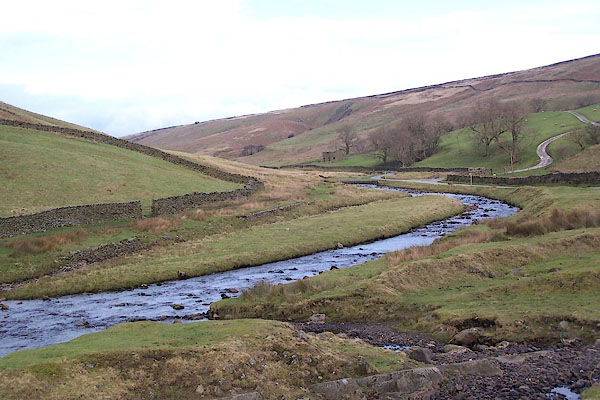
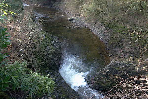
| Caves, potholes and shake holes are noted on the OS Explorer map. The river bed runs
in limestone and is riddled with holes; water disappears down sink holes, water appears
from tiny caves in the side of the beck. I have tried to illustrate some of these
in one short stretch of the stream. |
||||
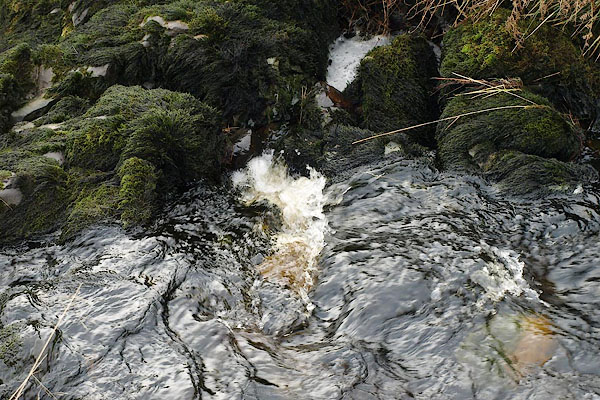 BRV90.jpg Water going down a hole. There was another sink just below this which took the rest of the stream. (taken 13.11.2009) 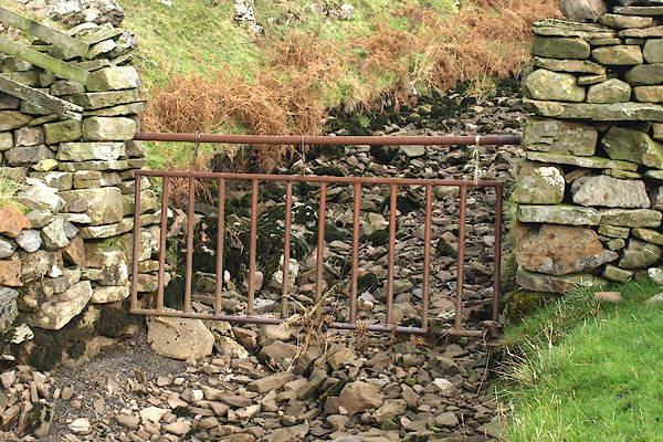 BRV89.jpg The flowing stream has gone. (taken 13.11.2009) 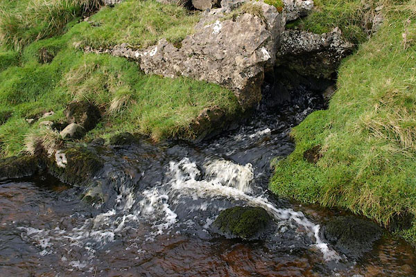 BRV88.jpg At some stage the water surfaces again. Here more is coming out from the bank. (taken 13.11.2009) 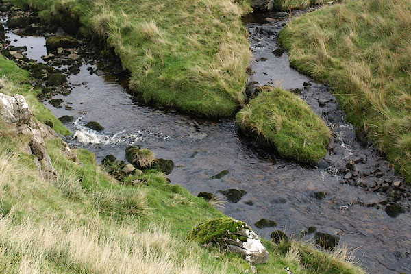 BRV87.jpg And near the same point (at the left, seen from above), a tributary runs in from the side. (taken 13.11.2009) 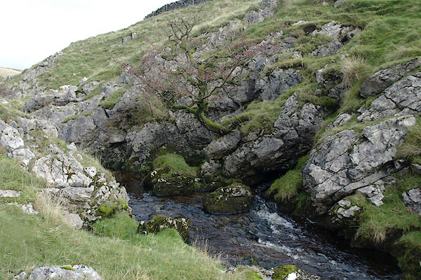 BRV86.jpg More water running from a crack in the rocks (taken 13.11.2009) 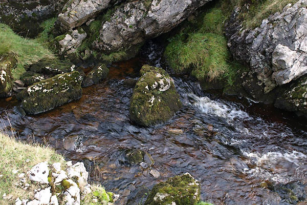 BRV85.jpg The same, close up. (taken 13.11.2009) 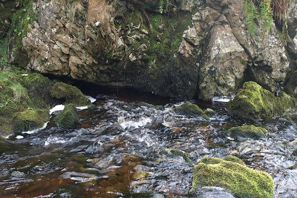 BRV84.jpg Water running in. (taken 13.11.2009) 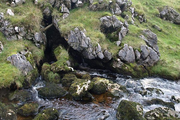 BRV83.jpg Water running in. (taken 13.11.2009) 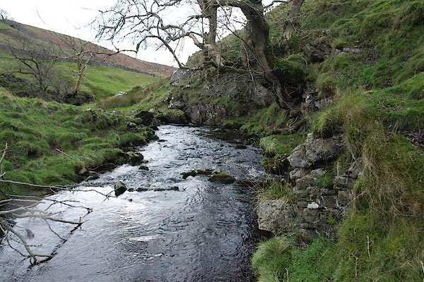 BRV82.jpg Looking down at (taken 13.11.2009) 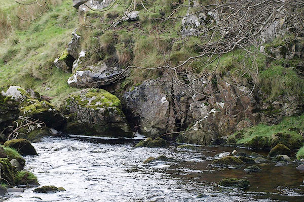 BRV81.jpg Some of the water is swallowed into a hole between the two rocks in the centre of the picture. (taken 13.11.2009) 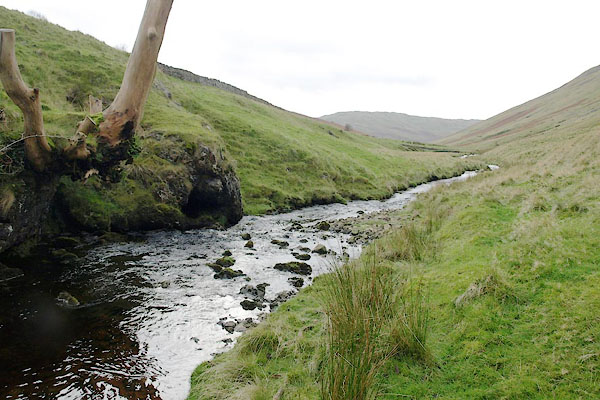 BRV80.jpg The beck at (taken 13.11.2009) 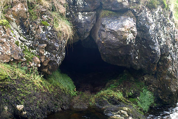 BRV79.jpg A relatively dry hole (taken 13.11.2009) |
||||
|
|
||||
| places:- |
|
|||
|
||||
|
||||
|
||||
|
||||
|
||||
|
||||
|
||||
|
||||
Lakes Guides menu.