 Old Cumbria Gazetteer
 |
 |
|
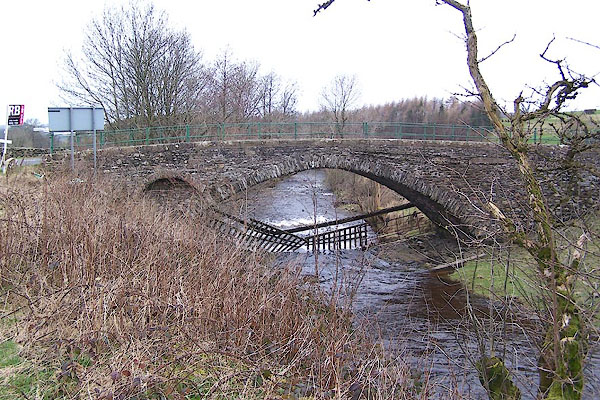
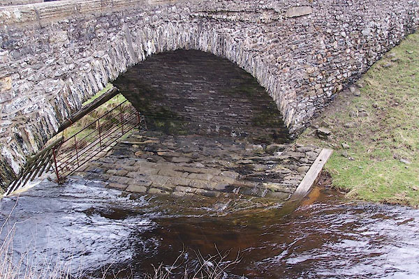
| Hodge Bridge, Barbon | ||
| Hodge Bridge | ||
| site name:- | Barbon Beck | |
| locality:- | Barbon | |
| civil parish:- | Barbon (formerly Westmorland) | |
| county:- | Cumbria | |
| locality type:- | bridge | |
| coordinates:- | SD62268255 | |
| 1Km square:- | SD6282 | |
| 10Km square:- | SD68 | |
| references:- | Hinchcliffe, Ernest: 1994: Packhorse Bridges of England: Cicerone Press (Milnthorpe,
Cumbria) |
|
|
|
||
 BLT49.jpg (taken 31.3.2006) 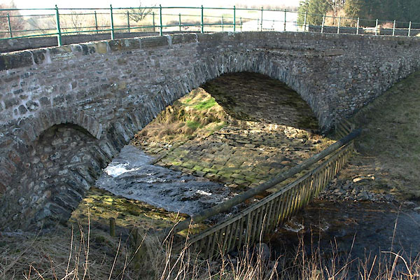 BXW63.jpg (taken 18.2.2013) |
||
|
|
||
| evidence:- | old map:- OS County Series (Wmd 43 16) placename:- Hodge Bridge |
|
| source data:- | Maps, County Series maps of Great Britain, scales 6 and 25
inches to 1 mile, published by the Ordnance Survey, Southampton,
Hampshire, from about 1863 to 1948. |
|
|
|
||
| evidence:- | old map:- Jefferys 1770 (Wmd) |
|
| source data:- | Map, 4 sheets, The County of Westmoreland, scale 1 inch to 1
mile, surveyed 1768, and engraved and published by Thomas
Jefferys, London, 1770.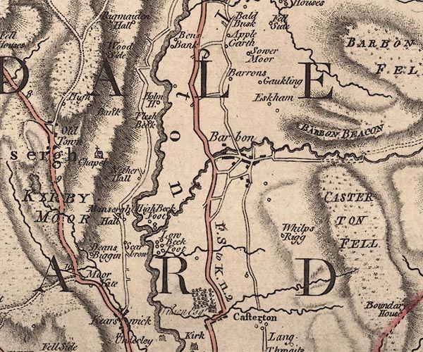 J5SD68SW.jpg double line, road, across a stream; bridge item:- National Library of Scotland : EME.s.47 Image © National Library of Scotland |
|
|
|
||
| evidence:- | database:- Listed Buildings 2010 placename:- Hodge Bridge |
|
| source data:- | courtesy of English Heritage "HODGE BRIDGE / / A683 / BARBON / SOUTH LAKELAND / CUMBRIA / II / 75586 / SD6226582545" |
|
| source data:- | courtesy of English Heritage "Bridge. Probably C18 with later parapets and widening. Stone rubble with dressed coping. Slightly pointed segmental arch with thin rough voussoirs. Southern approach widened on squinch arches, that to west probably C18, that to east probably C19. Low parapet has reeded coping and plain iron railings. Stream bed below bridge is paved, with further paving to west (downstream)." |
|
|
|
||
 BLT50.jpg (taken 31.3.2006) |
||
|
|
||
 Lakes Guides menu.