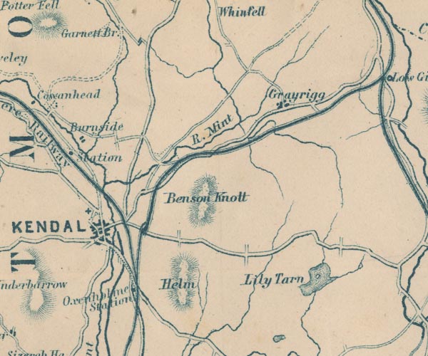
 Garnett 1850s-60s SD59


|

|
|
|
gazetteer links places may or may not be labelled on the map |
||

|
-- Benson Knott -- "Benson Knott" |
|
|
|
-- Burneside Station -- "Station" |
|
|
|
-- Burneside -- "Burneside" |
|
|
|
-- Grayrigg -- "Grayrigg" |
|
|
|
-- Helm, The -- "Helm" |
|
|
|
-- Kendal and Windermere Railway -- "Kendal & Windermere
Railway" |
|
|
|
-- Kendal -- "KENDAL" |
|
|
|
-- Lancaster and Carlisle Railway -- "Lancaster & Carlisle
Railway" -- "Lancaster & Carlisle Railway" |
|
|
|
-- Lancaster Canal |
|
|
|
-- Lily Mere -- "Lily Tarn" |
|
|
|
-- Mint, River -- "R. Mint" |
|
|
|
-- Oxenholme Station -- "Oxenholme Station" |
|
|
|
-- Kendal to Shap |
|
|
|
-- Kendal to Windermere |
|
|
|
-- Lancaster to Kendal |
|
|
|
-- Sprint, River -- "Sprint R." |
|
|
civil parishes The area roughly includes parts of parishes:- Skelsmergh Scalthwaiterigg Longsleddale Firbank Lambrigg Strickland Roger Docker Kendal Old Hutton and Holmescales Grayrigg Helsington Underbarrow and Bradleyfield Whitwell and Selside Killington Natland New Hutton Strickland Ketel Whinfell |
||
|
|
||
|
|
Lakes Guides menu. | |