 Garnett 1850s-60s SD57


|

|
|
|
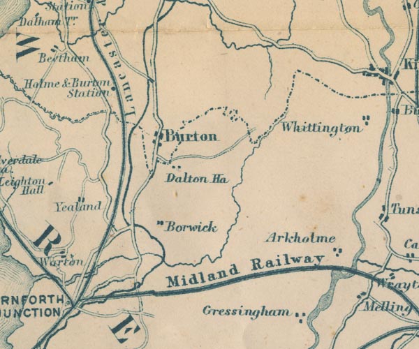
gazetteer links places may or may not be labelled on the map |
||

|
-- Arkholme -- "Arkholme" |
|
|
|
-- Borwick -- "Borwick" |
|
|
|
-- Burton and Holme Station -- "Holme & Burton
Station" |
|
|
|
-- Burton-in-Kendal -- "Burton" |
|
|
|
-- Dalton Hall -- "Dalton Ha." |
|
|
|
-- Furness and Midland Joint Railway -- "Midland
Railway" |
|
|
|
-- Lancaster and Carlisle Railway -- "Lancaster & Carlisle
Railway" -- "Lancaster & Carlisle Railway" |
|
|
|
-- Lancaster Canal |
|
|
|
-- Lancaster to Kendal |
|
|
|
-- Yealand Conyer -- "Yealand" |
|
|
|
-- Yealand Redmayne -- "Yealand" |
|
|
civil parishes The area roughly includes parts of parishes:- Hutton Roof Lupton Beetham Holme Burton-in-Kendal Kirkby Lonsdale |
||
|
|
||
|
|
Lakes Guides menu. | |