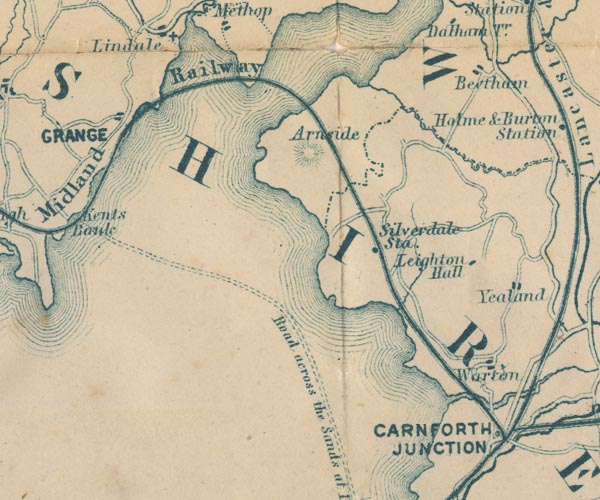
 Garnett 1850s-60s SD47


|

|
|
|
gazetteer links places may or may not be labelled on the map |
||

|
-- Arnside -- "Arnside" |
|
|
|
-- Beetham -- "Beetham" |
|
|
|
-- Carnforth Station -- "CARNFORTH JUNCTION" |
|
|
|
-- Kent Estuary |
|
|
|
-- Leighton Beck |
|
|
|
-- Leighton Hall -- "Leighton Hall" |
|
|
|
-- Lancaster Sands Road -- "Road across the Sands at Low
Water" |
|
|
|
-- Silverdale Station -- "Silverdale Sta." |
|
|
|
-- Ulverstone and Lancaster Railway -- "Midland
Railway" |
|
|
|
-- Warton -- "Warton" |
|
|
civil parishes The area roughly includes parts of parishes:- Broughton East Lower Allithwaite Lower Holker Upper Allithwaite Beetham Arnside Grange-over-Sands Meathop and Ulpha |
||
|
|
||
|
|
Lakes Guides menu. | |